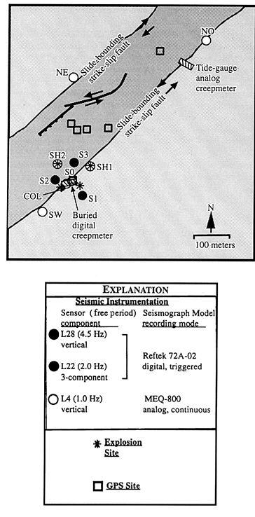
Figure 2.-- Schematic map of the central part of the Slumgullion landslide, the seismic network (station codes labeled), creepmeters, and GPS observation points (points near the main scarp and on the toe are not shown). These instruments were located to monitor one of the major slide-bounding strike-slip faults where the displacement rate of the slide mass is greatest (~1.6 cm/day). Major mapped faults (normal = hatchured line, strike-slip = solid line with arrows) within the slide are also shown. Four explosions (asterisks) were made and recorded to constrain the velocity structure. The main scarp is to the upper right of the figure.

![]() U.S. Department of the Interior |
U.S. Geological Survey
U.S. Department of the Interior |
U.S. Geological Survey
URL: http://pubsdata.usgs.gov/pubs/bul/b2130/ch14fig2.htm
Page Contact Information: GS Pubs Web Contact
Page Last Modified: Friday, 23-Mar-2012 14:25:16 EDT