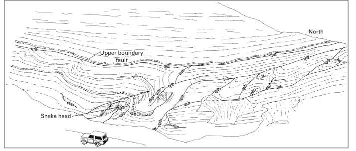
Figure 19. Sketch of a roadcut 0.6 mi north of Mathias, W. Va., along West Virginia Route 259, showing cross section of an up-to-the-north lateral ramp. Arrows indicate relative movement along faults. Note the "snake head" and upper boundary fault. All these features are perpendicular to the direction of tectonic transport. This exposure is probably the northernmost thrust fault in the Mathias lateral ramp system and is antithetic to the main system, which is up-to-the-south.