Figure 20A - Side-looking airborne radar (SLAR) images of parts of the Cumberland and Charlottesville 1-deg by 2-deg quadrangles showing the boundary lines enclosing the Mathias lateral ramp

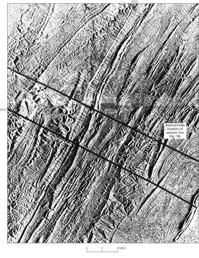
Figure 20A. Side-looking airborne radar (SLAR) images of parts of the Cumberland and Charlottesville 1°x2° quadrangles showing the boundary lines enclosing the Mathias lateral ramp. East-west line across image is a mosaic line. Image showing approximate location of the strike-line seismic-reflection profile in figure 18 (shown by ticked line).


To return to U.S. Geological Bulletin 2163, close window.

This page is https://pubs.usgs.gov/bulletin/b2163/html/fig20a.html
Maintained by Eastern Publications Group Web Team
Last updated 02.15.01 (krw)