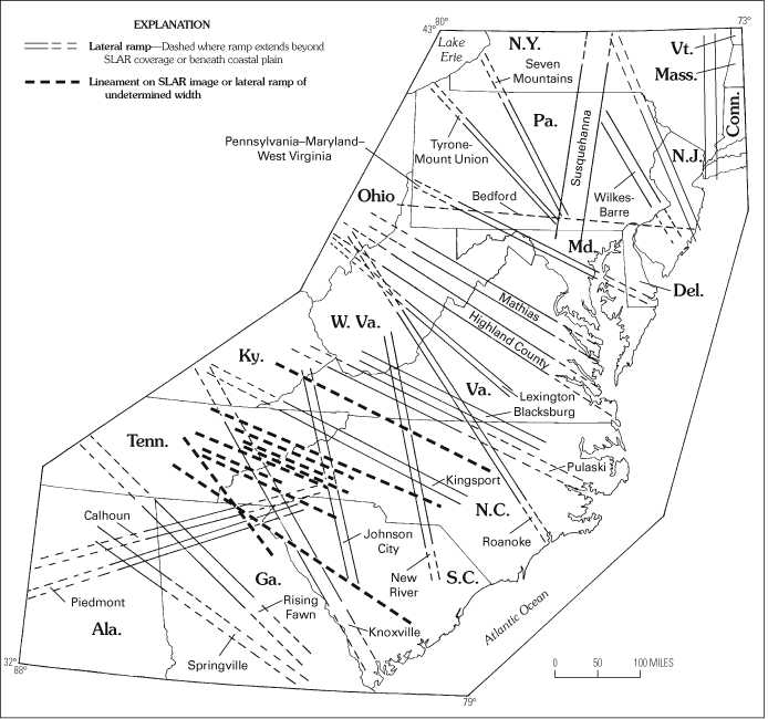
Figure 30. Map showing location of selected lateral ramps in the central and southern Appalachians. Bedford ramp and extensions of other ramps shown by light dashed lines. Two lateral ramps in the northeast corner of the map are in the northern Appalachians and are unnamed. Note the lineament swarms, represented by single heavy dashed lines, that more or less parallel some ramp lines in the southern half.