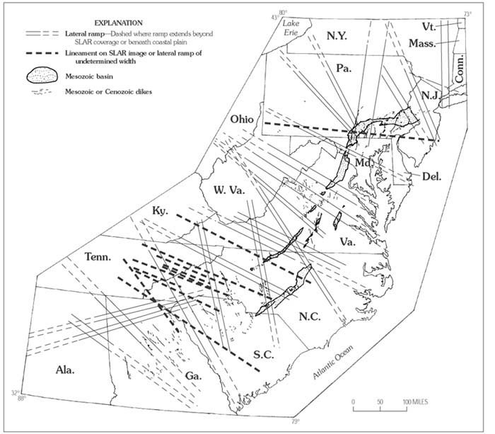
Figure 35. Map showing relationship among lateral ramps, Mesozoic basins, and associated Mesozoic and Cenozoic dikes in the central and southern Appalachians. See figure 30 for ramp names.
|
Figure 35. Map showing relationship among lateral ramps, Mesozoic basins, and associated Mesozoic and Cenozoic dikes in the central and southern Appalachians. See figure 30 for ramp names. |
This page is https://pubs.usgs.gov/bulletin/b2163/html/fig35.html
Maintained by Eastern Publications Group Web Team
Last updated 02.15.01 (krw)