U.S. Geological Survey: Science for a Changing World - USGS visiaul identifier and link to main Web site at http://www.usgs.gov/

Generalized geologic map of the north-central Virginia Blue Ridge. For a more detailed explanation, contact Richard Tollo @rtollo@gwu.edu 
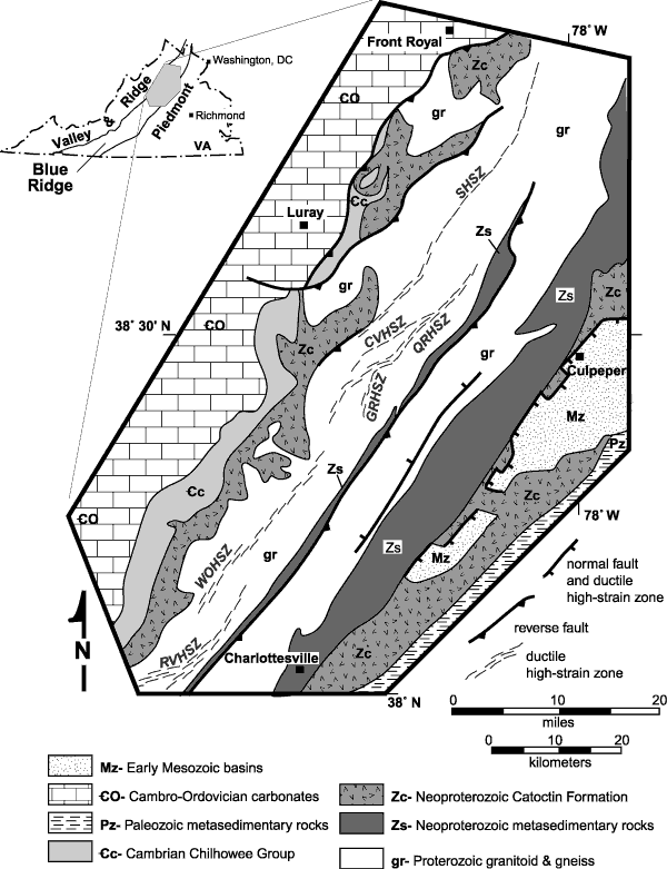
Figure 9. Generalized geologic map of the north-central Virginia Blue Ridge illustrating the location of major Paleozoic high-strain zones, including (from south to north) RVHSZ, Rockfish Valley high-strain zone; WOHSZ, White Oak high-strain zone; GRHSZ, Garth Run high-strain zone; QRHSZ, Quaker Run high-strain zone; CVHSZ, Champlain Valley high-strain zone; and SHSZ, Sperryville high-strain zone. Geology based, in part, on Virginia Division of Mineral Resources (1993); high-strain zones based on 1:24,000- and 1:100,000-scale mapping by authors.

U.S. Department of the Interior, U.S. Geological Survey
URL: https:// pubsdata.usgs.gov /pubs/circ/2004/1264/html/trip2/fig9.html
For more information, contact Richard Tollo
Maintained by Reston Publications Service Center
Last modified: 12:24:13 Wed 23 Nov 2016
Privacy statement | General disclaimer | Accessibility