U.S. Geological Survey: Science for a Changing World - USGS visual identifier and link to main Web site at http://www.usgs.gov/

Map of the field trip route showing Stops 1-7.
 
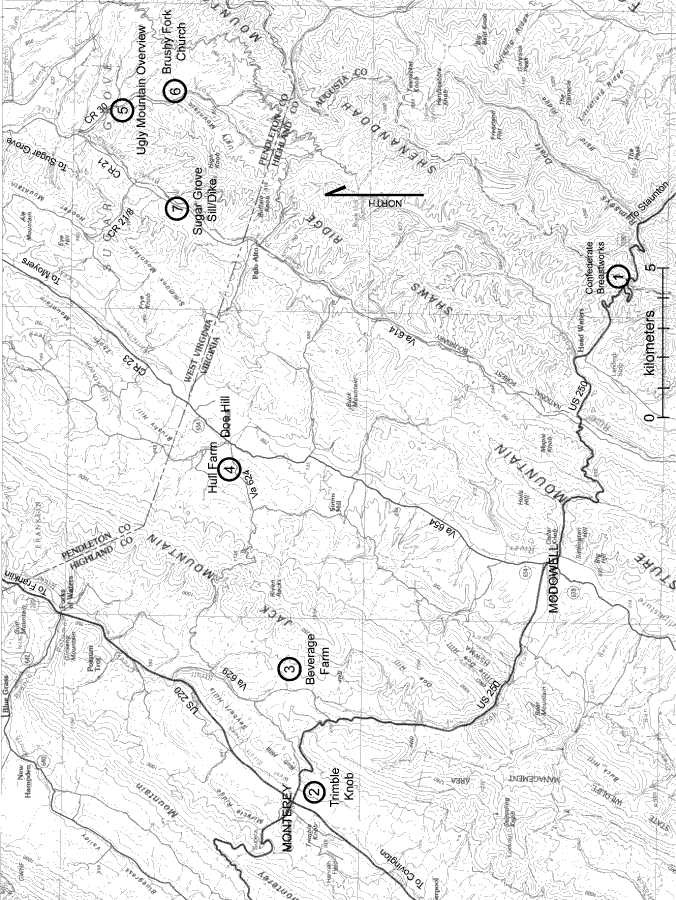
Figure 27. Map of the field trip route showing Stops 1–7. Base is from the USGS Staunton, Va., 30 × 60 minute quadrangle. Roads labeled “US” are U.S. highways; roads labeled “Va” are Virginia State roads, and roads labeled “CR” are Pendleton County roads.


U.S. Department of the Interior, U.S. Geological Survey
URL: https:// pubsdata.usgs.gov /pubs/circ/2004/1264/html/trip4/fig27.html
For more information, contact Jonathan Tso
Maintained by Reston Publications Service Center
Last modified: 12:24:30 Wed 23 Nov 2016
Privacy statement | General disclaimer | Accessibility