U.S. Geological Survey: Science for a Changing World - USGS visual identifier and link to main Web site at http://www.usgs.gov/

Onlap-offlap history of the Atlantic Coastal Plain, based on onshore outcrop and subsurface data. For a more detailed explanation, contact Lauck Ward at  lwward@vmnh.net.
 
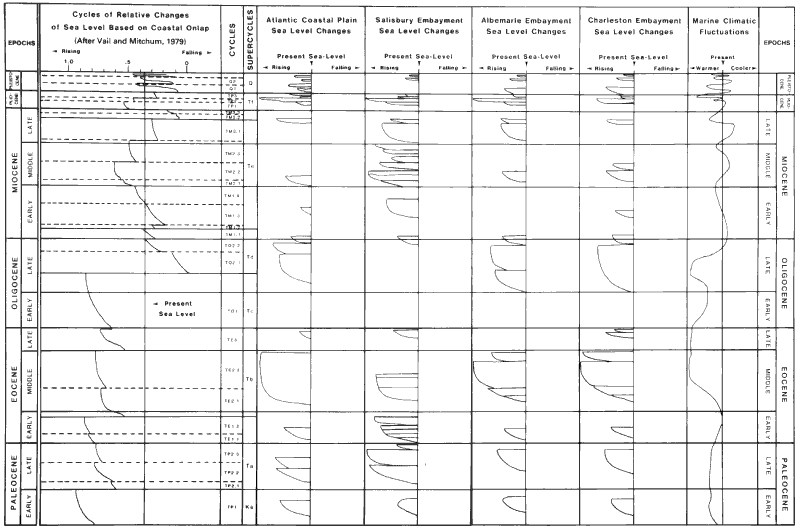
Figure 2. Onlap-offlap history of the Atlantic Coastal Plain, based on onshore outcrop and subsurface data. Sea-level fluctuations in the Salisbury, Albemarle, and Charleston embayments are plotted against a chart of cycles and supercycles by Vail and Mitchum (1979). Data from the basins are combined to approximate global sea-level events as seen along the Atlantic Coastal margin. The marine climate curve represents conditions in the Salisbury embayment and is based on data from fossil molluscan assemblages.

U.S. Department of the Interior, U.S. Geological Survey
URL: https:// pubsdata.usgs.gov /pubs/circ/2004/1264/html/trip9/fig2.html
For more information, contact Lauck Ward.
Maintained by Reston Publications Service Center
Last modified: 12:25:04 Wed 23 Nov 2016
Privacy statement | General disclaimer | Accessibility