
|
|
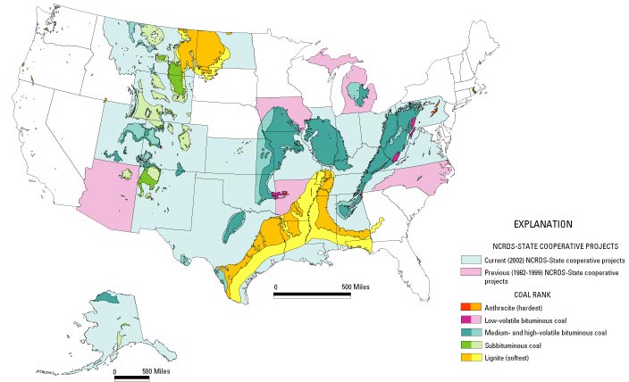
Figure 4. Map showing coal fields of the U.S. classified by coal rank and areas of cooperative study of coal resources and quality. For each category of coal rank, darker color indicates area of coal outcroppings and lighter color indicates area of subsurface coal. Also shown are States with long-term, current (light blue) or previous (light pink) cooperative relationships with the U.S. Geological Survey in the National Coal Resources Data System (NCRDS) for the long-term study of coal resources and quality. Modified from Tully (1996) and M.D. Carter (U.S. Geological Survey, written commun., 2002). (Some States contain coal fields that are too small to show rank colors.) |
U.S. Department of the Interior, U.S. Geological Survey
URL: https://
pubsdata.usgs.gov
/pubs/circ/c1143/html/fig4.html
For more information, contact Stanley Schweinfurth
Maintained by Eastern Publications Group
Last modified:
12:29:01 Wed 23 Nov 2016
Privacy statement | General disclaimer | Accessibility