![]()
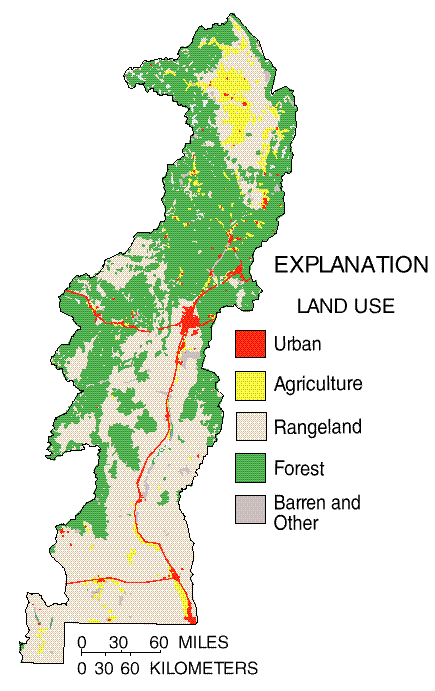
Approximately 5 percent of the land use is agricultural and urban; however, agricultural and urban land uses account for 89 percent and 8 percent, respectively, of the water used in the study area. Almost all public and domestic supplies rely on ground water, primarily from deeper aquifers. Surface-water availability typically is necessary for agriculture with the exception of a few areas where ground water is available in sufficient quantities.
 (33,893 bytes)
A comparison of precipitation and streamflow at selected sites for the study period 1992-95 with the historical period 1960-90 is shown above. Monthly total precipitation during the study period was generally higher than the monthly median at the two northern sites, whereas precipitation at the two southern sites was near the median. The monthly median streamflow at the two northern sites was generally about the same as the historical median monthly streamflow except during spring runoff when the monthly median during the study period exceeded the historical median streamflow. The streamflow at the two southern sites is controlled primarily by reservoir releases, but did exceed the historical median during the irrigation season. The impact of the above average precipitation and streamflow on the water quality of the Study Unit cannot be generalized, it must be evaluated on a site by site basis. This detailed evaluation is necessary because of the complexity of the interaction of surface water and ground water, irrigation withdrawal and return, and reservoir storage and release.