![]()
Fish communities and stream habitat (instream and riparian) were assessed at selected sites in three major physiographic provinces and three of four ecoregions of the Rio Grande Valley Study Unit. The structure of a community can be influenced by natural and human changes to physical and chemical characteristics of the stream. A stream reach, or section of stream, was selected to assess fish communities and stream habitat that best represented the condition of a longer river segment. This allows for an integrated approach to characterizing surface-water quality. A combination of qualitative and quantitative sampling methods was used to determine the species present in a reach and to provide a measure of structure, which can be expressed in a variety of ways including species richness, relative abundance, trophic complexity, native/non-native composition, and tolerance to human disturbance. Samples of fish were collected primarily during the summer low-flow period in 1993-95. These samples, in addition to more than 30 instream and riparian characteristics of stream habitat (including stream modification, bank erosion, bank vegetation stability, and riparian vegetation density) were used to describe water-quality conditions.
Fish communities were assessed at 10 sites in the Study Unit. In 25 samples, 29 species representing 10 families were identified. Species richness ranged from 1 to 13. Species richness was lowest at Medano Creek near Mosca, Colorado, where the Colorado Division of Wildlife removed all other species from the stream in an effort to reintroduce the Rio Grande cutthroat trout. Species richness increased downstream with increasing contributing drainage area; the Rio Grande at El Paso site had the most species. Warmwater fisheries generally support more species than cold-water fisheries; however, the site at El Paso may have the most species because it is downstream from a very large warm-water reservoir which could provide seed populations that are present downstream.
Fish, which are relatively long lived and can travel long distances, integrate water-quality conditions over a longer period of time and at a relatively larger spatial scale than algae and benthic invertebrates. Four indicators of biotic integrity (percentages of introduced species, omnivores, tolerant species, and anomalies) were used to provide a broad overview of the fish community structure.
At sites sampled during this study, 13 native and 16 introduced species of fish were identified. Introduced fish species predominate at four of six sites sampled in 1994, probably because of stocking of some of these fish species. The dominance of omnivores in samples from the Rio Grande below Taos Junction Bridge, Rio Chama near Chamita, Rio Grande at Isleta, and Rio Grande at El Paso (fig. 2) can be an indication of environmental stress at these sites. However, omnivores can also be an indication of increasing stream size. In 1994, tolerant species accounted for the entire fish community at Rio Grande at Isleta.
The occurrence of external anomalies on all fish samples was less than 2 percent except for the sample from Rio Grande at Isleta, which was 14 percent. Based on the relative percentages of introduced, omnivorous, tolerant fish and the number of fish with external anomalies, six of the sampled sites appear to show some indications of environmental perturbation. The biotic integrity at the Rio Grande at Isleta site appears to be the most impaired of all sites.
In 1995, fish communities were sampled in three separate reaches in both the Santa Fe River above Cochiti Lake and the Rio Grande near Isleta sites to assess small-scale spatial patterns in the structure of fish communities among the reaches at each site and to determine the influence of physical and chemical characteristics of each reach on the fish communities of each stream. The fish communities showed some variability among reaches at both of these sites. The variability in the spatial pattern at both sites might be because of natural variability; however, at the Santa Fe River site, the variability also could be related to the presence or absence of such important habitat features as shallow pools. The stream physical or chemical characteristics among each reach at each site did not seem to influence the spatial pattern of fish communities. No significant correlation existed between fish communities at each reach and either the physical variables (such as channel width, depth, and substrate composition) or the chemical variables (such as water temperature, DO, and specific conductance).
The relative abundance of fish species and the total number of individuals varied in samples collected at sites sampled annually. All sites, except for Rio Grande near Del Norte, had a decline in the total number of individuals in a sample from 1993 to 1995. This temporal decline also could be caused by natural variability within the fish community or some artifact of sampling.
Stream habitat characteristics are used to describe the environmental setting at sites selected for ecological surveys. At the spatial scales of basin, stream segment, stream reach, and microhabitat, physical characteristics of streams strongly influence water quality and the capacity of a stream to support healthy biological communities. Basin factors, such as physiographic province, ecoregion, and climate, can be used to evaluate natural influence on biological communities. Stream segments are a more discrete unit that should have relatively homogeneous physical, chemical, and biological characteristics. Within a stream segment, a stream reach was selected for an intensive site evaluation. Microhabitat features, such as macrophyte beds, woody debris, and bed substrate, also were evaluated within each stream reach. The presence or absence of different biological communities at Study-Unit sites is influenced to varying degrees by the environmental setting at a particular site. For instance, fish communities are more influenced by climate, which is considered a basin factor, than by specific microhabitat conditions.
Principal component analysis was used to determine the overall variance in the combination of various stream habitat characteristics. Physiographic province and ecoregion were the physical variables that explained most variance among sites. Physiographic provinces are distinct areas that have common topography, rock types and structure, and geologic and geomorphic history. Ecoregions are relatively homogeneous ecological regions and are classified by spatially variable combinations of geomorphology, soils, physiography, land use and land cover, and potential natural vegetation. Because a combination of physical variables define both physiographic province and ecoregion, most variance among sites is explained by these two habitat characteristics.
A habitat degradation index also was used to describe the physical condition of the sites selected for ecological surveys. The index included four habitat characteristics: stream modification, bank erosion, bank vegetation stability, and riparian vegetation density. Use of these four habitat characteristics revealed that 6 of 10 sites sampled appear to have significant habitat degradation. These sites are Rio Grande near Del Norte, Colorado; Conejos River near Lasauses, Colorado; Rio Chama near Chamita, New Mexico; Santa Fe River above Cochiti Lake, New Mexico; Rio Grande at Isleta, New Mexico; and Rio Grande at El Paso, Texas. Saguache Creek near Saguache, Colorado; Medano Creek near Mosca, Colorado; and Rio Grande below Taos Junction Bridge near Taos, New Mexico, were sites that have moderate to minimal habitat degradation. Rito de los Frijoles in Bandelier National Monument, New Mexico, was the only site that had minimal habitat degradation. The habitat at Rito de los Frijoles was characterized by no stream modification, very little bank erosion, highly stable banks, and dense riparian vegetation.
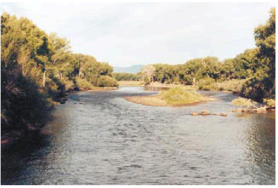
Stream habitat changes significantly from the upper to the lower part of the basin. Top photograph is Rio Grande near Del Norte, Colorado; lower photograph is Rio Grande at El Paso, Texas (photographs by Lisa F. Carter, U.S. Geological Survey).