 Click here to view screen-resolution image - 45K
Click here to view screen-resolution image - 45K
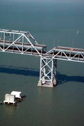
Click here to view screen-resolution image - 45K15. Aerial view of roadbed collapse near the interface of the cantilever and truss sections of the San Francisco-Oakland Bay Bridge. View northwestward. [C.E. Meyer, U.S. Geological Survey]
 Click here to view screen-resolution image - 45K
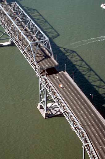
16. Aerial view of the collapsed section of the San Francisco-Oakland Bay Bridge. View westward. [C.E. Meyer, U.S. Geological Survey]
 Click here to view screen-resolution image - 45K
17. Sand boil or sand volcano measuring 2 m (6.6 ft) in length erupted in median of Interstate Highway 80 west of the Bay Bridge toll plaza when ground shaking transformed loose water-saturated deposit of subsurface sand into a sand-water slurry (liquefaction). Vented sand contains marine-shell fragments. [J.C. Tinsley, U.S. Geological Survey]