Skip Links

USGS - science for a changing world

Data Series 829

Archive of Digital Chirp Subbottom Profile Data Collected During USGS Cruise 13GFP01, Brownlee Dam and Hells Canyon Reservoir, Idaho and Oregon, 2013

By Arnell S. Forde, Shawn V. Dadisman, James G. Flocks, Ryan Fosness, Chris Welcker, and Kyle W. Kelso

13GFP01 Location Map


Home | Acronyms | Contents | Navigation | Profiles | Logs | Metadata | Software | Index


Click on the highlighted area to view the area in greater detail.

Location Map | Area 1 | Area 1a | Area 2 | Area 2a | Area 3 | Area 3a

13GFP01 Location Map Link to Area 1 location map Link to Area 2 location map Link to Area 1a location map Link to Area 3 location map

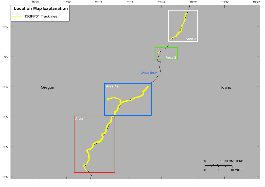
Figure 3. Location map of all digital subbottom profile data collected during USGS field activity 13GFP01.


Home | Acronyms | Contents | Navigation | Profiles | Logs | Metadata | Software | Index

Accessibility FOIA Privacy Policies and Notices

Take Pride in America logo USA.gov logo U.S. Department of the Interior | U.S. Geological Survey
URL: http://pubsdata.usgs.gov/pubs/ds/0829/html/location.html
Page Contact Information: GS Pubs Web Contact
Page Last Modified: Monday, 28-Nov-2016 19:29:13 EST