 Introduction Introduction
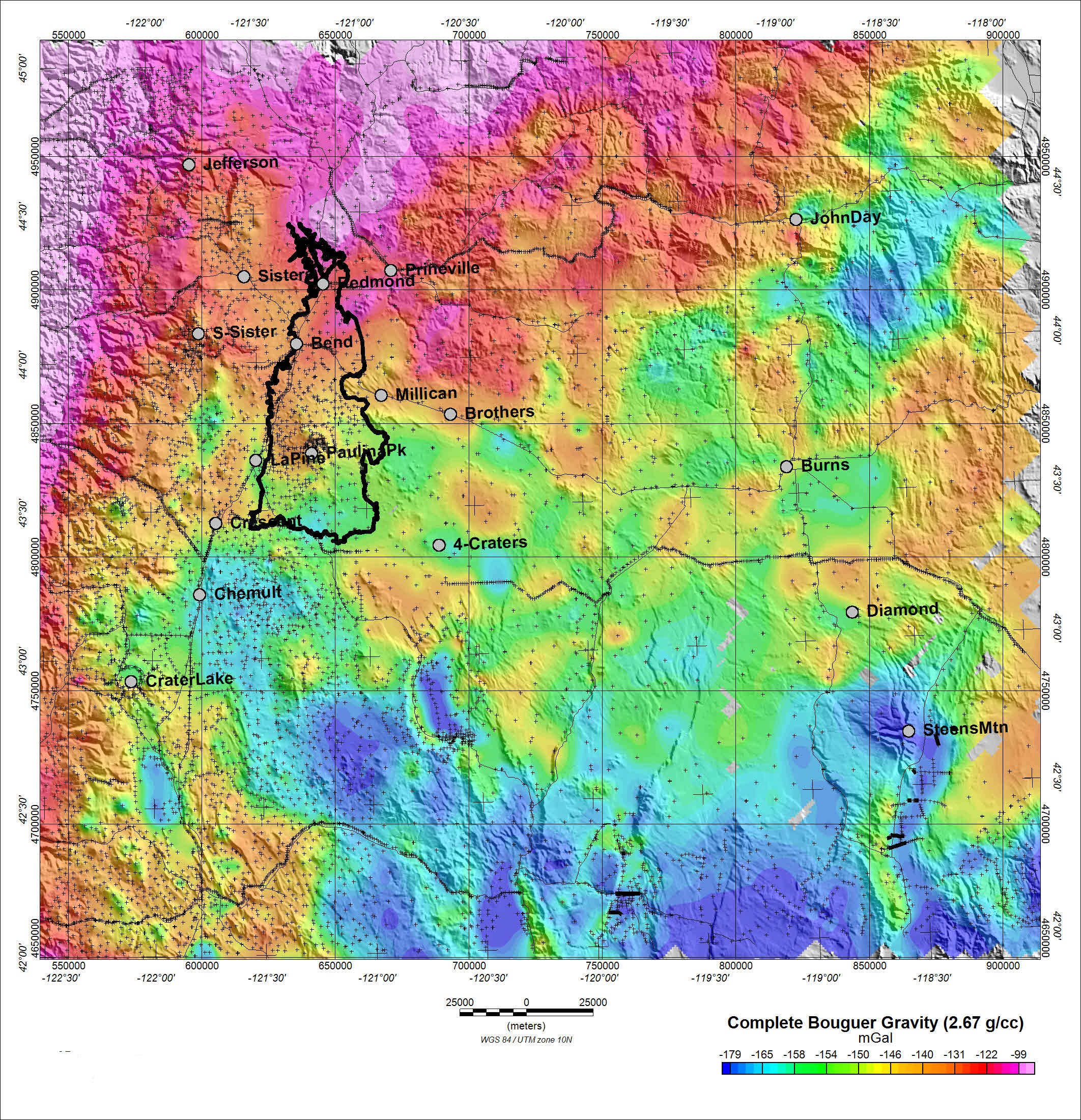
Newberry Volcano in central Oregon is a 3,100-square-kilometer (1,200-square-mile) shield-shaped composite volcano, occupying a location east of the main north-south trend of the High Cascades volcanoes and forming a transition between the High Lava Plains subprovince of the Basin and Range Province to the east and the Cascade Range to the west. Magnetic, gravity, and radiometric data have been gathered and assessed for the region around the volcano. These data have widely varying quality and resolution, even within a given dataset, and these limitations are evaluated and described in this release.
Publicly available gravity data in general are too sparse to permit detailed modeling except along a few roads with high-density coverage. Likewise, magnetic data are also unsuitable for all but very local modeling, primarily because available data consist of a patchwork of datasets with widely varying line-spacing. Gravity data show only the broadest correlation with mapped geology, whereas magnetic data show moderate correlation with features only in the vicinity of Newberry Caldera. At large scales, magnetic data correlate poorly with both geologic mapping and gravity data. These poor correlations are largely due to the different sensing depths of the two potential fields methods, which respond to physical properties deeper than the surficial geology. Magnetic data derive from rocks no deeper than the Curie-point isotherm depth (10 to 15 kilometers, km, maximum), whereas gravity data reflect density-contrasts to 100 to 150 km depths. Radiometric data from the National Uranium Resource Evaluation (NURE) surveys of the 1980s have perhaps the coarsest line-spacing of all (as much as 10 km between lines) and are extremely “noisy” for several reasons inherent to this kind of data. Despite its shallow-sensing character, only a few larger anomalies in the NURE data correlate well with geologic mapping.
The purpose of this data series release is to collect and place the available geophysical data in the hands of other investigators in a readily comprehensible form. All data-compilation, splicing, filtering, and overlay-map displays were accomplished with the commercial Geosoft™ system, Advanced Option. Images are provided in both JPG and PDF formats.
|
First posted April 18, 2014
Part or all of this report is presented in Portable Document Format (PDF). For best results viewing and printing PDF documents, it is recommended that you download the documents to your computer and open them with Adobe Reader. PDF documents opened from your browser may not display or print as intended. Download the latest version of Adobe Reader, free of charge.
|

