| Title Page |
| Introduction |
| Data |
| Print files |
| Links |
| Index page |
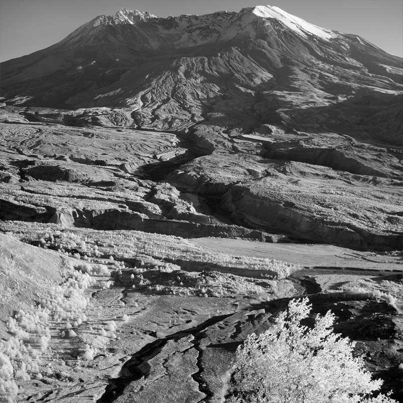
View of Mount St. Helens, Washington looking south from outside the Johnston Ridge Observatory in Mount St. Helens National Volcanic Monument. Photographed near sunset with a digital infrared camera that images wavelenghts in the near infrared from 715-1100nm (USGS photograph by Andrew D. Barron, October 18, 2011.)