Skip Links

USGS - science for a changing world

Data Series 855

Mobile Terrestrial Light Detection and Ranging (T-LiDAR) Survey of Areas on Dauphin Island, Alabama, in the Aftermath of Hurricane Isaac, 2012

By D.R. Kimbrow

Photo Abstract

Topographic survey data of areas on Dauphin Island on the Alabama coast were collected using a truck-mounted mobile terrestrial light detection and ranging system. This system is composed of a high frequency laser scanner in conjunction with an inertial measurement unit and a position and orientation computer to produce highly accurate topographic datasets. A global positioning system base station was set up on a nearby benchmark and logged vertical and horizontal position information during the survey for post-processing. Survey control points were also collected throughout the study area to determine residual errors. Data were collected 5 days after Hurricane Isaac made landfall in early September 2012 to document sediment deposits prior to clean-up efforts. Three data files in ASCII text format with the extension .xyz are included in this report, and each file is named according to both the acquisition date and the relative geographic location on Dauphin Island (for example, 20120903_Central.xyz). Metadata are also included for each of the files in both Extensible Markup Language with the extension .xml and ASCII text formats. These topographic data can be used to analyze the effects of storm surge on barrier island environments and also serve as a baseline dataset for future change detection analyses.

First posted June 19, 2014

For additional information, contact:
Director, Alabama Water Science Center
75 TechnaCenter Drive
Montgomery, AL 36117
Telephone: (334) 395-4120
http://al.water.usgs.gov/

Part or all of this report is presented in Portable Document Format (PDF). For best results viewing and printing PDF documents, it is recommended that you download the documents to your computer and open them with Adobe Reader. PDF documents opened from your browser may not display or print as intended. Download the latest version of Adobe Reader, free of charge.


Suggested citation:

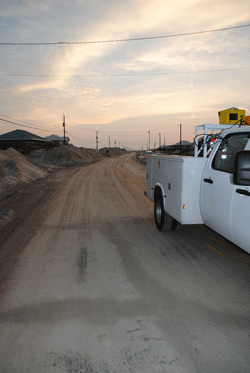
Kimbrow, D.R., 2014, Mobile terrestrial light detection and ranging (T-LiDAR) survey of areas on Dauphin Island, Alabama, in the aftermath of Hurricane Isaac, 2012: U.S. Geological Survey Data Series 855, https://dx.doi.org/10.3133/ds855.

ISSN 2327–638X (online)


Contents

Abstract

Introduction

Data Collection and Processing Methods

Electronic Data Format

References Cited


Accessibility FOIA Privacy Policies and Notices

Take Pride in America logo USA.gov logo U.S. Department of the Interior | U.S. Geological Survey
URL: http://pubsdata.usgs.gov/pubs/ds/0855/index.html
Page Contact Information: GS Pubs Web Contact
Page Last Modified: Monday, 28-Nov-2016 19:28:35 EST