Data Series 1095
1U.S. Geological Survey
2Cherokee Nation Technologies
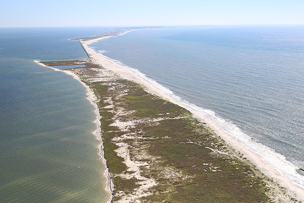
| Abstract West-facing oblique aerial photograph of Dauphin Island, Alabama, showing the well-defined breakwater, September 2015. Photograph by Amy Hartsfield, Amy & Company, Inc. (Morgan, 2016). [Click image to enlarge] Dauphin Island, Alabama, is a barrier island located in the northern Gulf of Mexico that supports local residences, tourism, commercial infrastructure, and historic Fort Gaines. During the past decade, Dauphin Island was affected by several major hurricanes—Hurricanes Ivan (2004), Katrina (2005), and Isaac (2012)—and storms, along with sea-level rise, continue to present a threat to island stability. State and Federal managers are using a scientific approach to identify, formulate, and implement a long-term plan to provide restoration options for Dauphin Island, thereby helping increase its resilience against future storms and sea-level rise. Island morphology, including current bathymetry and shoreline data, is one scientific domain being investigated in an effort to produce a comprehensive restoration plan funded by an interagency grant from the National Fish and Wildlife Foundation Gulf Environmental Benefit Fund. In August 2015, the U.S. Geological Survey (USGS) St. Petersburg Coastal and Marine Science Center (SPCMSC), in cooperation with the U.S. Army Corps of Engineers at the U.S. Army Engineer Research and Development Center, Mobile District, and the State of Alabama, conducted bathymetric surveys of the nearshore waters surrounding Dauphin Island. This report provides a detailed methodology for the data acquisition and post-processing of 1,165-line kilometers (km) of single-beam bathymetry data collected under the USGS–SPCMSC Alabama Barrier Island Restoration Study. These data were acquired and processed under USGS field activity number 2015–326–FA. Data are provided in three datums: (1) the International Terrestrial Reference Frame of 2000, ellipsoid height (from –47.04 meters (m) to –29.36 m); (2) the North American Datum of 1983, CORS96 realization (NAD83 (CORS96)) horizontal, and the North American Vertical Datum 1988 GEOID12A vertical (from –0.24 m to –17.33 m); and (3) NAD83 (CORS96) horizontal, and mean lower low water vertical (from –0.12 m to –17.93 m). The x,y,z point datasets, trackline shapefiles, digital and handwritten Field Activity Collection Systems logs, one 50-m digital elevation model, and formal Federal Geographic Data Committee metadata are obtainable from the Data Downloads page or the associated USGS data release. Note: These data are scientific in nature and are not to be used for navigation. Any use of trade names is for descriptive purposes only and does not imply endorsement by the U.S. Government. AcknowledgmentsThe authors would like to thank the following:
Author contributions are as follows:
NOTE: Any use of trade names is for descriptive purposes only and does not imply endorsement by the U.S. Government. Information StatementThis publication was prepared by an agency of the U.S. Government. Although these data were processed successfully on a computer system at the U.S. Geological Survey, no warranty expressed or implied is made regarding the display or utility of the data on any other system, or for general or scientific purposes, nor shall the act of distribution imply any such warranty. The U.S. Geological Survey shall not be held liable for improper or incorrect use of the data described and (or) contained herein. Reference herein to any specific commercial product, process, or service by trade name, trademark, manufacturer, or otherwise does not constitute or imply its endorsement, recommendation, or favoring by the U.S. Government or any agency thereof. Suggested Citation:DeWitt, N.T., Stalk, C.A., Flocks, J.G., Bernier, J.C., Kelso, K.W., Fredericks, J.J., and Tuten, T.M., 2018, Nearshore single-beam bathymetry data collected in 2015, Dauphin Island, Alabama: U.S. Geological Survey Data Series 1095, https://doi.org/10.3133/ds1095. ContactNancy T. DeWitt |