U.S. Geological Survey Data Series 242
1U.S. Geological Survey, St. Petersburg, FL 33701.
2CSC, St. Petersburg, FL 33701.
U.S. Department of the Interior
U.S. Geological Survey
Florida Integrated Science Center - St. Petersburg
Publications are available from USGS Information Services, Box 25286, Federal Center, Denver, CO 80225-0046 (telephone 1-888-ASK-USGS; e-mail: infoservices@usgs.gov).
Table of Contents (Disc 1 of 2): |
||||
 |
||||
This DVD publication was prepared by an agency of the United States Government. Neither the United States Government nor any agency thereof nor any of their employees makes any warranty, expressed or implied, or assumes any legal liability or responsibility for the accuracy, completeness, or usefulness of any information, apparatus, product, or process disclosed in this report or represents that its use would not infringe privately owned rights. Reference therein to any specific commercial product, process, or service by trade name, trademark, manufacturer, or otherwise does not constitute or imply its endorsement, recommendation, or favoring by the United States Government or any agency thereof.
Although all data and software published on this disc have been used by the USGS, no warranty, expressed or implied, is made by the USGS as to the accuracy of the data and related materials and (or) the functioning of the software. The act of distribution shall not constitute any such warranty, and no responsibility is assumed by the USGS in the use of these data, software, or related materials.
Note: The Web version of this archive does not contain the SEG-Y Trace files. These files are very large and would require extremely long download times. To obtain the complete DVD archive, contact USGS Information Services at 1-888-ASK-USGS.
This disc is readable on any computing platform that has standard DVD driver software installed. The minimum software requirements are a Web browser, Adobe Reader, and a text editor. If you cannot fully access the information on this page, please contact USGS Information Services at inforservices@usgs.gov or 1-888-ASK-USGS. Warning! The only supported Web browsers that properly display all features of the interactive profiles are Internet Explorer 6 for Windows and Firefox 1.5 for all platforms
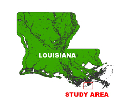
In August of 2005, the U.S. Geological Survey conducted geophysical surveys offshore of Port Fourchon and Timbalier Bay, Louisiana, as part of the USGS Subsidence and Coastal Change (SCC) Study. This report serves as an archive of unprocessed digital Chirp seismic reflection data, trackline maps, navigation files, GIS files, Field Activity Collection System (FACS) logs, observer's logbook, and formal FGDC metadata. Gained digital images of the seismic profiles are also provided. Refer to the Acronyms page for expansion of acronyms and abbreviations used in this report.
The archived trace data are in standard Society of Exploration Geophysicists (SEG) SEG-Y format (Barry and others, 1975) and may be downloaded and processed with commercial or public domain software such as Seismic Unix (SU). Example SU processing scripts and USGS software for viewing the SEG-Y files (Zihlman, 1992) are also provided.
The original trace files for lines 05c01, 05c02, 05c03, 05c04a, 05c05, 05c06, 05c07, 05c08, 05c10, 05c11, 05c12, 05c13, 05c14a, 05c18, 05c19, and 05c20 were divided into two trace files each (for example, 05c01 became 05c01_a and 05c01_b) because the original total number of traces exceeded the maximum allowed by the processing software.
The USGS Florida Integrated Science Center (FISC) - St. Petersburg assigns a unique identifier to each cruise or field activity. For example, 05SCC01 tells us the data were collected in 2005 for the Subsidence and Coastal Change (SCC) Study and the data were collected during the first field activity for that project in that calendar year. Refer to http://walrus.wr.usgs.gov/infobank/programs/html/definition/activity.html for a detailed description of the method used to assign the field activity ID.
All Chirp systems use a signal of continuously varying frequency; however, the Chirp system used during these surveys produces a high resolution, shallow penetration (less then 50 ms) profile image beneath the seafloor. The sound source and receiver is a towfish, which is typically flown 2-5 m above the seafloor. The acoustic energy is reflected at density boundaries (such as the seafloor or sediment layers beneath the seafloor), detected by a receiver, and recorded by a PC-based seismic acquisition system. This process is repeated at timed intervals (for example, 0.125 s) and recorded for specific intervals of time (for example, 50 ms). In this way, a two-dimensional vertical image of the shallow geologic structure beneath the ship track is produced. Figure 1 displays acquisition geometry. Refer to table 1 for a summary of acquisition parameters. See the digital FACS equipment log (7 KB) for details about the acquisition equipment used. Table 2 lists trackline statistics. Scanned images of the handwritten FACS logs and handwritten science logbook (23 MB) are also provided as PDF files.
The unprocessed seismic data are stored in SEG-Y format (Barry and others, 1975). For a detailed description of the data format, refer to the SEG-Y Format page. See the How To Download SEG-Y Data page for download instructions. The printable profiles provided here are GIF images that were gained using Seismic Unix software. Refer to the Software page for examples of the processing scripts and details about the processing steps. The processed SEG-Y data were then exported to Chesapeake Technology, Inc. (CTI) SonarWeb software to produce an interactive version of the profile that allows the user to obtain a geographic location and depth from the profile for a cursor position. This information is displayed in the status bar of the browser. Warning! The only supported Web browsers that properly display all features of the interactive profiles are Internet Explorer 6 for Windows and Firefox 1.5 for all platforms. For all browsers, the status bar and JavaScript must be enabled. Firefox also requires "Change status bar text" to be checked under Advanced JavaScript Settings. Caution–use of other browsers may result in spurious or no information given in the status window. The printable and interactive profiles can be viewed from the Profiles page or from links on the trackline maps.
Detailed information about the navigation systems used can be found in table 1 and the FACS equipment log (7 KB). To view the trackline maps and navigation files, and for more information about these items, see the Navigation page.
NOTE: Although data were collected in UTM Zones 15 and 16, all equipment and data processing were set to Zone 15 for this cruise.
The Disc Contents page is a diagram of the location of all files and folders contained on this disc and provides links to these files and folders. All discs are identical except for the SEG-Y files. Disc 1 contains SEG-Y files for lines 05c01_a through 05c13_b, and disc 2 contains SEG-Y files for lines 05c14 through 05c21.
To access the information contained on these discs, use a Web browser to open the file index.html. This report is divided into five sections: Navigation Data and Maps, Seismic Profiles, Field Activity Logs, Metadata, and Software. Links at the top and bottom of each page provide access to these sections. This report contains links to the USGS and collaborators or other resources that are only accessible if access to the Internet is available while viewing these documents. Warning! The only supported Web browsers that properly display all features of the interactive profiles are Internet Explorer 6 for Windows and Firefox 1.5 for all platforms
Funding for this study was provided by the USGS Coastal and Marine Geology Program. We thank R/V G.K. Gilbert captain Dave Bennett of Eckerd College for his assistance in data collection. This document was improved by the reviews of Nancy Dewitt (USGS) and Sarah Kruse (University of South Florida) at the FISC - St. Petersburg, Florida.
Barry, R.M., Cavers, D.A., and Kneale, C.W., 1975, Recommended standards for digital tape formats: Geophysics, v. 40, no. 2, p. 344-352. Also available online at http://www.seg.org/publications/tech-stand.
Zihlman, F.N., 1992, DUMPSEGY V1.0: A program to examine the contents of SEG-Y disk-image seismic data: U.S. Geological Survey Open-File Report 92-590, 28 p.

![]() U.S. Department of the Interior |
U.S. Geological Survey
U.S. Department of the Interior |
U.S. Geological Survey
URL: https://pubsdata.usgs.gov/pubs/ds/2007/242/index.html
Page Contact Information: Publishing Services
Page Last Modified: Monday, 28-Nov-2016 12:24:32 EST