In cooperation with U.S. Agency for International Development
This publication was completed under Interagency Agreement 306-P-00-04-00566-00 between the U.S. Agency for International Development and the U.S. Geological Survey.
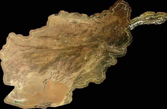
The 50 tiled images in this dataset are natural-color renditions of the calibrated six-band Landsat mosaics created from Landsat Enhanced Thematic Mapper Plus (ETM+) data. Natural-color images depict the surface as seen by the human eye. The calibration of the Landsat ETM+ maps produced by Davis (2006) are relative reflectance and need to be “grounded„ with ground-reflectance data, but the difficulties in performing fieldwork in Afghanistan precluded ground-reflectance surveys. For natural color calibration, which involves only the blue, green, and red color bands of Landsat, we could use ground photographs, Munsell color readings of ground surfaces, or another image base that accurately depicts the surface color.
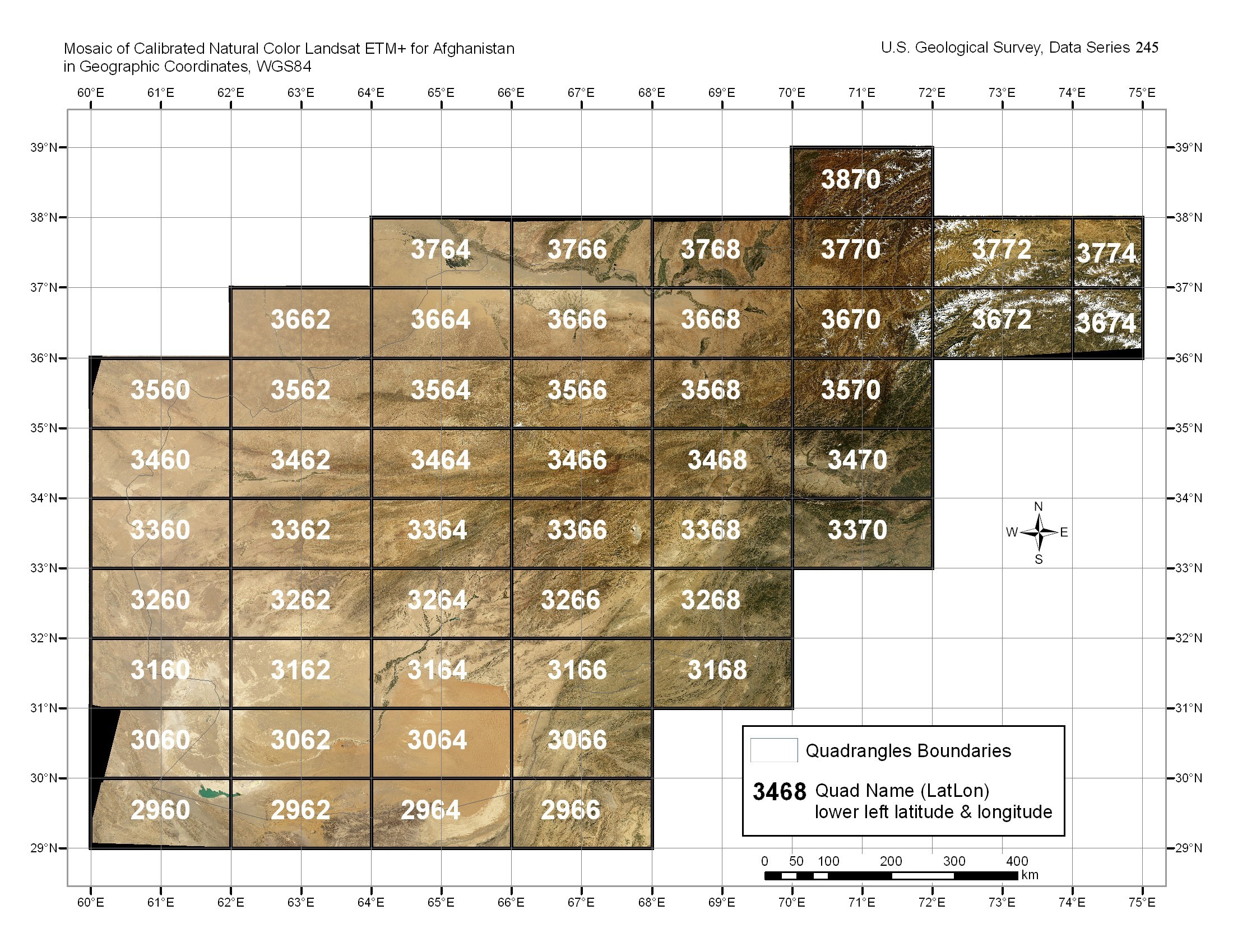
Each map quadrangle is 1° of latitude by° of longitude. The numbers assigned to each map quadrangle refer to the latitude and longitude coordinates of the lower left corner of the quadrangle. For example, quadrangle Q2960 has its lower left corner at lat 29° N., long 60° E. Each quadrangle overlaps adjacent quadrangles by 100 pixels (2.85 km). Only the 14.25-m-spacial-resolution UTM and 28.5-m-spacial-resolution WGS84 geographic geotiff datasets are available in this report to decrease the amount of space needed.
The images are (three-band, eight-bit) geotiffs with embedded georeferencing. As such, most software will not require the associated world files. An index of all available images in geographic is displayed here: INDEX_GEO_DD.PDF. The country of Afghanistan spans three UTM zones: (41–43). Maps are stored as geoTIFFs in their respective UTM zone projection. Indexes of all available topographic map sheets in their respective UTM zone are displayed here: INDEX_UTM_Z41.PDF, INDEX_UTM_Z42.PDF, INDEX_UTM_Z43.PDF. You will need Adobe Reader to view the PDF files. Download a copy of the latest version of Adobe Reader for free.
Read this report as a 10-page PDF file (LANDSAT_NATURAL_COLOR.PDF; 5.5 MB)
For questions about the content of this report, contact Philip Davis or Trent Hare
UTM_Z41_14M (open this directory)
Includes the compressed geotiff map quadrangles that fall within UTM Zone 41 at their true resolution of 14.25 meters/pixel.
UTM_Z42_14M (open this directory)
Includes the compressed geotiff map quadrangles that fall within UTM Zone 42 at their true resolution of 14.25 meters/pixel.
UTM_Z43_14M (open this directory)
Includes the compressed geotiff map quadrangles that fall within UTM Zone 43 at their true resolution of 14.25 meters/pixel.
GEO_DD_28M (open this directory)
The compressed geotiff quadrangles in this directory are in geographic (WGS84). The calculated cellsize in arc degrees is 0.0003087 arc degrees in X and 0.0002569 arc degrees in Y (28.5-m/pixel in projection). These files have been compressed using the zip format. See the SOFTWARE section for a utility to decompress the files although most operating systems can readily handle this type of file.
GEO_DD_28M/JPEG2000_MOSAIC (open this directory)
The Jpeg2000 image in this directory is a mosaic of the GEO_DD_28M 50 images but resampled to 0.00062 arc degrees (~57-m/pixel) square. The Kakadu compression method applied using the GDAL library with a default quality of 20:1. URL: http://www.gdal.org/ last accessed Jan. 27, 2007.
INDEX MAPS
METADATA
SHAPEFILES (open directory)
PLOTS_66x52_850K (open this directory)
The projection defined is Transverse Mercator using a WGS84 datum, 66º East central meridian, 34º North reference latitude, a scale factor of 0.9996, and a false easting and northing of zero. Country and province borders, major cities, and roads were obtained from Afghanistan Information Management Service and superposed on the countrywide, natural-color mosaic.
SOFTWARE (open this directory)
Produced in cooperation with:

This report is for sale as a three-DVD–ROM set from:
U.S. Geological Survey
Information Services, National Mapping Division
Box 25046
Denver Federal Center
Denver, CO 80225-0046
Telephone: (888) ASK-USGS
ISBN: 1-411-31777-7
Current pricing information is available from http://ask.usgs.gov/to_order.html.
USGS Afghanistan Project Product No. 036

![]() U.S. Department of the Interior | U.S. Geological Survey
U.S. Department of the Interior | U.S. Geological Survey
URL: https://pubs.usgs.gov/ds/2007/245/
Page Contact Information: Michael Diggles
Page Last Modified: March 2, 2007
