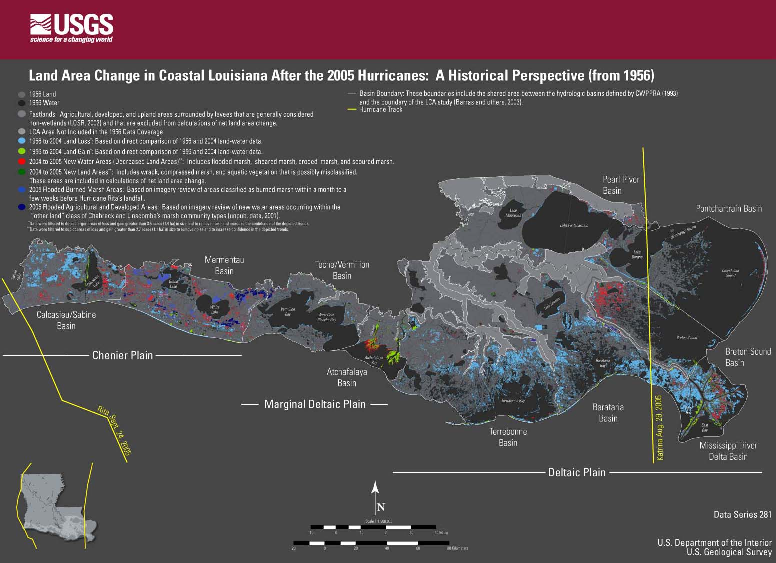
Hurricane
Katrina made landfall on the eastern coastline of Louisiana on August
29, 2005; Hurricane Rita made landfall on the western coastline of Louisiana
on September 24, 2005. Comparison of Landsat Thematic Mapper (TM) satellite
imagery acquired before and after the landfalls of Katrina and Rita and
classified to identify land and water demonstrated that water area increased
by 217 mi2 (562 km2) in coastal Louisiana as a result of the storms. These new water areas represent
land losses caused by direct removal of wetlands. They also indicate
transitory changes in water area caused by remnant flooding, removal
of aquatic vegetation, scouring of marsh vegetation, and water-level
variation attributed to normal tidal and meteorological variation between
satellite images. Permanent land losses cannot be estimated until several
growing seasons have passed and the transitory impacts of the hurricanes
are minimized. The purpose of this study was to provide preliminary information
on water area changes in coastal Louisiana acquired shortly after the
landfalls of both hurricanes (detectable with Landsat TM imagery) and
to serve as a regional baseline for monitoring posthurricane wetland
recovery.
The images are provided
in low-resolution, Joint Photographic Experts Group (JPEG) format for
efficiency in Web viewing and in high-resolution, Portable Document
Format (PDF) for downloading and printing; they are not Section 508 compliant.
Introduction
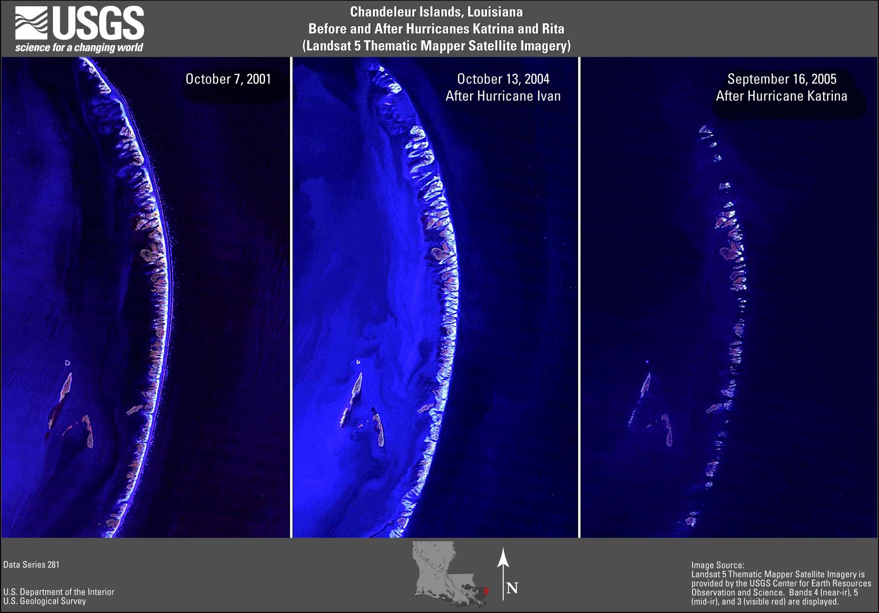
- Figure 1. Chandeleur
Islands TM image (JPEG or PDF).
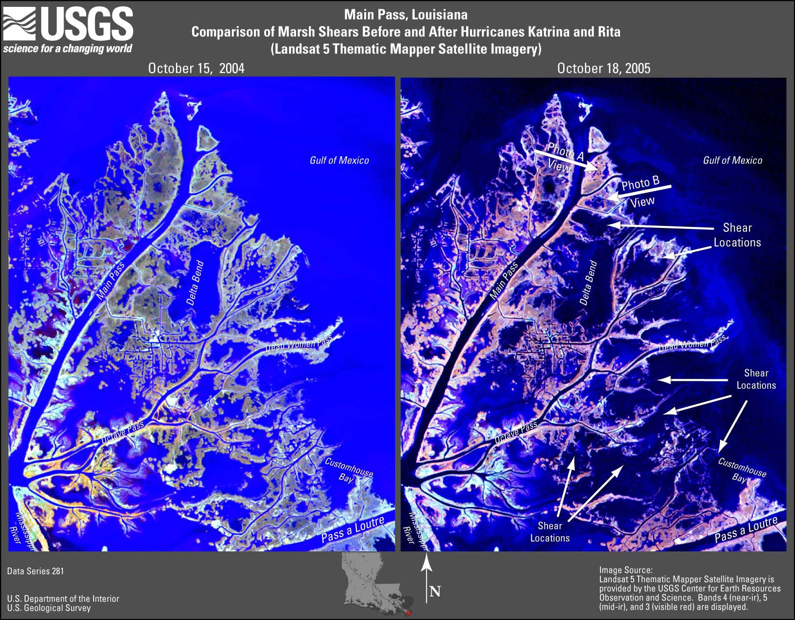
- Figure 2A. Main
Pass TM image (JPEG or PDF).
- Figure 2B. Main
Pass photo A (JPEG or PDF).
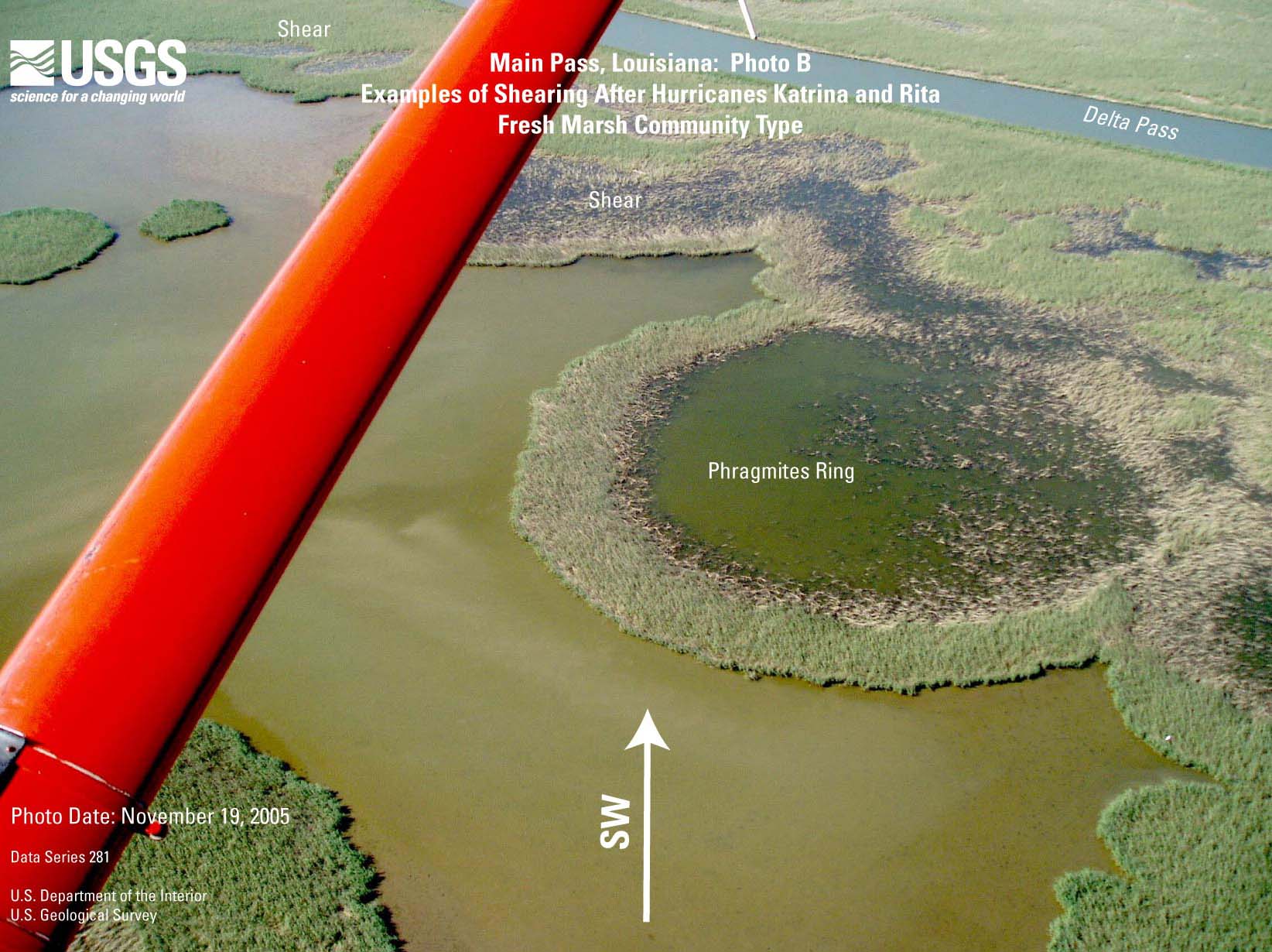
- Figure 2C. Main
Pass photo B (JPEG or PDF).
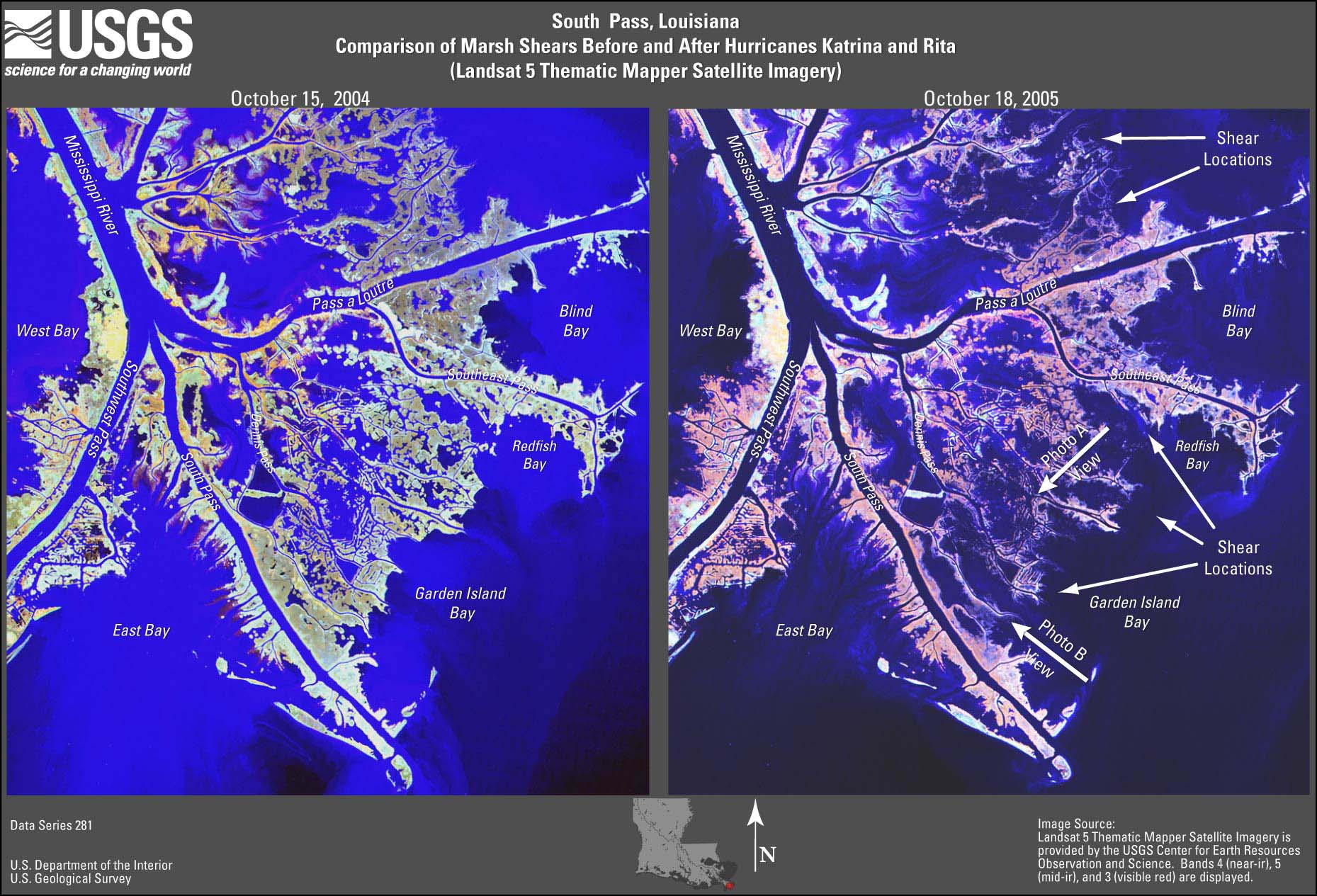
- Figure 3A. South
Pass TM image (JPEG or PDF).
- Figure 3B. South
Pass photo A (JPEG or PDF).
- Figure 3C. South
Pass photo B (JPEG or PDF).
- Figure 3D. South
Pass after Ivan TM image (JPEG or PDF).
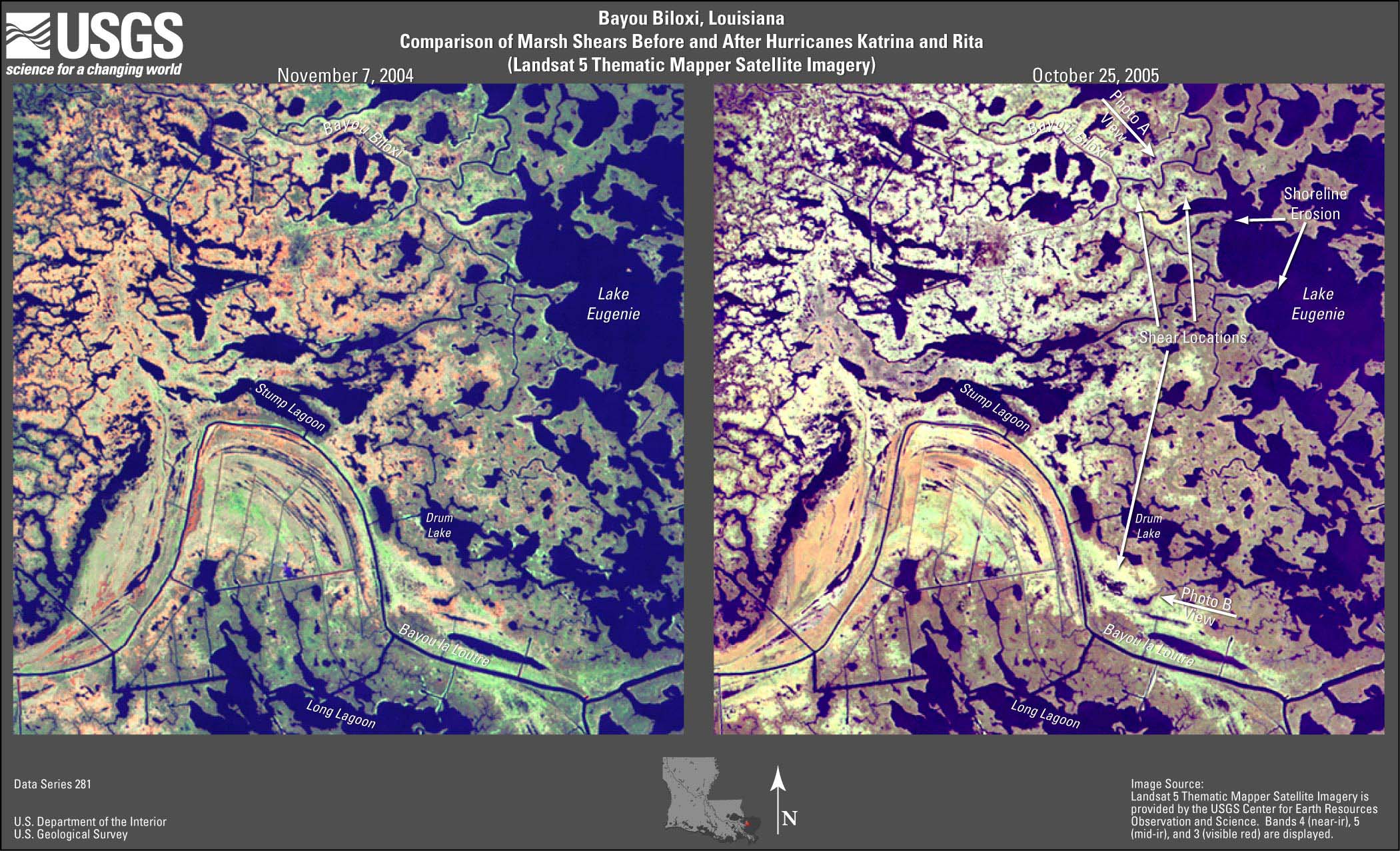
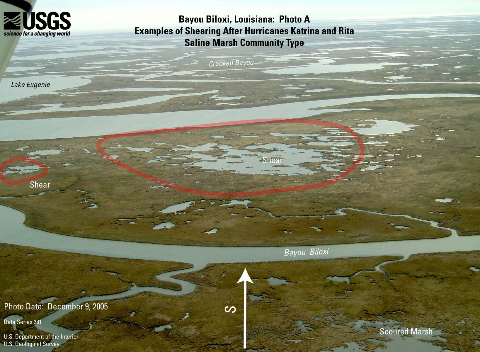
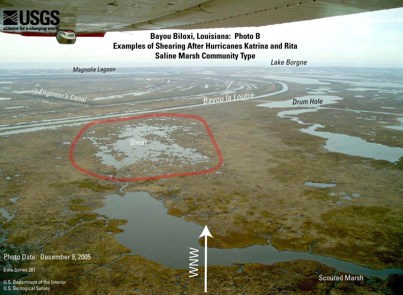
- Figure 4A. Bayou
Biloxi TM image (JPEG or PDF).
- Figure 4B. Bayou
Biloxi photo A (JPEG or PDF).
- Figure 4C. Bayou
Biloxi photo B (JPEG or PDF).
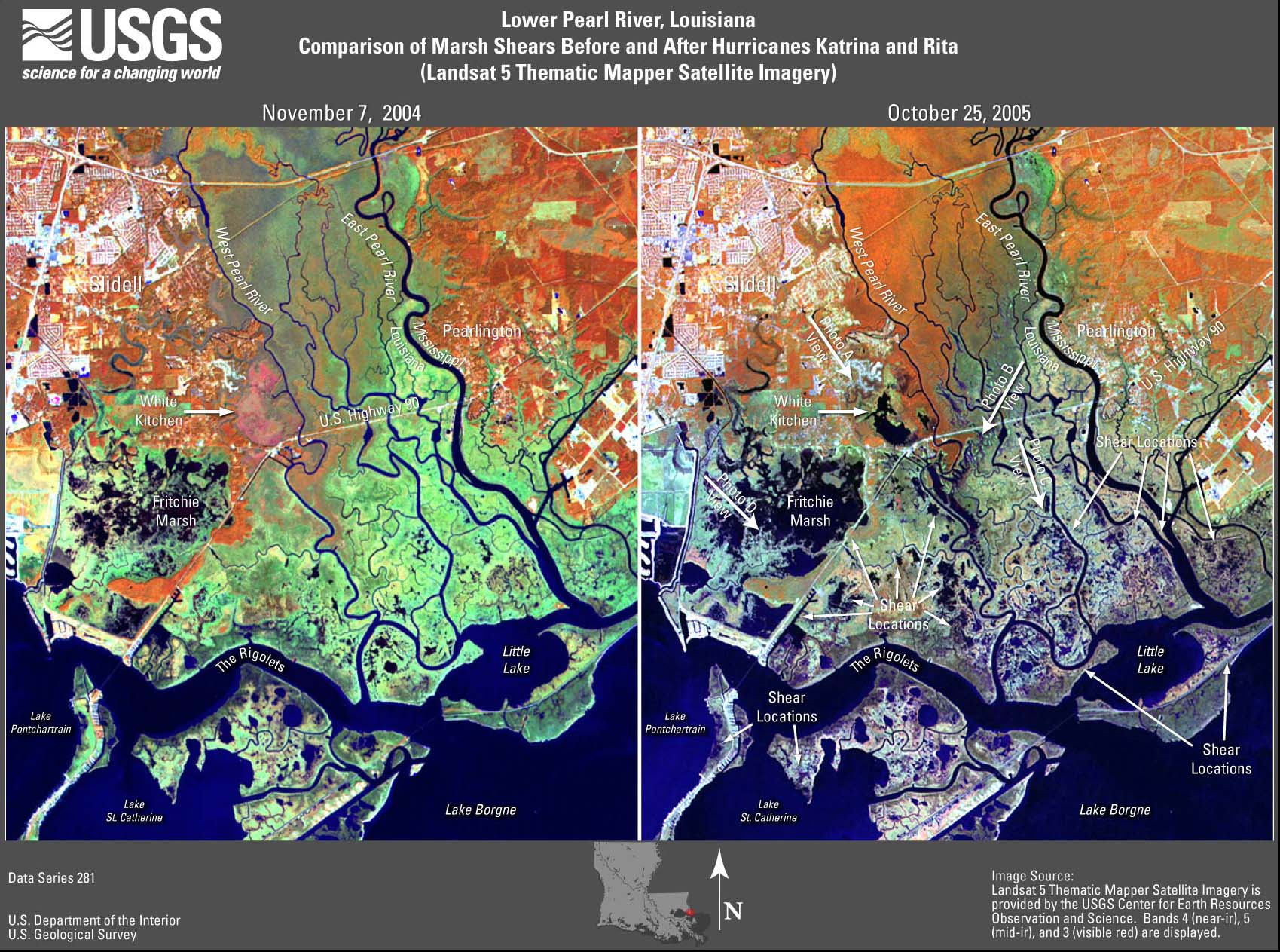
- Figure 5A. Lower
Pearl River TM image (JPEG or PDF).
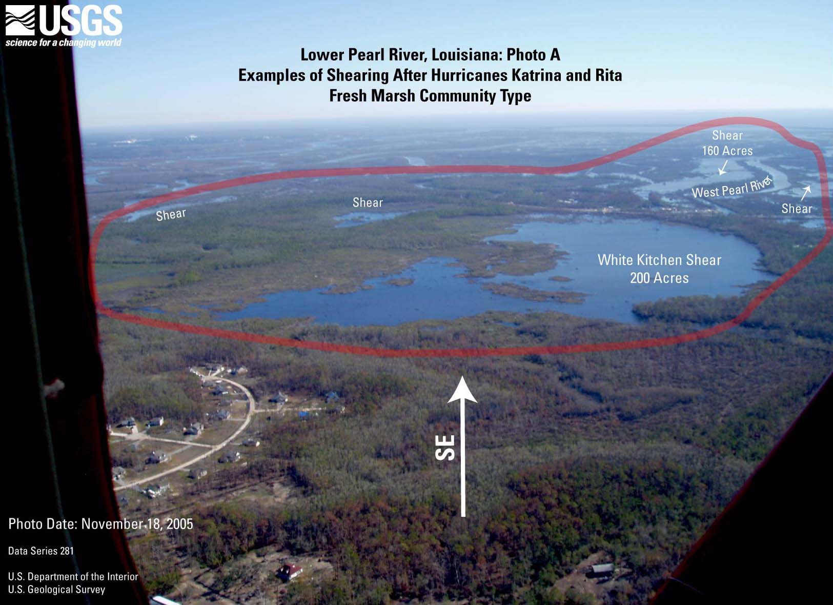
- Figure 5B. Lower
Pearl River photo A (JPEG or PDF).
- Figure 5C. Lower
Pearl River photo B (JPEG or PDF).
- Figure 5D. Lower
Pearl River photo C (JPEG or PDF).
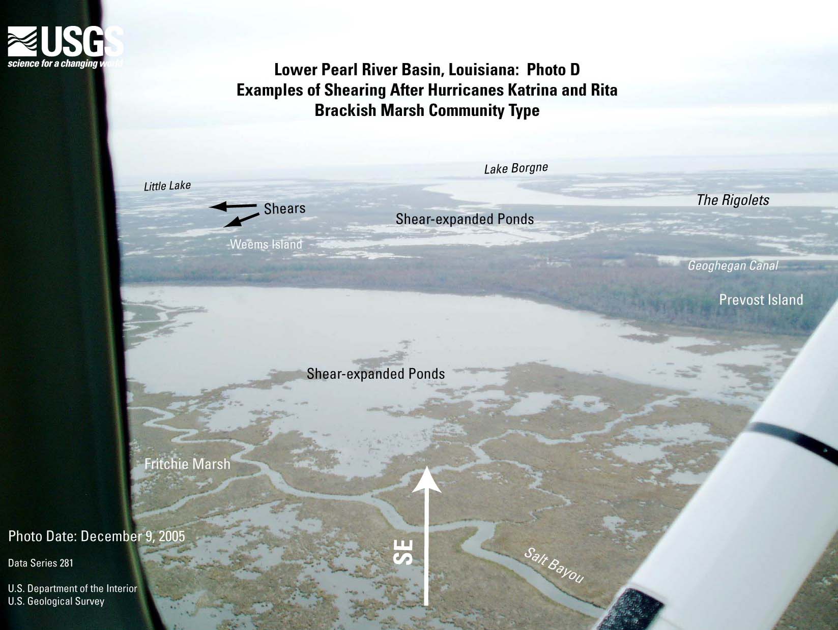
- Figure 5E. Lower
Pearl River photo D (JPEG or PDF).
- Figure 6A. Alligator
Point TM image (JPEG or PDF).
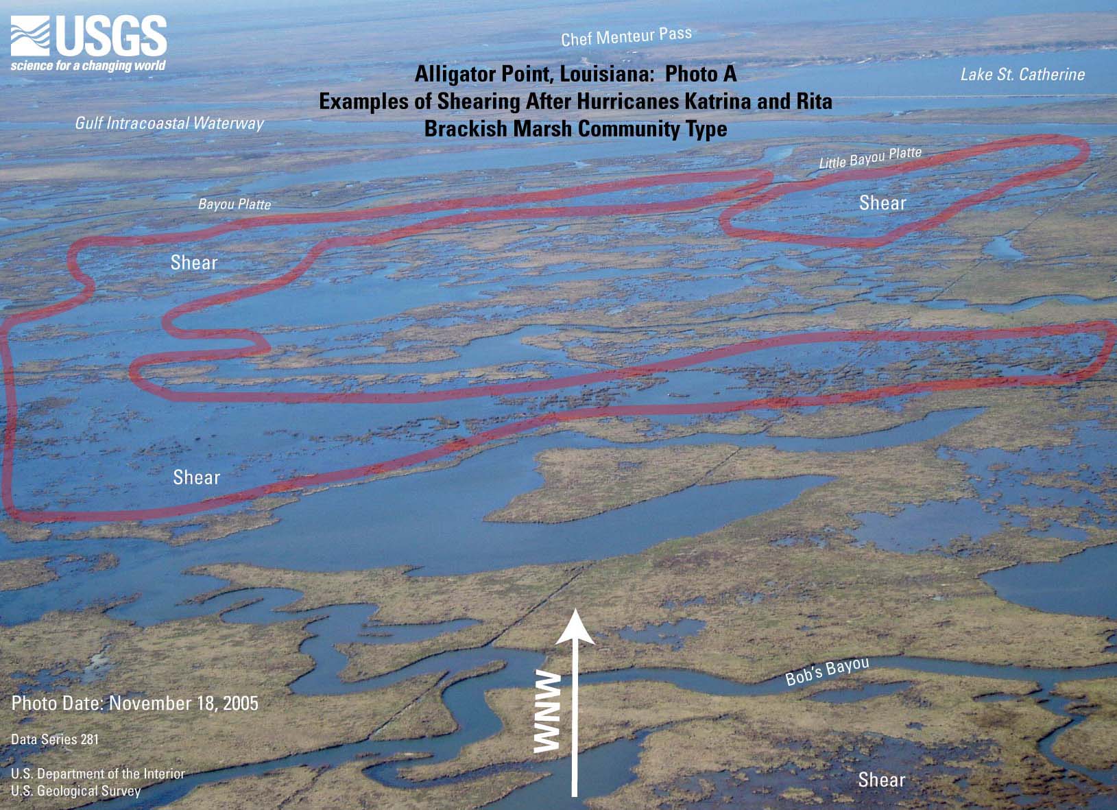
- Figure 6B. Alligator
Point photo A (JPEG or PDF).
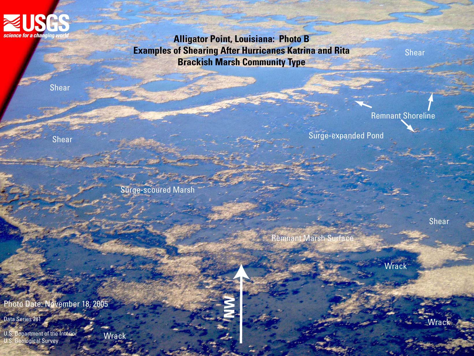
- Figure 6C. Alligator
Point photo B (JPEG or PDF).
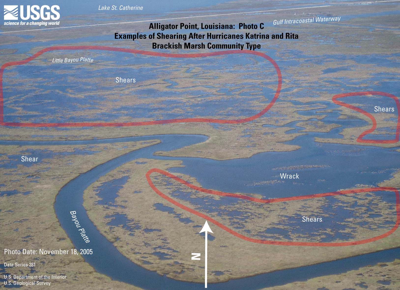
- Figure 6D. Alligator
Point photo C (JPEG or PDF).
- Figure 7A. Delacroix
TM image (JPEG or PDF).
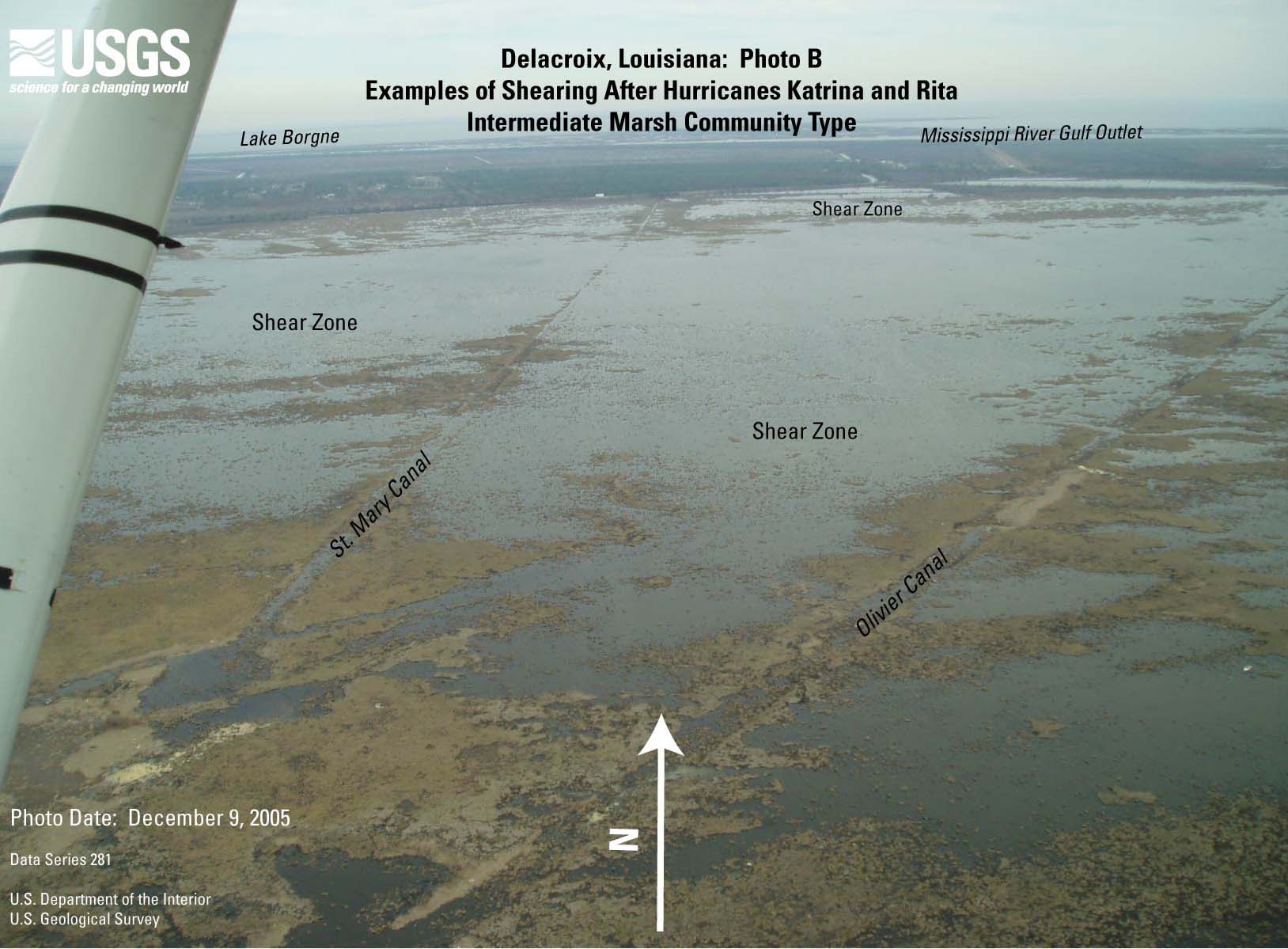
- Figure 7B. Delacroix
photo A (JPEG or PDF).
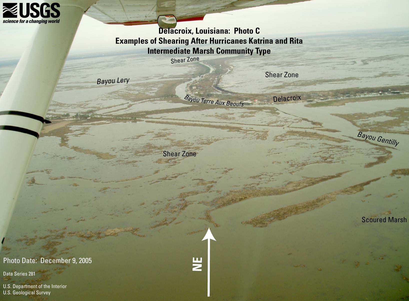
- Figure 7C. Delacroix
photo B (JPEG or PDF).
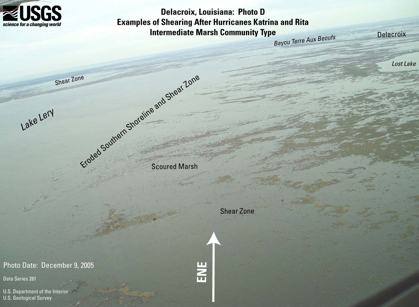
- Figure 7D. Delacroix
photo C (JPEG or PDF).
- Figure 7E. Delacroix
photo D (JPEG or PDF).
- Figure 7F. Delacroix
photo E (JPEG or PDF).
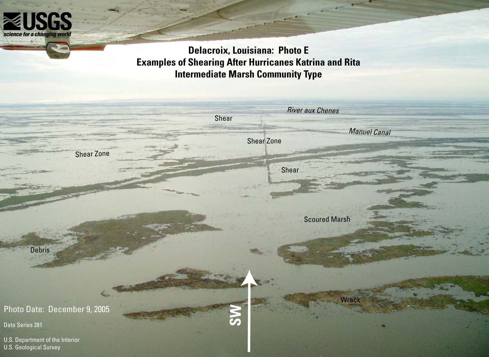
- Figure 7G. Delacroix
photo F (JPEG or PDF).
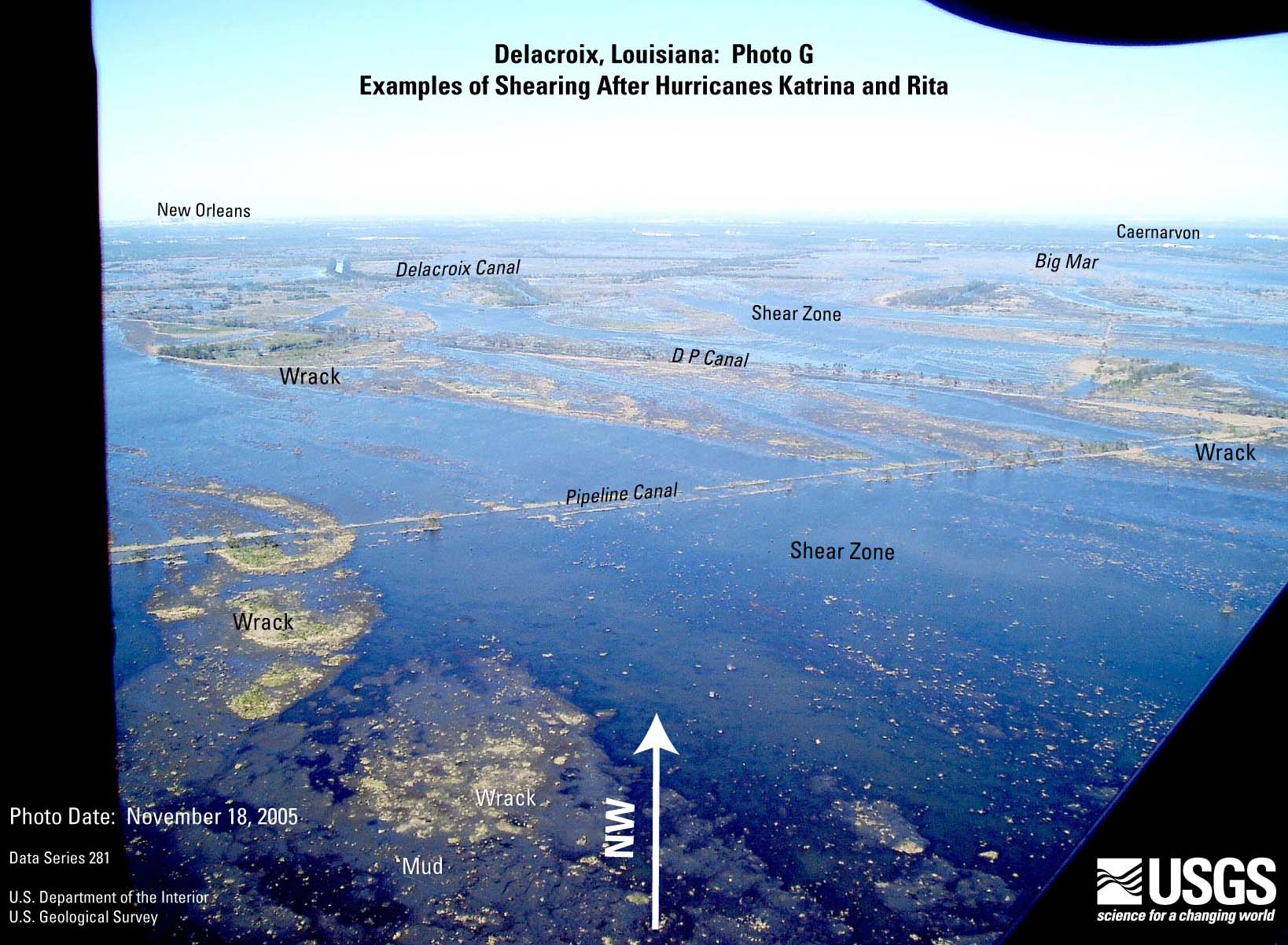
- Figure 7H. Delacroix
photo G (JPEG or PDF).
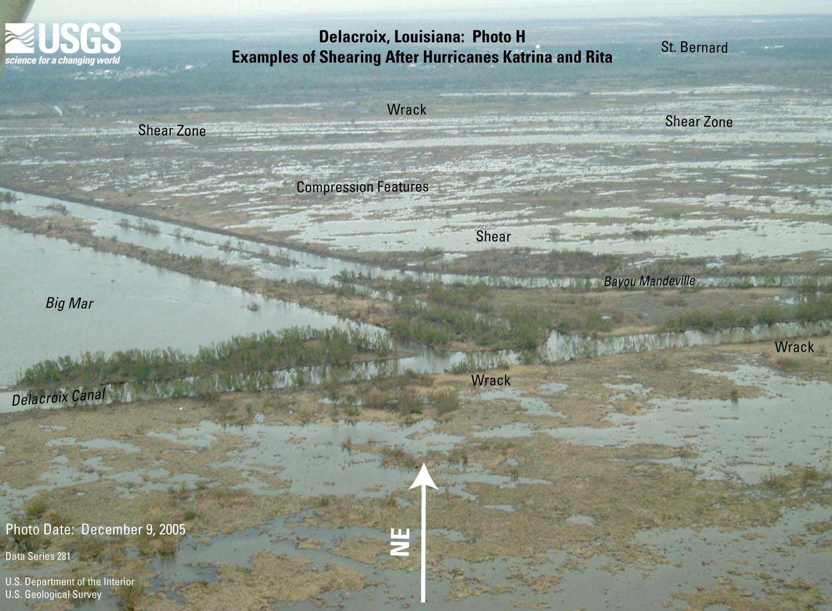
- Figure 7I. Delacroix
photo H (JPEG or PDF).
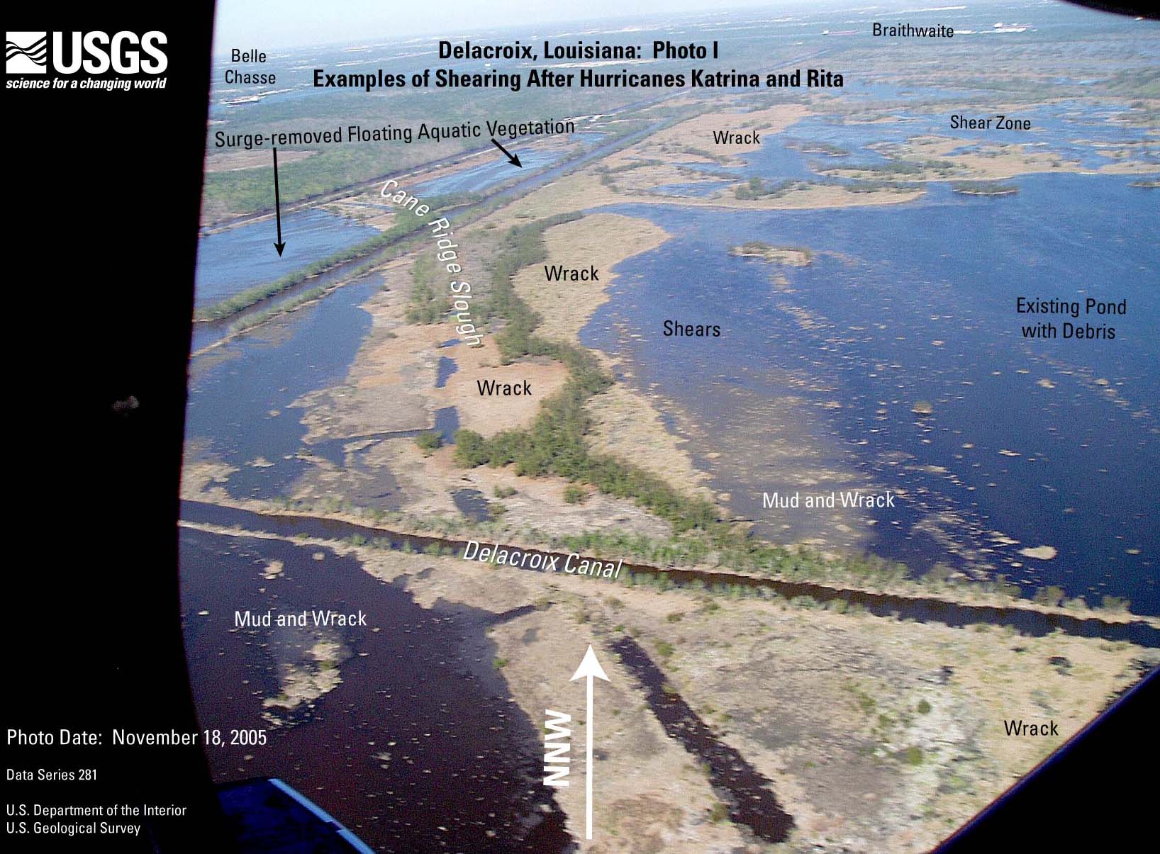
- Figure 7J. Delacroix
photo I (JPEG or PDF).
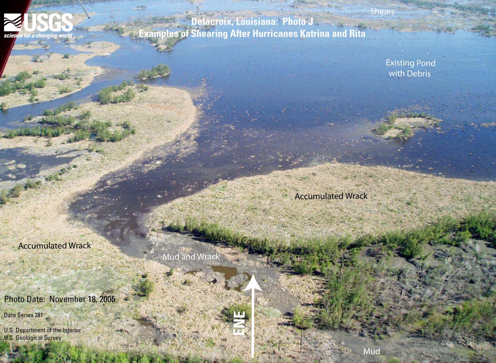
- Figure 7K. Delacroix
photo J (JPEG or PDF).
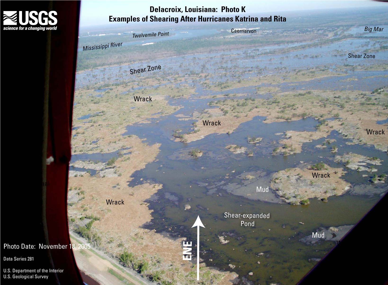
- Figure 7L. Delacroix
photo K (JPEG or PDF).
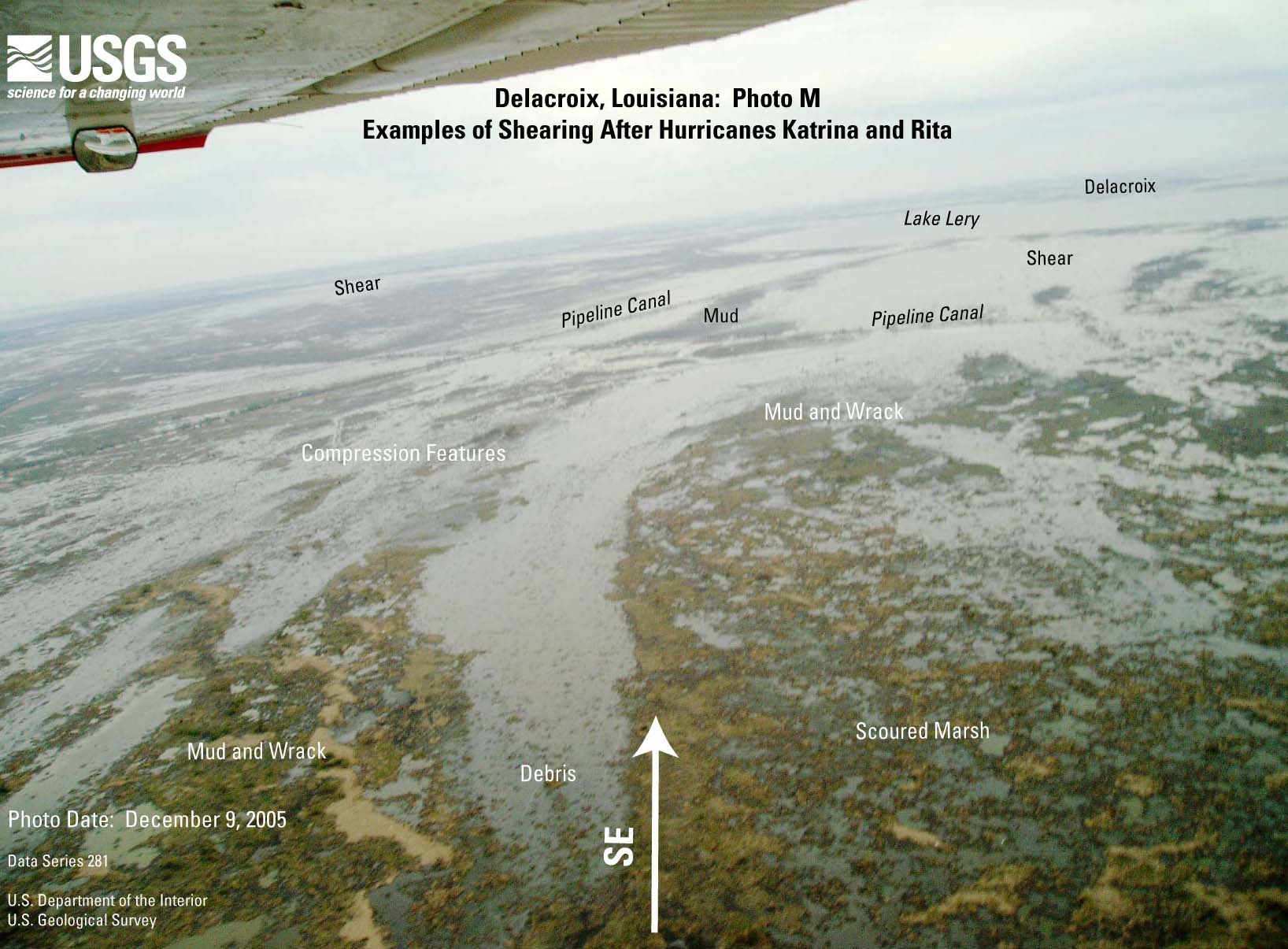
- Figure 7M. Delacroix photo L (JPEG or PDF).
- Figure 7N. Delacroix
photo M (JPEG or PDF).
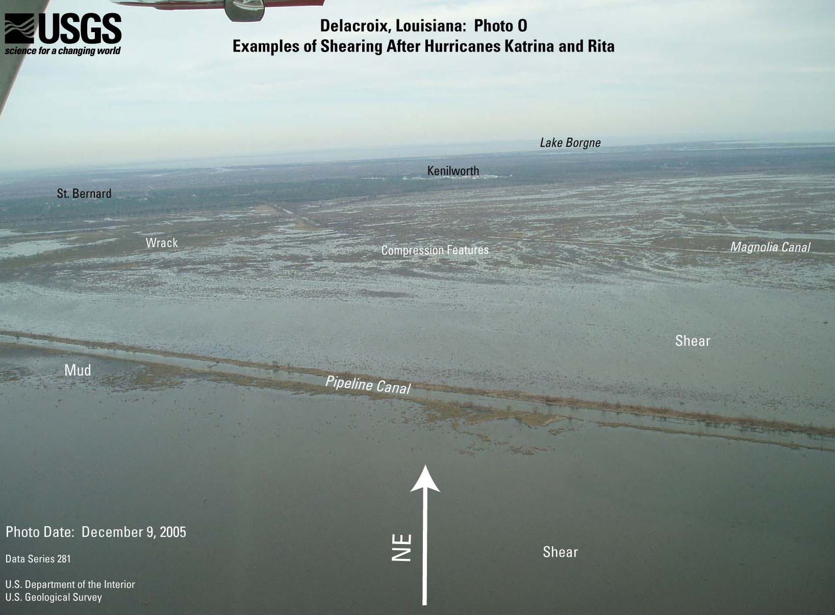
- Figure 7O. Delacroix
photo N (JPEG or PDF).
- Figure 7P. Delacroix
photo O (JPEG or PDF).
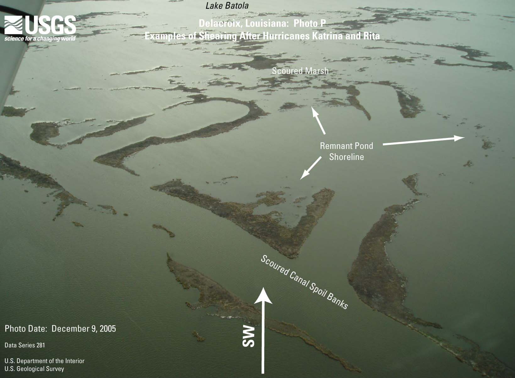
- Figure 7Q. Delacroix
photo P (JPEG or PDF).
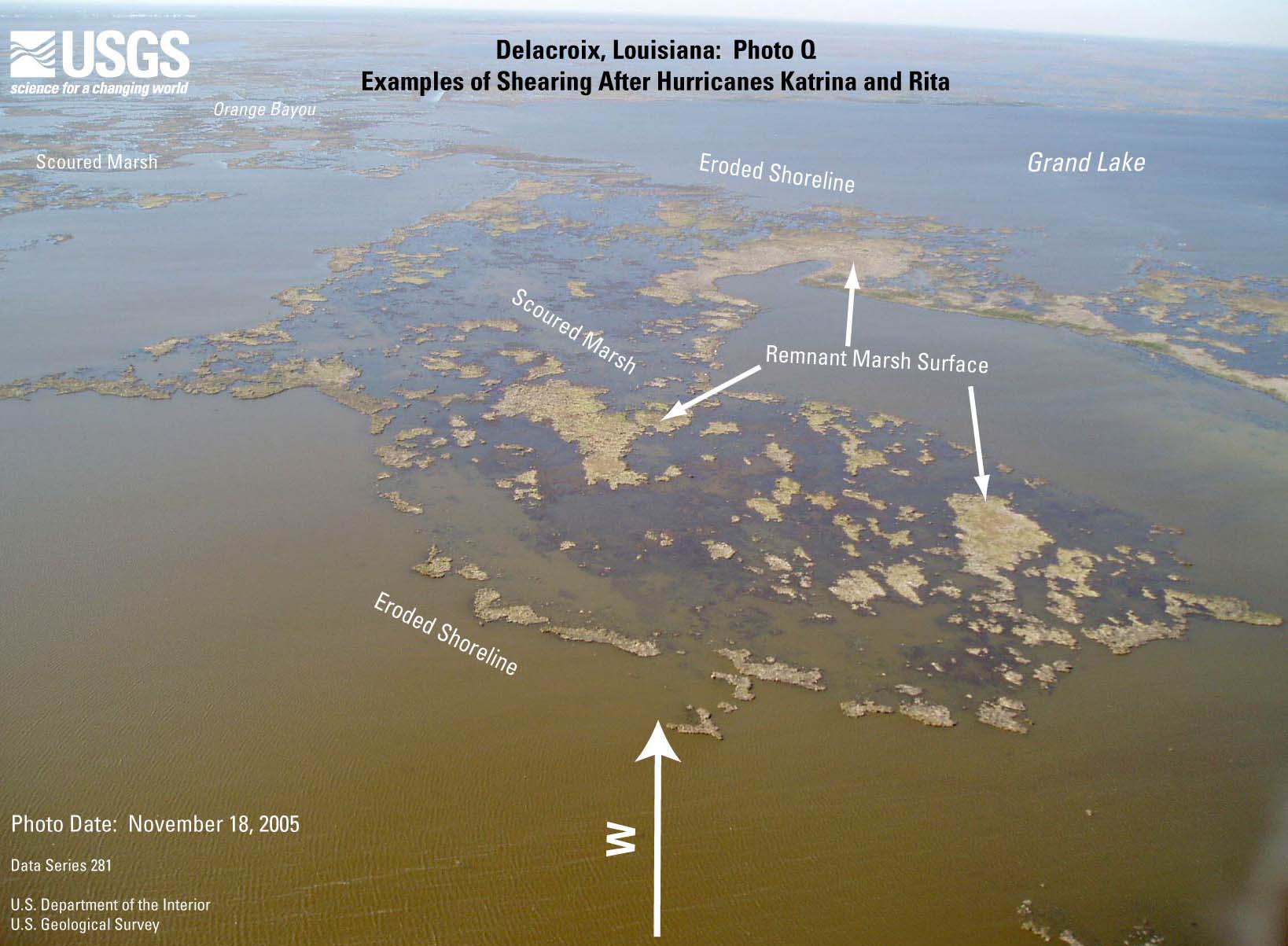
- Figure 7R. Delacroix
photo Q (JPEG or PDF).
- Figure 7S. Delacroix
photo R (JPEG or PDF).
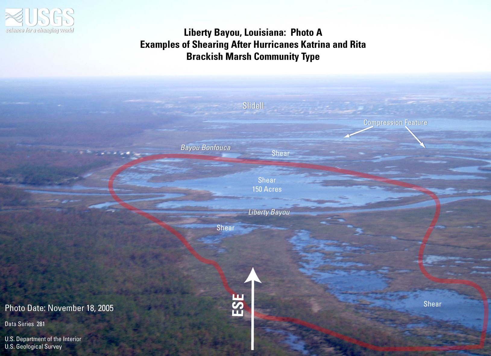
- Figure 8A. Liberty
Bayou TM image (JPEG or PDF).
- Figure 8B. Liberty
Bayou photo A (JPEG or PDF).
- Figure 8C. Liberty
Bayou photo B (JPEG or PDF).
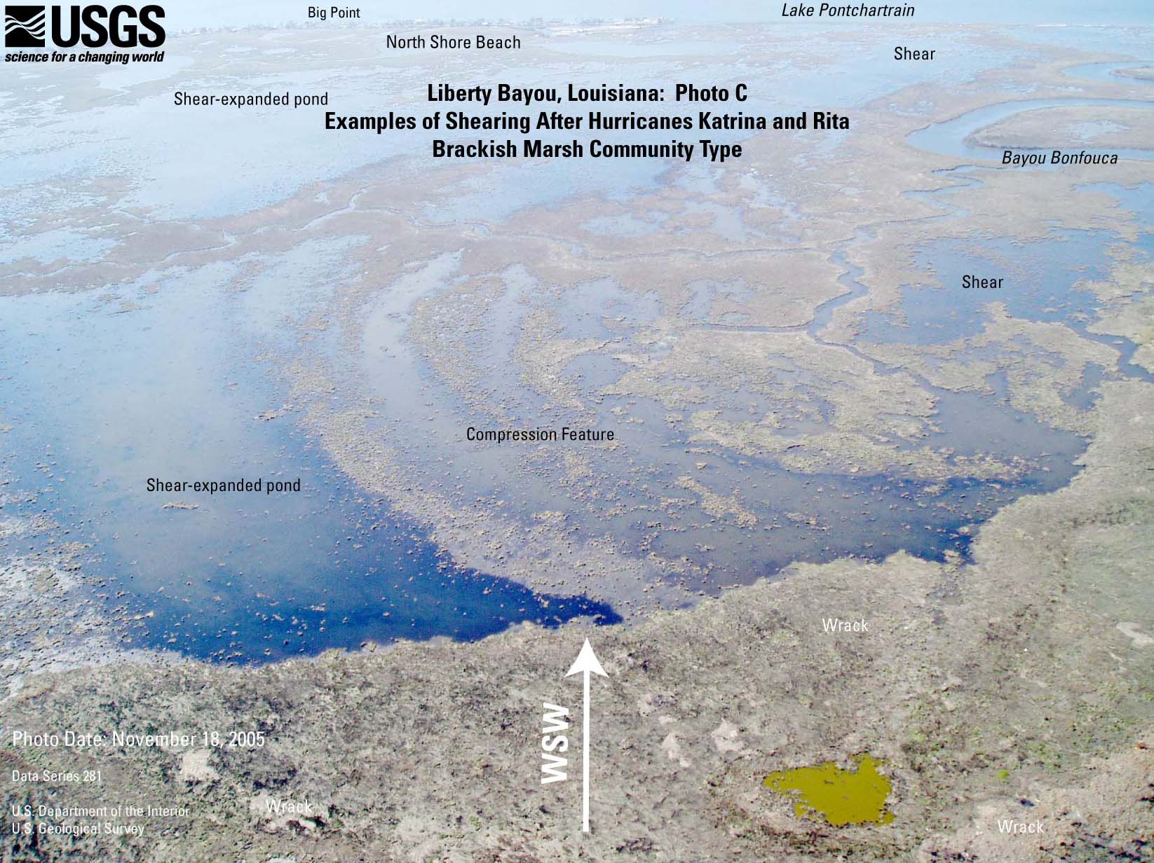
- Figure 8D. Liberty
Bayou photo C (JPEG or PDF).
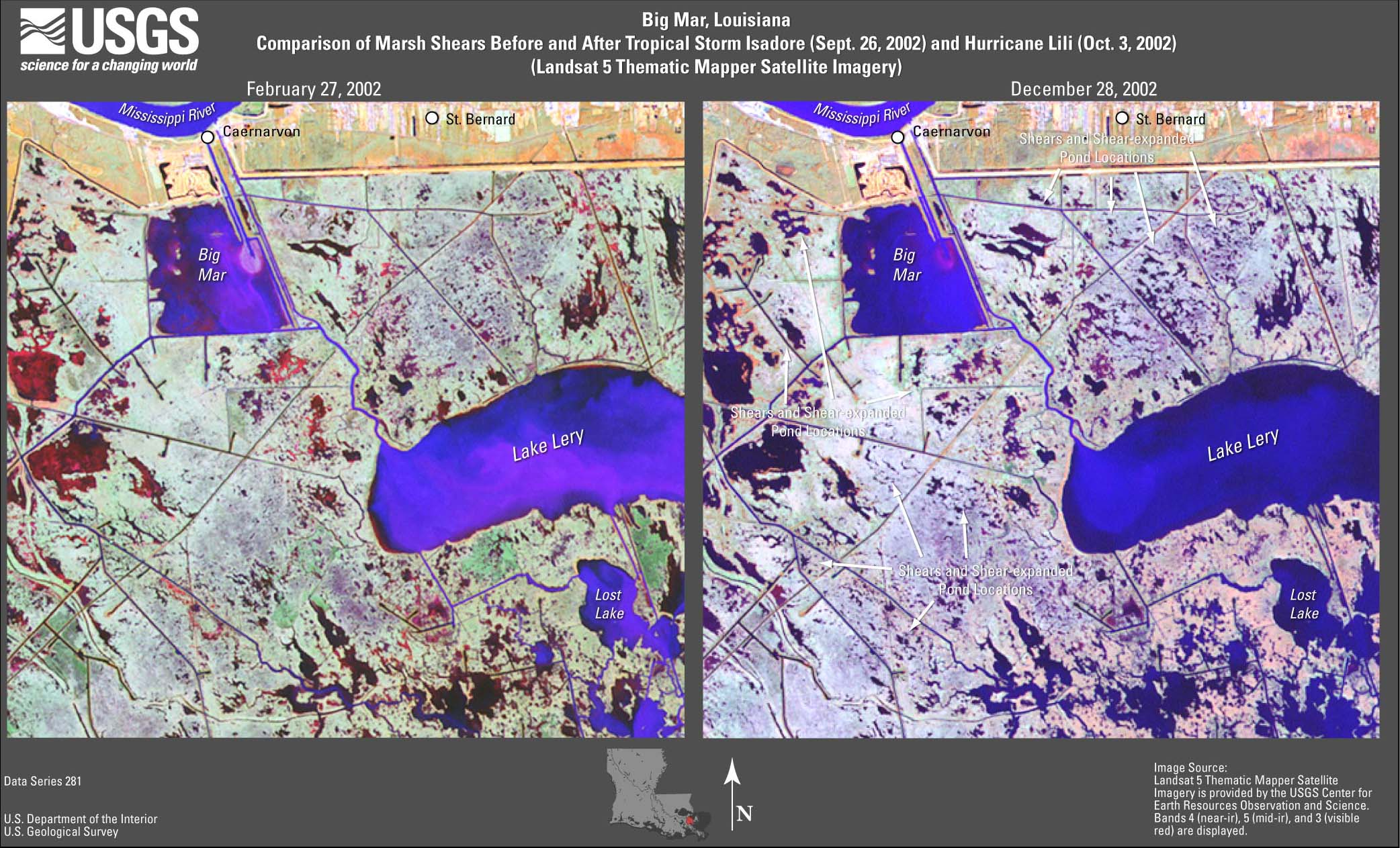
- Figure 9. Big
Mar TM image (JPEG or PDF).
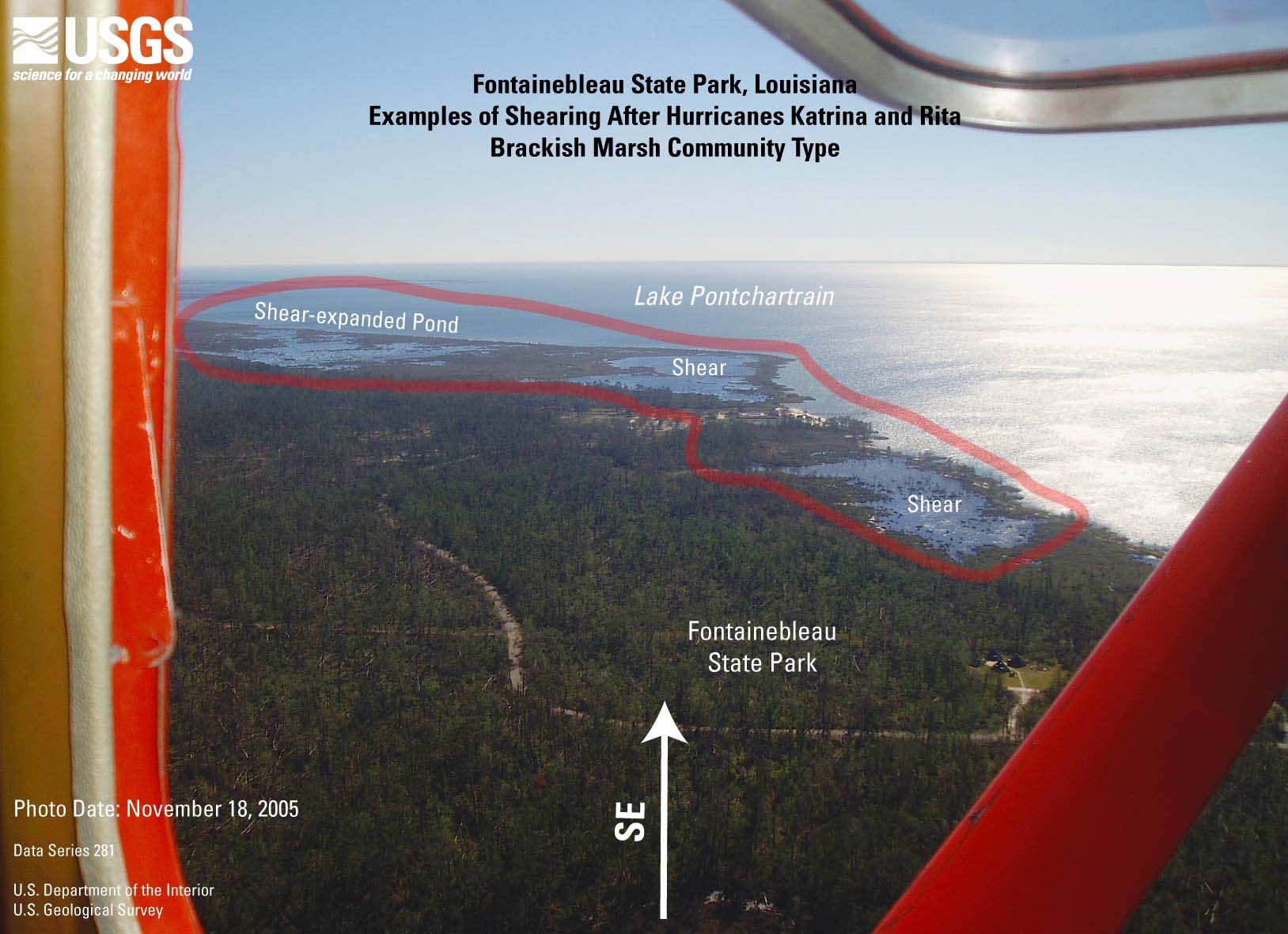
- Figure 10A. Fontainebleau
State Park TM image (JPEG or PDF).
- Figure 10B. Fontainebleau
State Park photo (JPEG or PDF).
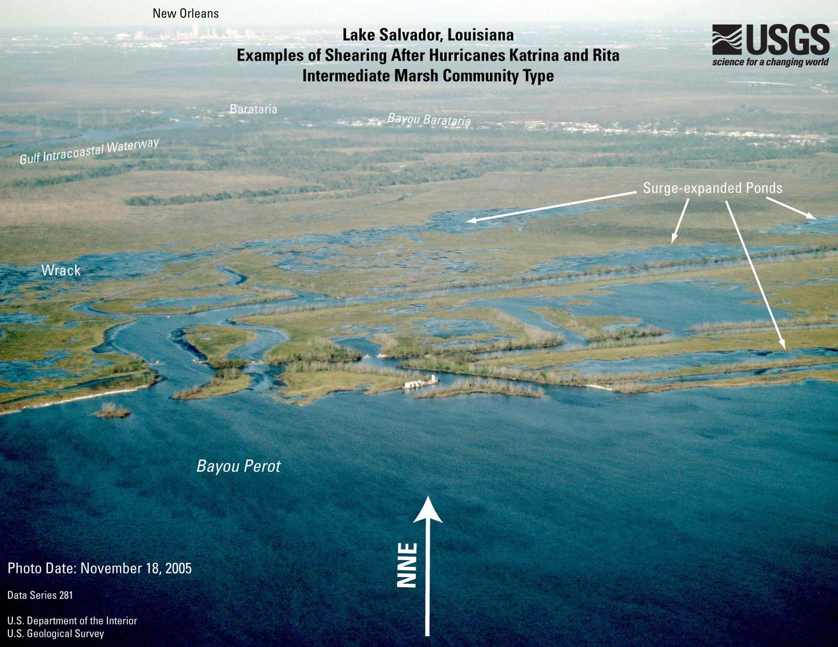
- Figure 11A. Lake
Salvador TM image (JPEG or PDF).
- Figure 11B. Lake
Salvador photo (JPEG or PDF).
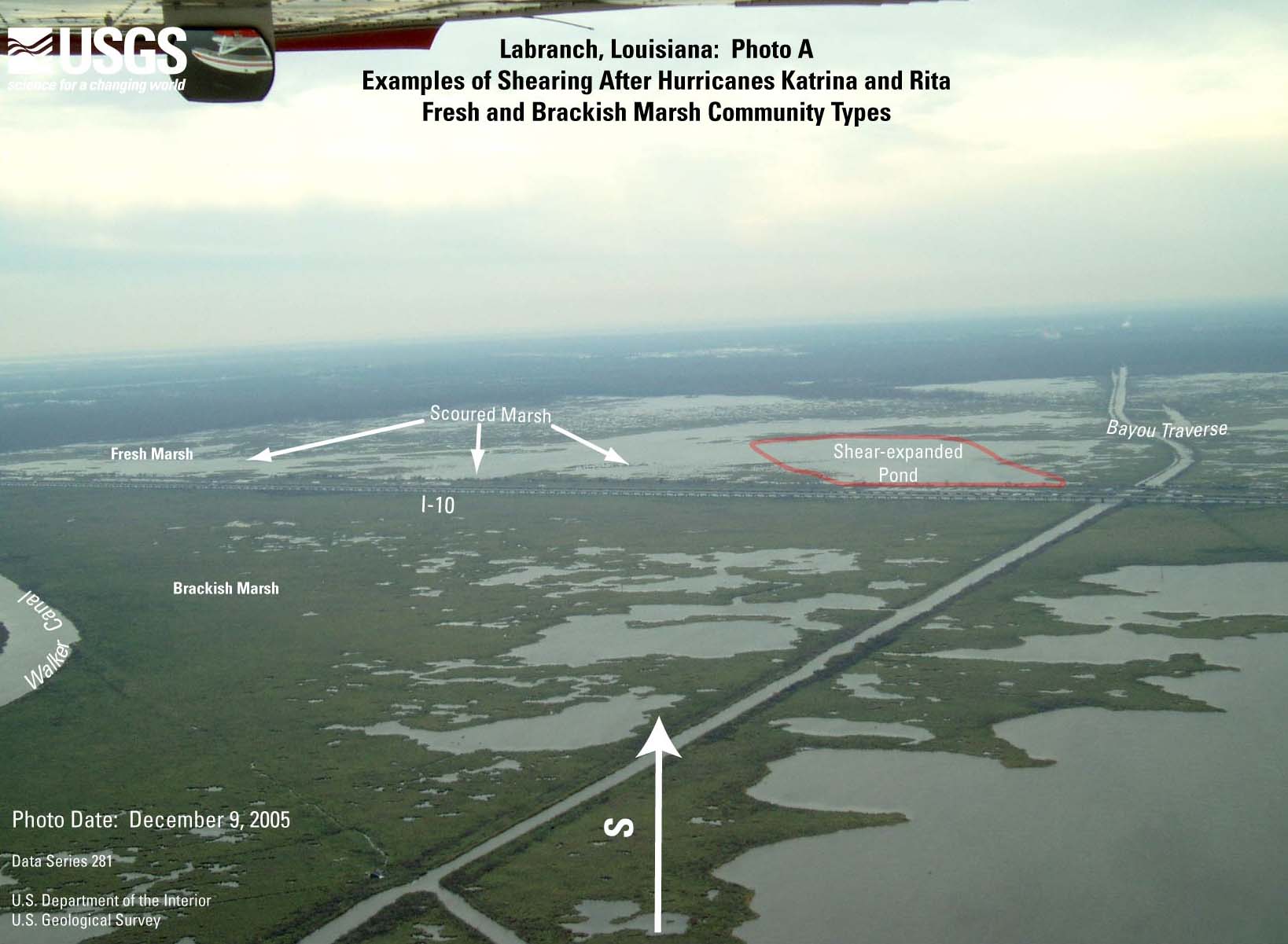
- Figure 12A. Labranch
TM image (JPEG or PDF).
- Figure 12B. Labranch
photo A (JPEG or PDF).
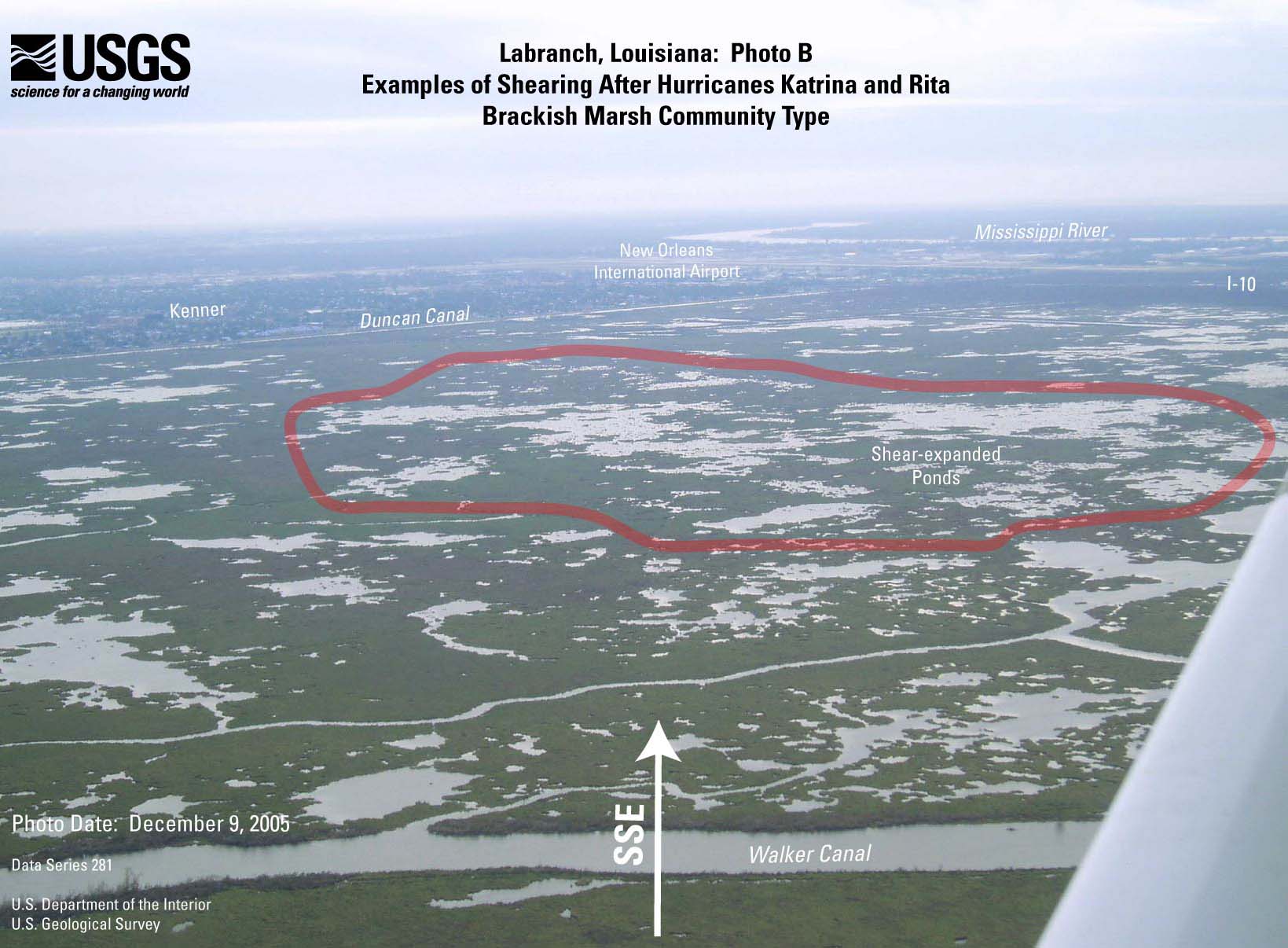
- Figure 12C. Labranch
photo B (JPEG or PDF).
- Figure 12D. Labranch
photo C (JPEG or PDF).
- Figure 13A. Bayou
Pointe au Chien TM image (JPEG or PDF).
- Figure 13B. Bayou
Pointe au Chien photo A (JPEG or PDF).
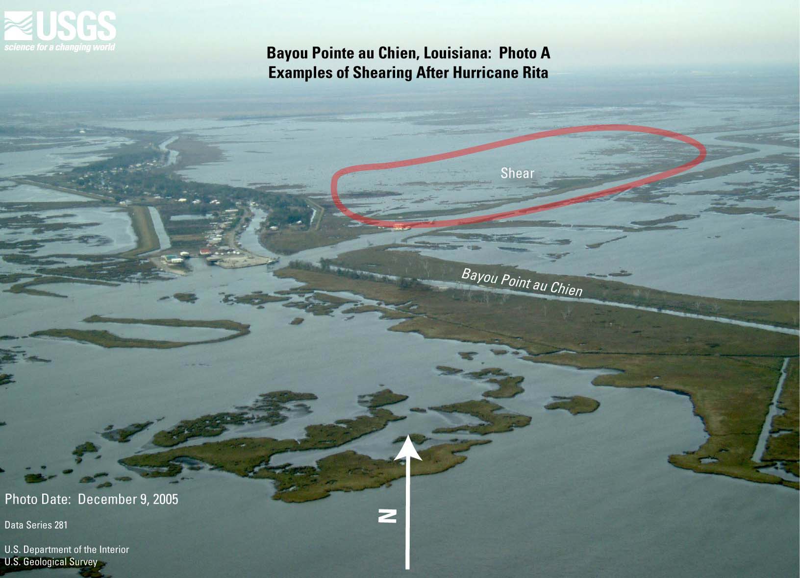
- Figure 13C. Bayou
Pointe au Chien photo B (JPEG or PDF).
- Figure 14A. Lake
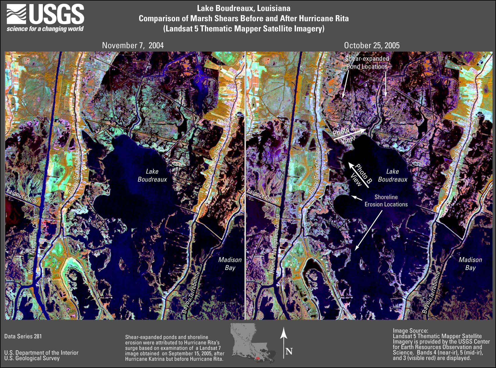
Boudreaux TM image (JPEG or PDF).
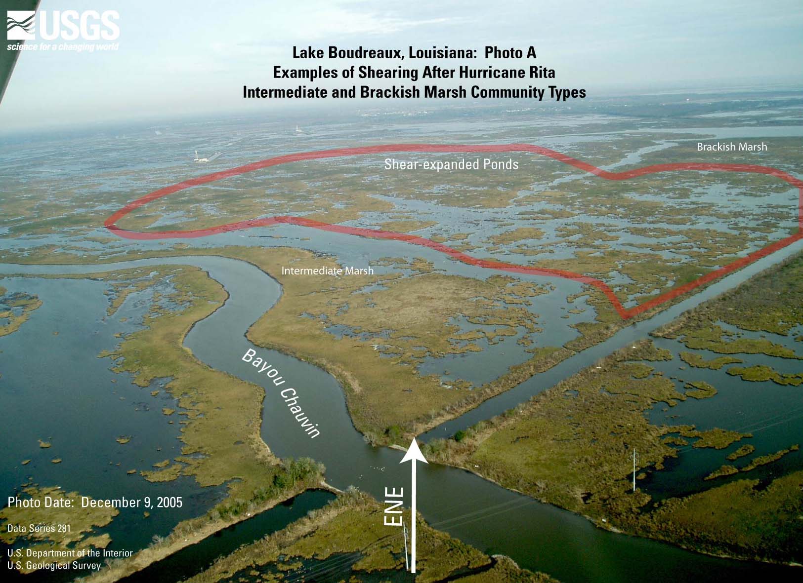
- Figure 14B. Lake
Boudreaux photo A (JPEG or PDF).
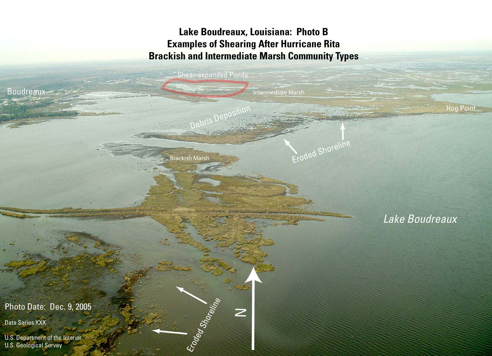
- Figure 14C. Lake
Boudreaux photo B (JPEG or PDF).
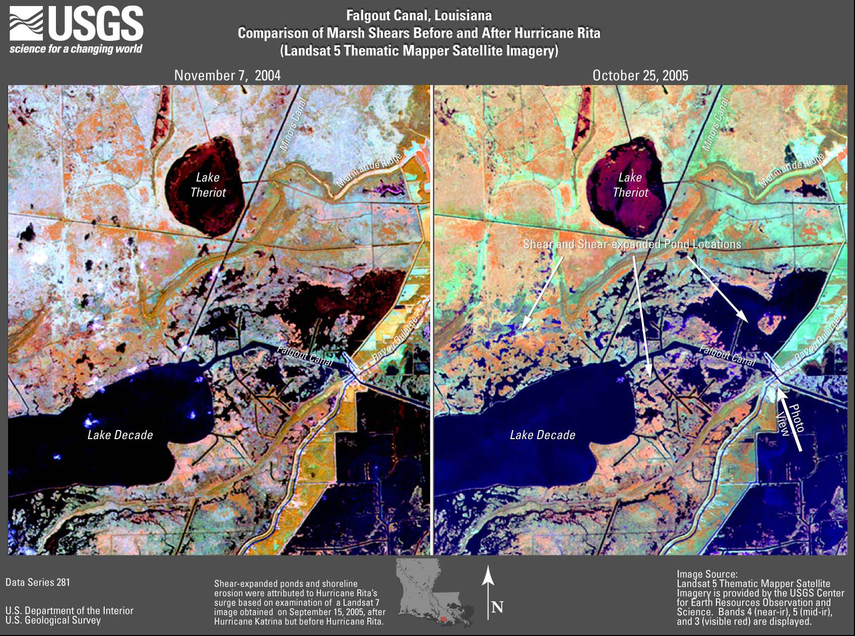
- Figure 15A. Falgout
Canal TM image (JPEG or PDF).
- Figure 15B. Falgout
Canal photo (JPEG or PDF).
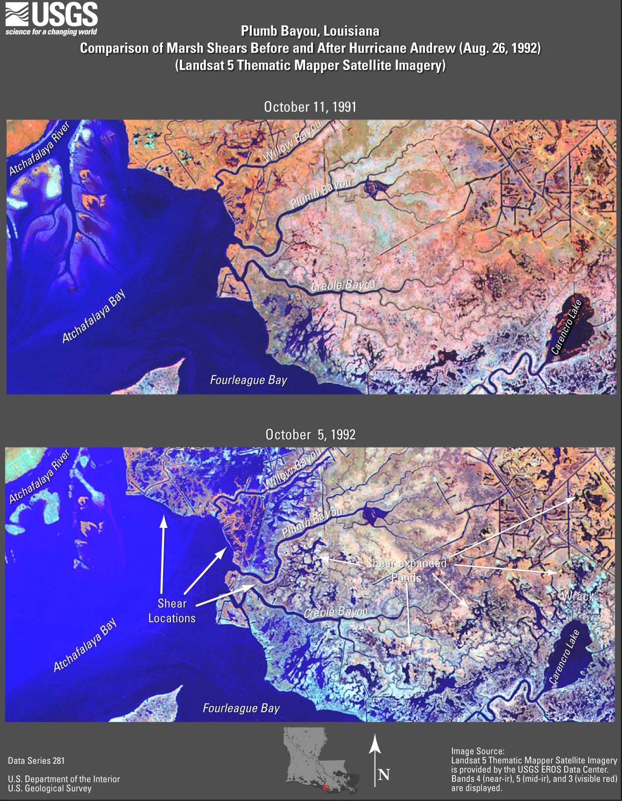
- Figure 16A. Plumb
Bayou (Rita) TM image (JPEG or PDF).
- Figure 16B. Plumb
Bayou (Lili) TM image (JPEG or PDF).
- Figure 16C. Plumb
Bayou (Andrew) TM image (JPEG or PDF).
- Figure 17. Big
Hog Bayou TM image (JPEG or PDF).
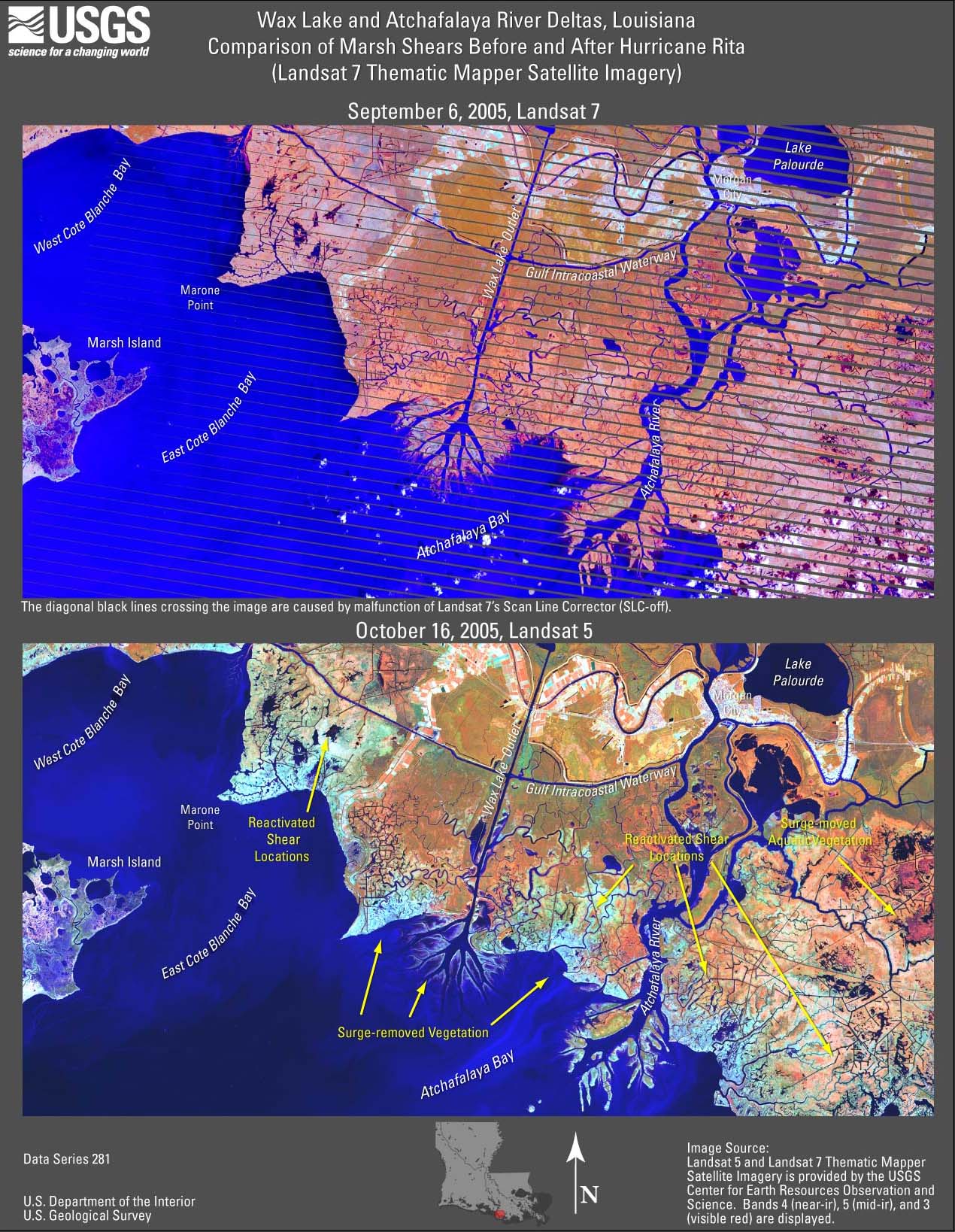
- Figure 18A. Wax
Lake and Atchafalaya River Deltas (Rita) TM image (JPEG or PDF).
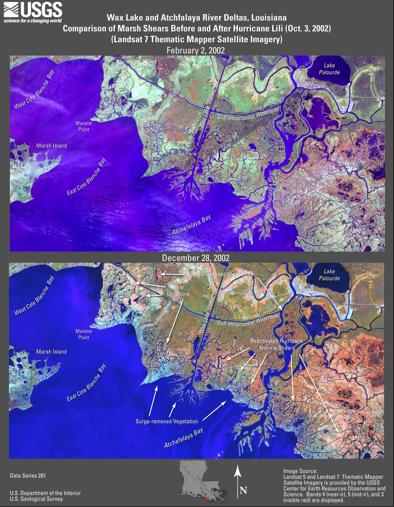
- Figure 18B. Wax
Lake and Atchafalaya River Deltas (Lili) TM image (JPEG or PDF).
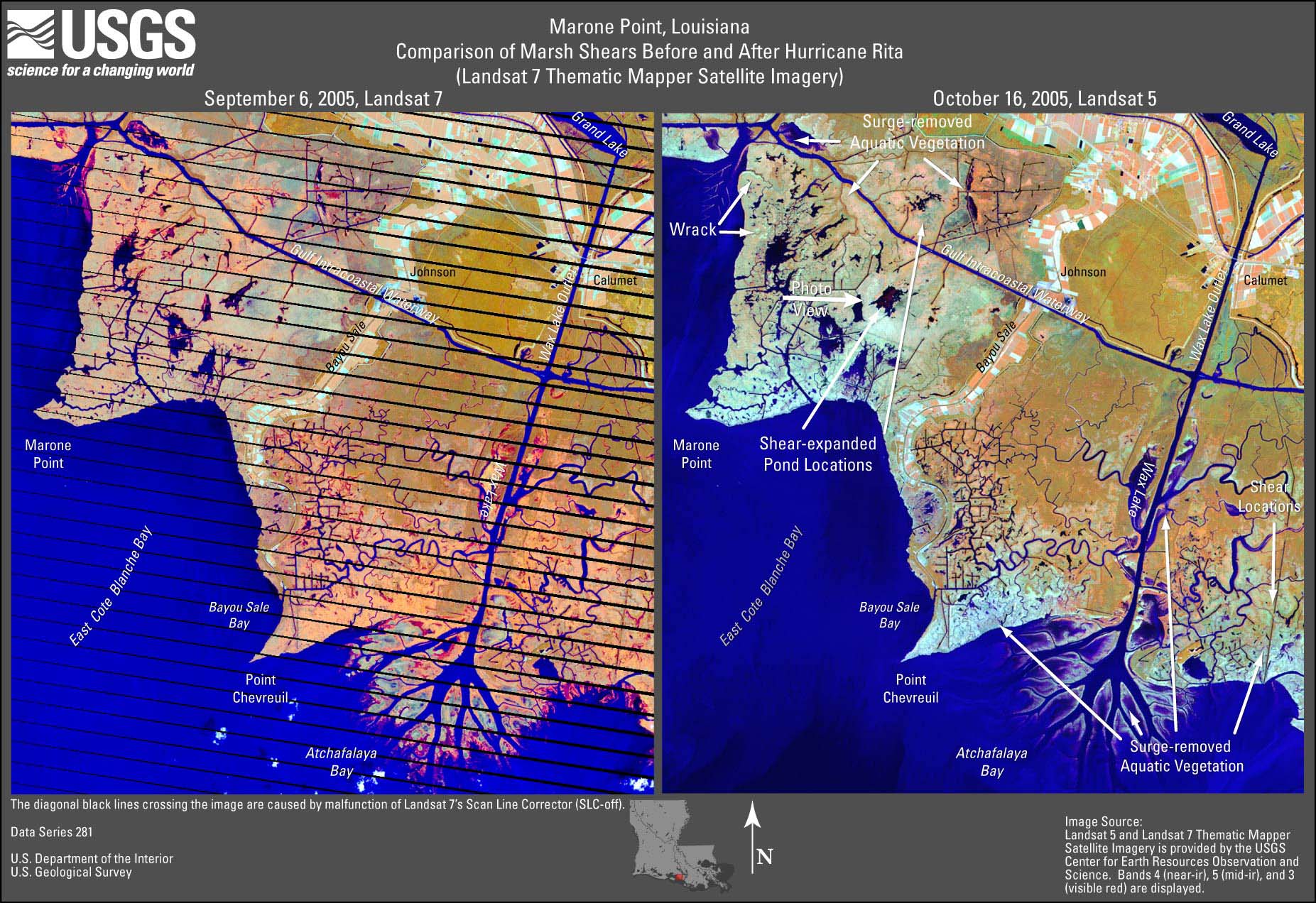
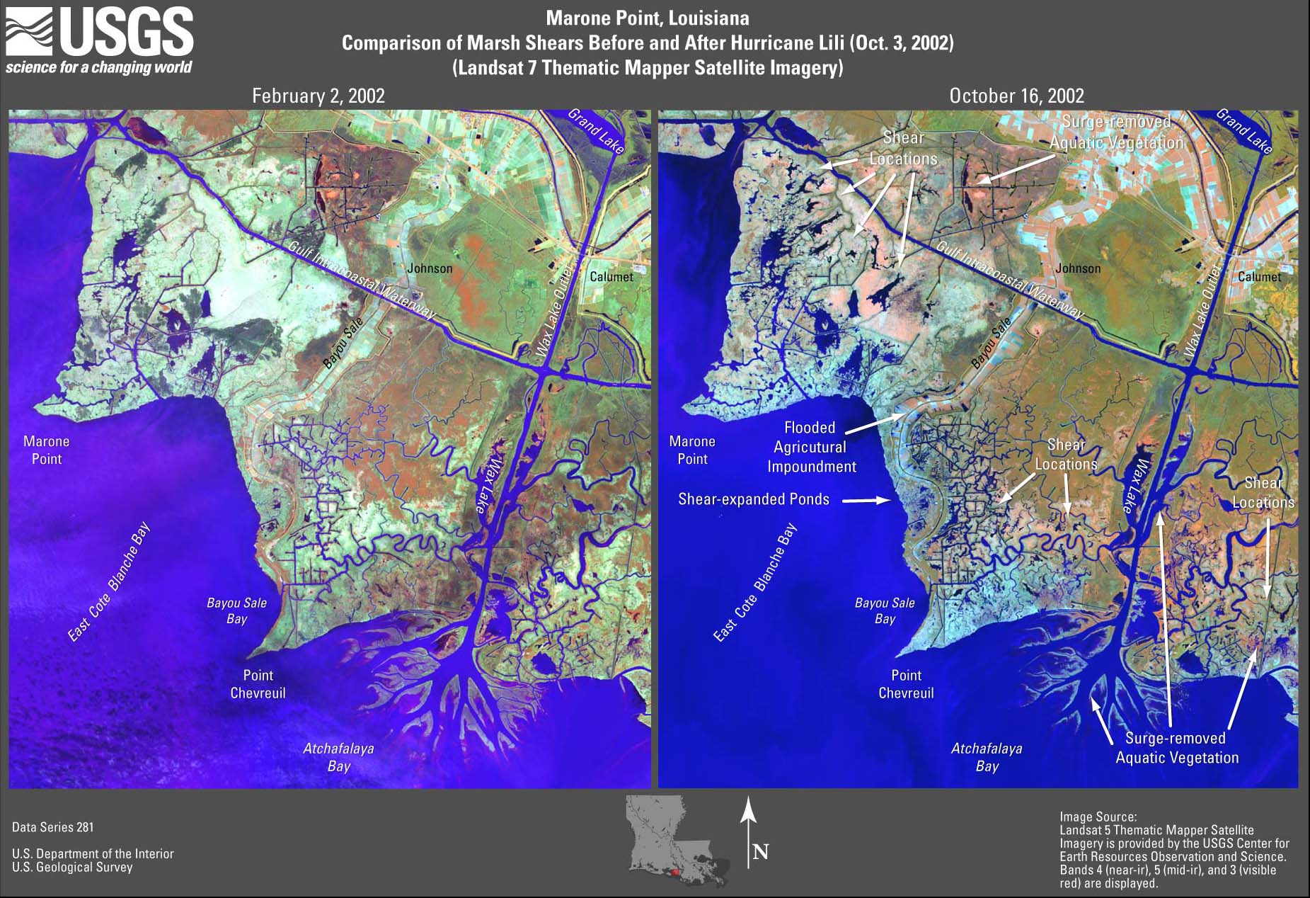
- Figure 19A. Marone
Point (Rita) TM image (JPEG or PDF).
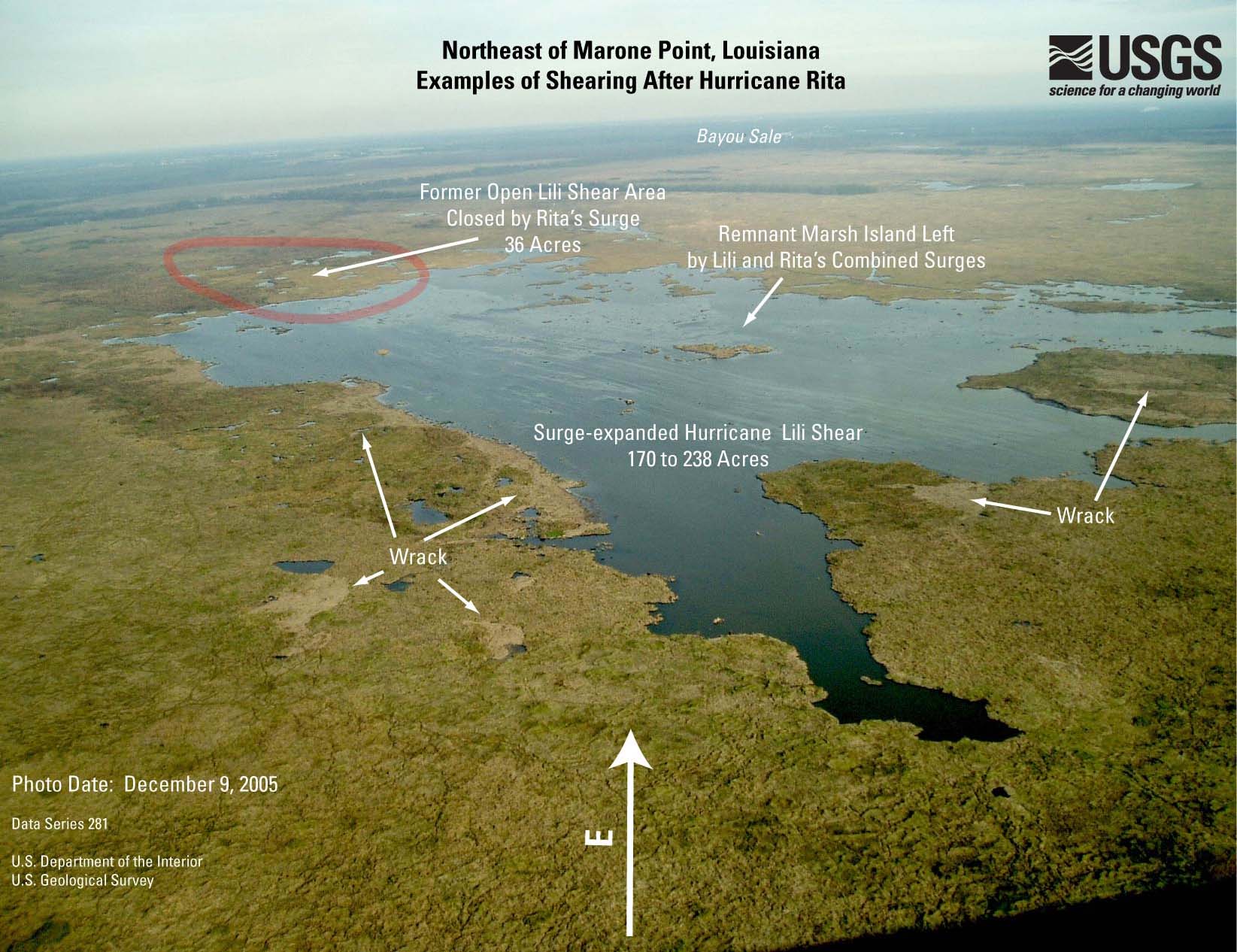
- Figure 19B. Marone
Point photo (JPEG or PDF).
- Figure 19C. Marone
Point (Lili) TM image (JPEG or PDF).
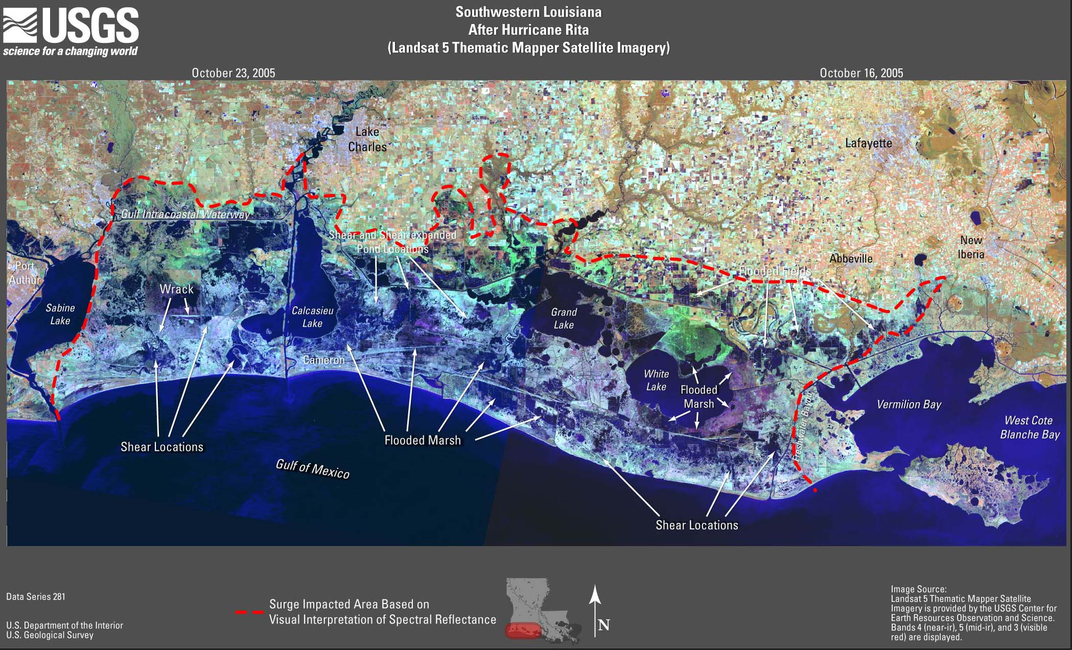
- Figure 20. Southwestern
Louisiana after Rita TM image (JPEG or PDF).
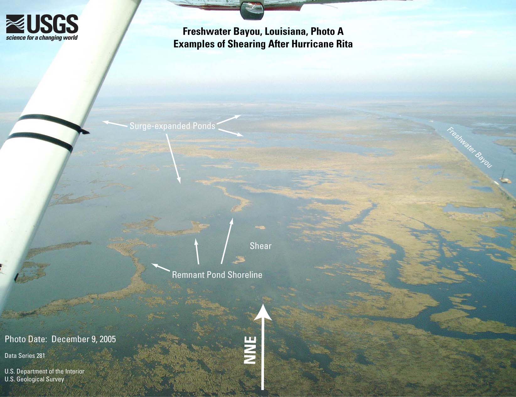
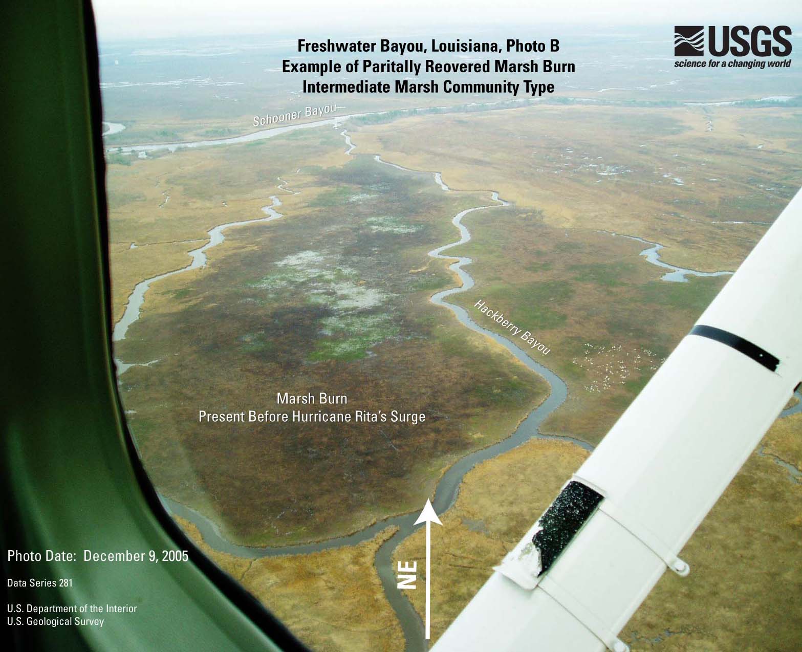
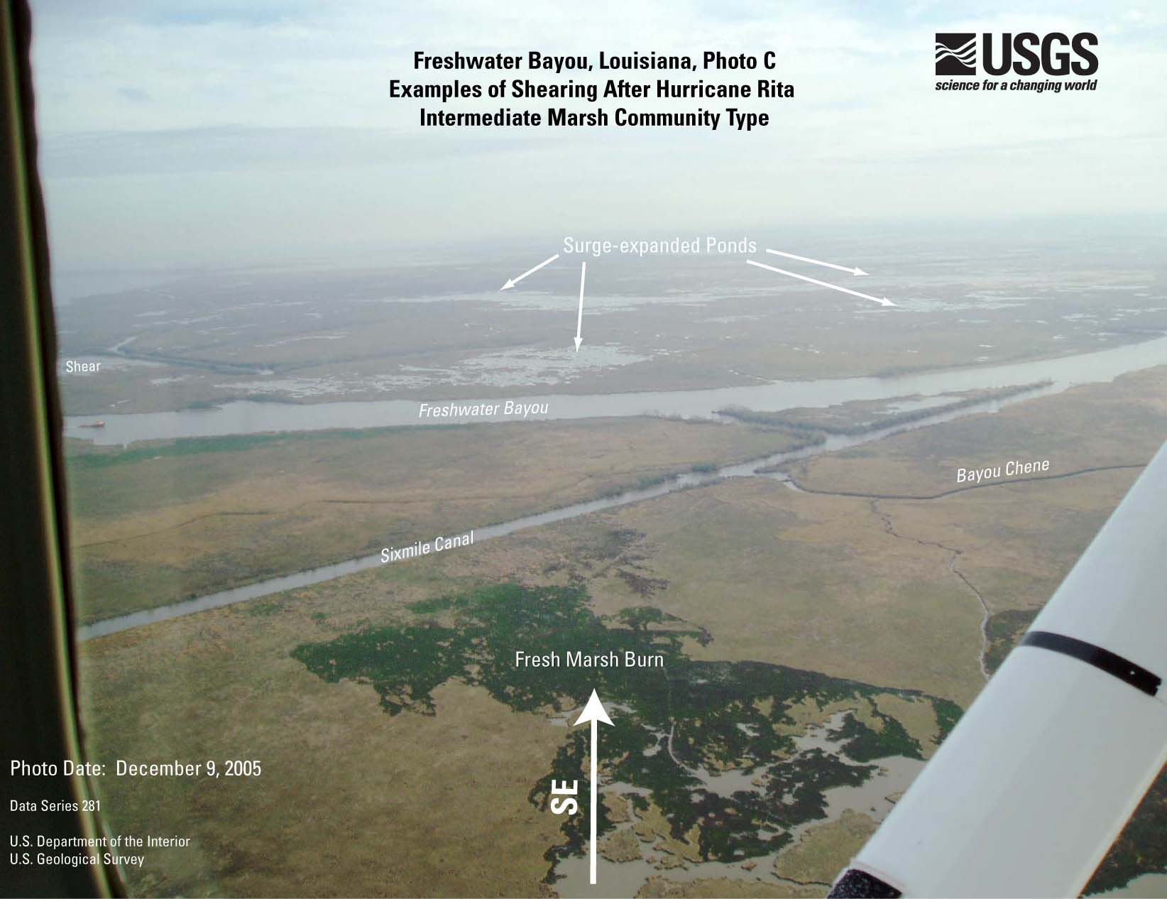
- Figure 21A. Freshwater
Bayou TM image (JPEG or PDF).
- Figure 21B. Freshwater
Bayou photo A (JPEG or PDF).
- Figure 21C. Freshwater
Bayou photo B (JPEG or PDF).
- Figure 21D. Freshwater
Bayou photo C (JPEG or PDF).
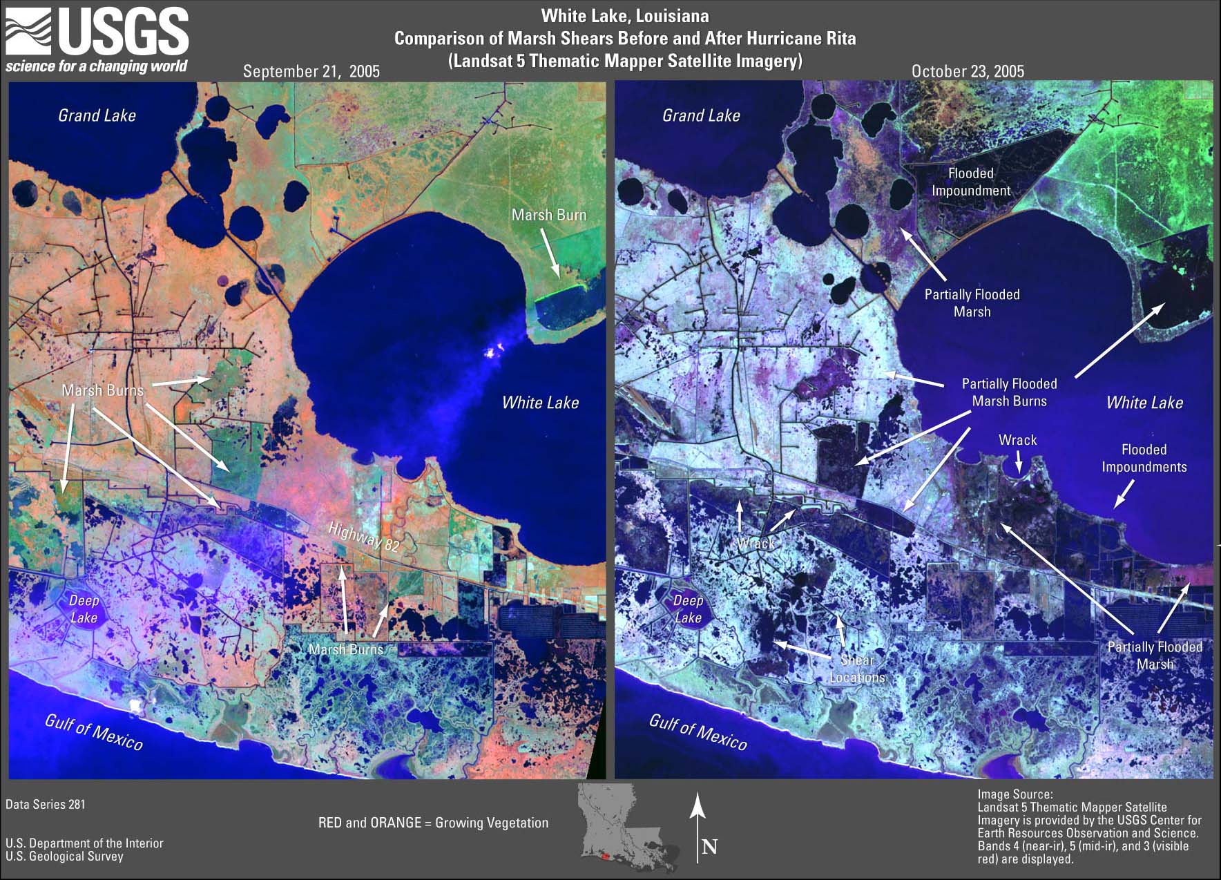
- Figure 22A. White
Lake TM image, 9-05 to 10-05 (JPEG or PDF).
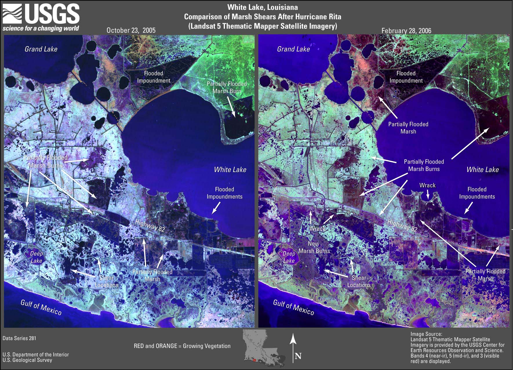
- Figure 22B. White
Lake TM image, 10-05 to 2-06 (JPEG or PDF).
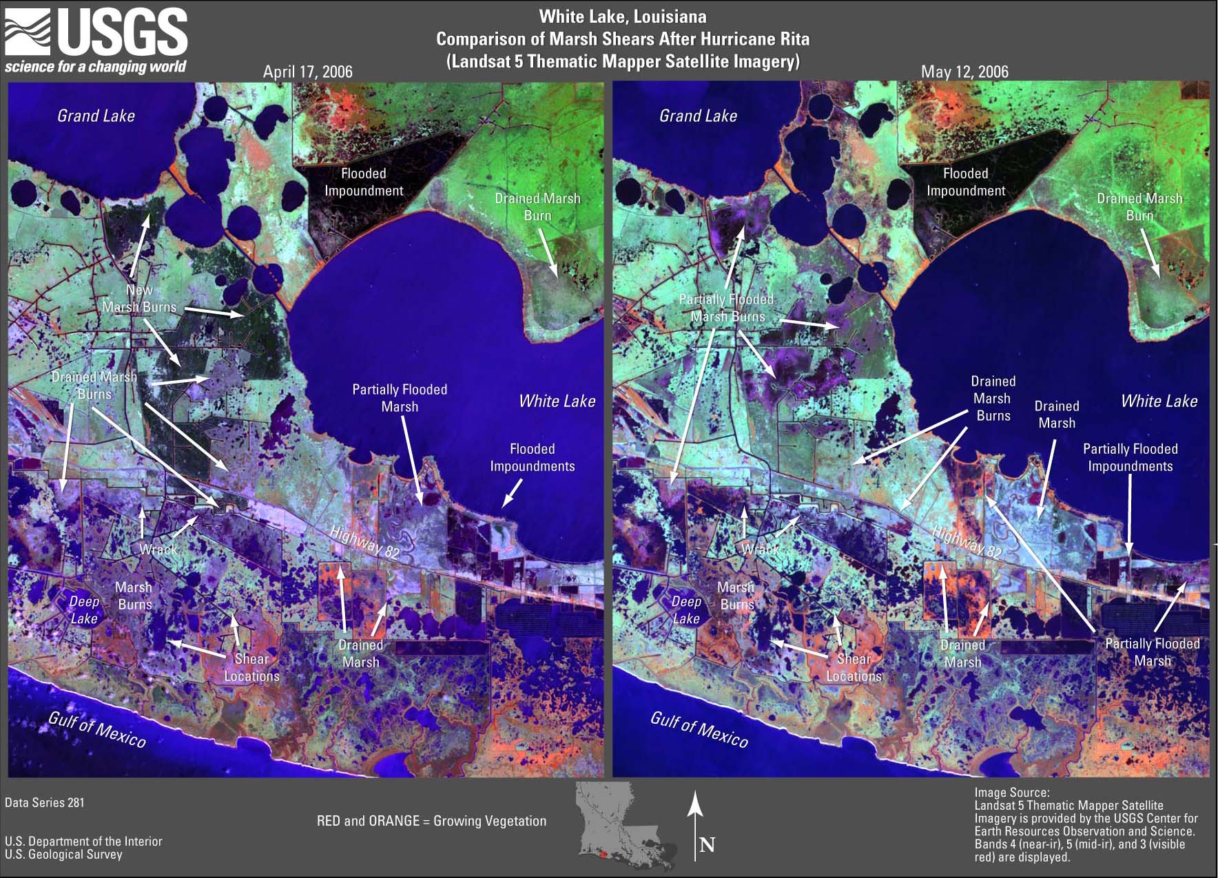
- Figure 22C. White
Lake TM image, 2-06 to 4-06 (JPEG or PDF).
- Figure 22D. White
Lake TM image, 4-06 to 5-06 (JPEG or PDF).
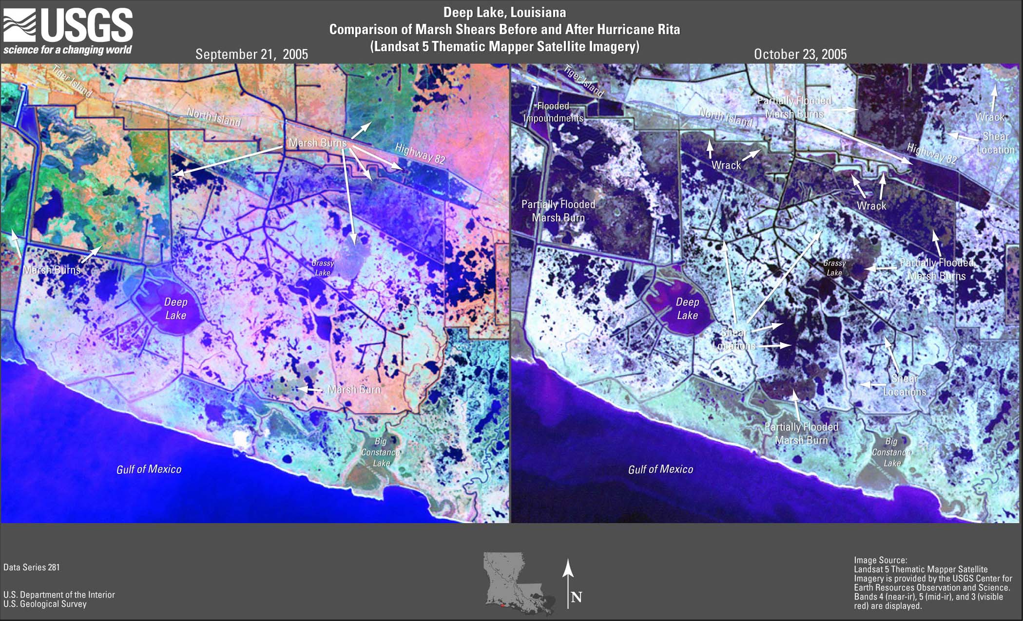
- Figure 23. Deep
Lake TM image (JPEG or PDF).
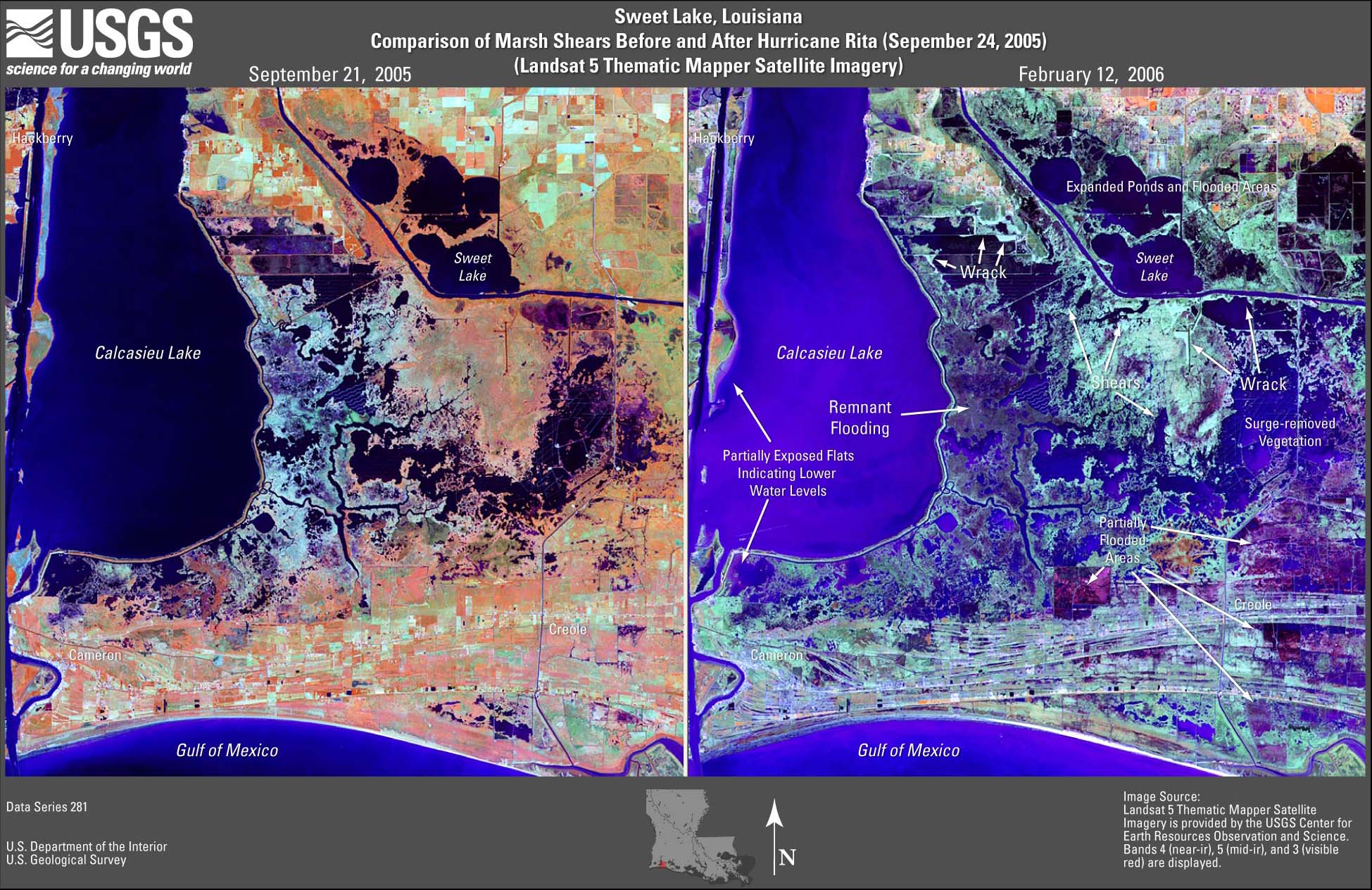
- Figure 24. Sweet
Lake TM image (JPEG or PDF).
- Figure 25. Johnsons
Bayou TM image (JPEG or PDF).
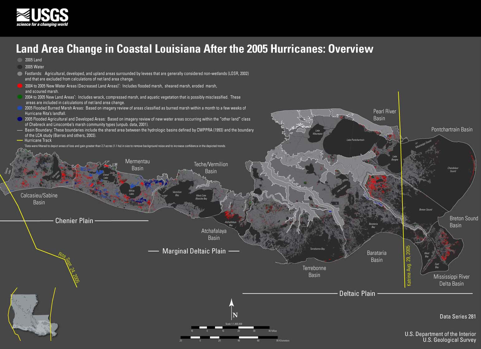
- Figure 26. Overview
(JPEG or PDF).
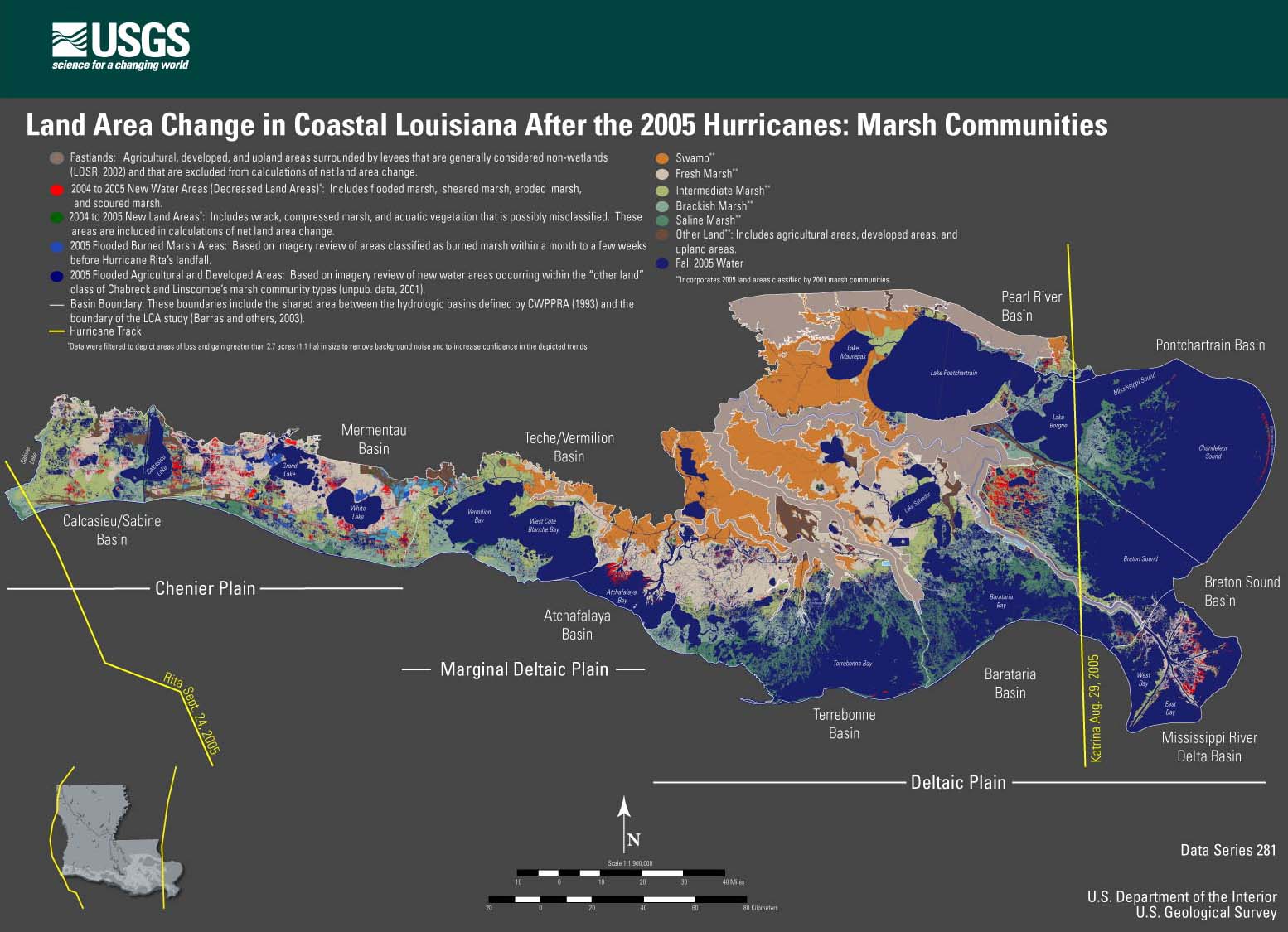
- Figure 27. Marsh
communities (JPEG or PDF).
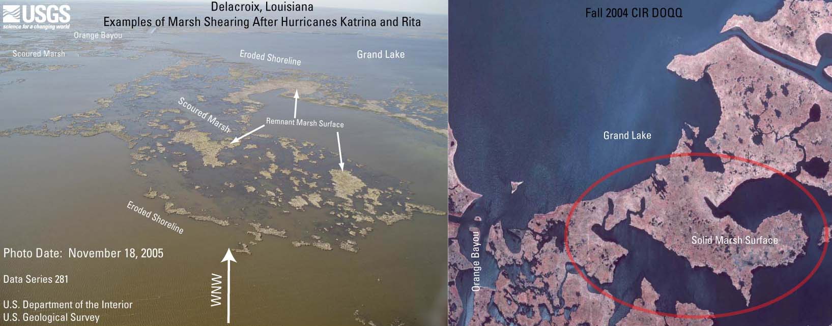
- Figure 28. Delacroix
photo and digital orthophoto quarter quadrangle (DOQQ) (JPEG or PDF).
- Figure 29. Historical
perspective (JPEG or PDF).
|

