U.S. Geological Survey Data Series 259
1ETI, St. Petersburg, FL 33701.
2U.S. Geological Survey, St. Petersburg, FL 33701.
U.S. Department of the Interior
U.S. Geological Survey
Florida Integrated Science Center - St. Petersburg
Publications are available from USGS Information Services, Box 25286, Federal Center, Denver, CO 80225-0046 (telephone 1-888-ASK-USGS; e-mail: infoservices@usgs.gov).
Table of Contents: |
||||
 |
||||
This DVD publication was prepared by an agency of the United States Government. Although these data have been processed successfully on a computer system at the U.S. Geological Survey, no warranty expressed or implied is made regarding the display or utility of the data on any other system, or for general or scientific purposes, nor shall the act of distribution imply any such warranty. The U.S. Geological Survey shall not be held liable for improper or incorrect use of the data described and (or) contained therein. Reference therein to any specific commercial product, process, or service by trade name, trademark, manufacturer, or otherwise does not constitute or imply its endorsement, recommendation, or favoring by the United States Government or any agency thereof.
This disc is readable on any computing platform that has standard DVD driver software installed. The minimum software requirements are a Web browser, Adobe Reader, and a text editor. If you cannot fully access the information on this page, please contact USGS Information Services at inforservices@usgs.gov or 1-888-ASK-USGS. Note: The only supported Web browsers that properly display all features of the interactive profiles are Internet Explorer 6 for Windows and Firefox 1.5 for all platforms
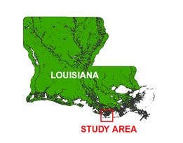
In June of 2006, the U.S. Geological Survey conducted a geophysical survey offshore of Isles Dernieres, Louisiana, as part of the USGS Barrier Island Coastal Monitoring project, which is part of a broader study focused on Subsidence and Coastal Change (SCC). This report serves as an archive of unprocessed digital Chirp seismic reflection data, trackline maps, navigation files, GIS files, Field Activity Collection System (FACS) logs, observer's logbook, and formal FGDC metadata. Gained digital images of the seismic profiles are also provided. Refer to the Acronyms page for expansions of acronyms and abbreviations used in this report.
The archived trace data are in standard Society of Exploration Geophysicists (SEG) SEG-Y format (Barry and others, 1975) and may be downloaded and processed with commercial or public domain software such as Seismic UNIX (SU). Example SU processing scripts and USGS software for viewing the SEG-Y files (Zihlman, 1992) are also provided.
The USGS Florida Integrated Science Center (FISC) - St. Petersburg assigns a unique identifier to each cruise or field activity. For example, 06SCC01 tells us the data were collected in 2006 for the Subsidence and Coastal Change (SCC) study and the data were collected during the first field activity for that study in that calendar year. Refer to http://walrus.wr.usgs.gov/infobank/programs/html/definition/activity.html for a detailed description of the method used to assign the field activity ID.
All Chirp systems use a signal of continuously varying frequency; however, the Chirp system used during this survey produces a high resolution, shallow penetration (less then 50 ms) profile image beneath the seafloor. The towfish is a sound source and receiver, which is typically towed 2-5 m above the seafloor. The acoustic energy is reflected at density boundaries (such as the seafloor or sediment layers beneath the seafloor), detected by a receiver, and recorded by a PC-based seismic acquisition system. This process is repeated at timed intervals (for example, 0.125 s) and recorded for specific intervals of time (for example, 50 ms). In this way, a two-dimensional vertical image of the shallow geologic structure beneath the ship track is produced. Figure 1 displays acquisition geometry. Refer to table 1 for a summary of acquisition parameters. See the digital FACS equipment log (12 KB) for details about the acquisition equipment used. Table 2 lists trackline statistics. Scanned images of the handwritten FACS logs and handwritten science logbook (4 MB) are also provided as PDF files.
The unprocessed seismic data are stored in SEG-Y format (Barry and others, 1975). For a detailed description of the data format, refer to the SEG-Y Format page. See the How To Download SEG-Y Data page for download instructions. The printable profiles provided here are GIF images that were gained using Seismic UNIX software. Refer to the Software page for details about the processing and examples of the processing scripts. The processed SEG-Y data were then exported to Chesapeake Technology, Inc. (CTI) SonarWeb software to produce an interactive version of the profile that allows the user to obtain a geographic location and depth from the profile for a cursor position. This information is displayed in the status bar of the browser.
Allow scripts to:
![]() Change status bar text
Change status bar text
Use of other browsers may result in spurious or no information given in the status window.
The printable and interactive profiles can be viewed from the Profiles page or from links located on the Survey Area Map page. Detailed information about the navigation system used can be found in table 1 and the FACS equipment log (12 KB). To view the trackline maps and navigation files, and for more information about these items, see the Navigation page.
NOTE: Intermittently during data collection, a vertical striped pattern was observed in the profiles. This anomaly was caused by an acquisition software malfunction that resulted in repetitious zero values for traces when the record length was set to less than 50 ms (fig. 2). The cause of the malfunction was not determined until after the cruise.
The Disc Contents page is a diagram of the location of all files and folders contained on this disc and provides links to these files and folders.
To access the information contained on this disc, use a Web browser to open the file index.html. This report is divided into five sections: Navigation Data and Maps, Seismic Profiles, Field Activity Logs, Metadata, and Software. Links at the top and bottom of each page provide access to these sections. This report contains links to the USGS and collaborators or other resources that are only accessible if access to the Internet is available while viewing these documents. Note: The only supported Web browsers that properly display all features of the interactive profiles are Internet Explorer 6 for Windows and Firefox 1.5 for all platforms
Funding and (or) support for this study were provided by the USGS Coastal and Marine Geology Program and the University of New Orleans. We thank R/V G.K. Gilbert captain Richard W. Young of the USGS in St. Petersburg, Florida, for his assistance in data collection. We also thank Karynna Calderon formerly of the CSC in St. Petersburg, Florida, for her assistance in data archiving. This document was improved by the reviews of Kate Ciembronowicz (ETI) and Dennis Krohn (USGS) at the FISC - St. Petersburg, Florida.
Barry, R.M., Cavers, D.A., and Kneale, C.W., 1975, Recommended standards for digital tape formats: Geophysics, v. 40, no. 2, p. 344-352. Also available online at http://www.seg.org/publications/tech-stand.
Zihlman, F.N., 1992, DUMPSEGY V1.0: A program to examine the contents of SEG-Y disk-image seismic data: U.S. Geological Survey Open-File Report 92-590, 28 p.

![]() U.S. Department of the Interior |
U.S. Geological Survey
U.S. Department of the Interior |
U.S. Geological Survey
URL: http://pubsdata.usgs.gov/pubs/ds/259/index.html
Page Contact Information: Contact USGS
Page Last Modified: Monday, 28-Nov-2016 12:55:34 EST