U.S. Geological Survey Data Series 348
1Jacobs Technology Inc., St. Petersburg, FL 33701.
2U.S. Geological Survey, St. Petersburg, FL 33701.
3St. Johns River Water Management District, Palatka, FL 32178.
U.S. Department of the Interior
U.S. Geological Survey
Florida Integrated Science Center - St. Petersburg
Publications are available from USGS Information Services, Box 25286, Federal Center, Denver, CO 80225-0046 (telephone 1-888-ASK-USGS; e-mail: infoservices@usgs.gov).
Page Contents: |
||||
 |
||||
This CD publication was prepared by an agency of the United States Government. Although these data have been processed successfully on a computer system at the U.S. Geological Survey, no warranty expressed or implied is made regarding the display or utility of the data on any other system, nor shall the act of distribution imply any such warranty. The U.S. Geological Survey shall not be held liable for improper or incorrect use of the data described and (or) contained herein. Reference herein to any specific commercial product, process, or service by trade name, trademark, manufacturer, or otherwise does not constitute or imply its endorsement, recommendation, or favoring by the United States Government or any agency thereof.
This disc is readable on any computing platform that has standard CD driver software installed. The minimum software requirements are a Web browser, Adobe Reader, and a text editor. If you cannot fully access the information on this page, please contact USGS Information Services at infoservices@usgs.gov or 1-888-ASK-USGS. NOTE: The only supported Web browsers that properly display all features of the interactive profiles are Internet Explorer 6 or greater for Windows and Firefox 1.5 or greater for all platforms
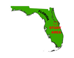
In July of 2002, the U.S. Geological Survey and St. Johns River Water Management District (SJRWMD) conducted geophysical surveys in Lakes Ada, Crystal, Jennie, Mary, Rice, and Sylvan, central Florida, as part of the USGS Lakes and Coastal Aquifers (LCA) study. This report serves as an archive of unprocessed digital boomer seismic reflection data, trackline maps, navigation files, Geographic Information System (GIS) files, and formal Federal Geographic Data Committee (FGDC) metadata. Filtered and gained (a relative increase in signal amplitude) digital images of the seismic profiles are also provided. Refer to the Acronyms page for expansions of acronyms and abbreviations used in this report.
The archived trace data are in standard Society of Exploration Geophysicists (SEG) SEG-Y format (Barry and others, 1975) and may be downloaded and processed with commercial or public domain software such as Seismic Unix (SU). Example SU processing scripts and USGS software for viewing the SEG-Y files (Zihlman, 1992) are also provided.
The USGS Florida Integrated Science Center (FISC) - St. Petersburg assigns a unique identifier to each cruise or field activity. For example, 02LCA02 tells us the data were collected in 2002 for the Lakes and Coastal Aquifers (LCA) study and the data were collected during the second field activity for that study in that calendar year. Refer to http://walrus.wr.usgs.gov/infobank/programs/html/definition/activity.html for a detailed description of the method used to assign the field activity ID.
The boomer plate is an acoustic energy source that consists of capacitors charged to a high voltage and discharged through a transducer in the water. The transducer is towed on a sled floating on the water surface and when discharged emits a short acoustic pulse, or shot, which propagates through the water, sediment column, or rock beneath. The acoustic energy is reflected at density boundaries (such as the seafloor, sediment, or rock layers beneath the seafloor), detected by the receiver, and recorded by a PC-based seismic acquisition system. This process is repeated at timed intervals (for example, 0.5 s) and recorded for specific intervals of time (for example, 100 ms). In this way, a two-dimensional (2-D) vertical profile of the shallow geologic structure beneath the ship track is produced. Figure 1 displays the acquisition geometry. Refer to table 1 for a summary of acquisition parameters. Table 2 lists trackline statistics.
The unprocessed seismic data are stored in SEG-Y format (Barry and others, 1975). For a detailed description of the data format, refer to the SEG-Y Format page. See the How To Download SEG-Y Data page for download instructions. The printable profiles provided here are GIF images that were filtered and gained using Seismic Unix software. Refer to the Software page for details about the processing and examples of the processing scripts. The processed SEG-Y data were exported to Chesapeake Technology, Inc. (CTI) SonarWeb software to produce an interactive Web page of the profile, which allows the user to obtain a geographic location and depth from the profile for a curser position. This information is displayed in the status bar of the browser.
| NOTE: The only supported Web browsers that properly display all features of the interactive profiles are Internet Explorer 6 or greater for Windows and Firefox 1.5 or greater for all platforms. If using Internet Explorer 7, Active Content/Active X controls must be disabled. Please refer to the details and setup page for more information.
For all browsers, the status bar and JavaScript must be enabled. Firefox also requires "Change status bar text" to be checked under Advanced JavaScript Settings. This option can be found on the main Toolbar under Tools > Options > Content (tab) > Advanced > Allow scripts to:
Use of other browsers may result in spurious or no information given in the status window. |
The printable and interactive profiles can be viewed from the Profiles page or from links located on the trackline maps. To view the trackline maps and navigation files, and for more information about these items, see the Navigation page. Detailed information about the navigation system used can be found in table 1.
The Disc Contents page is a diagram of the location of all files and folders contained on this disc, it also provides links to these files and folders.
To access the information contained on this disc, use a Web browser to open the file index.html. This report is divided into seven sections: Acronyms and Abbreviations, Disc Contents, Navigation Data and Maps, Seismic Profiles, Field Activity Logs, FGDC Metadata, and Software. Links at the top and bottom of each page provide access to these sections. This report contains links to the USGS and collaborators or other resources that are only accessible if access to the Internet is available while viewing these documents.
Funding for this study were provided by the USGS Coastal and Marine Geology Program and the SJRWMD. We thank captain John Lombardi of the SJRWMD in Palatka, FL for his assistance in data collection. This document was improved by the reviews of Tom Smith (USGS) and Peter Howd (ETI) at the FISC - St. Petersburg, FL.
Barry, K.M., Cavers, D.A., and Kneale, C.W., 1975, Recommended standards for digital tape formats: Geophysics, v. 40, no. 2, p. 344-352. Also available on-line at http://www.seg.org/publications/tech-stand.
Zihlman, F.N., 1992, DUMPSEGY V1.0: A program to examine the contents of SEG-Y disk-image seismic data: U.S. Geological Survey Open-File Report 92-590, 28 p. Also available on-line at http://pubs.er.usgs.gov/usgspubs/ofr/ofr92590.

![]() U.S. Department of the Interior |
U.S. Geological Survey
U.S. Department of the Interior |
U.S. Geological Survey
URL: pubsdata.usgs.gov/pubs/ds/348/index.html
Page Contact Information: Publishing Services
Page Last Modified: Monday, 28-Nov-2016 13:00:04 EST
