Geographic Analysis and Monitoring Program
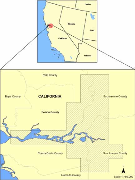
The Sacramento/San Joaquin Delta region of California. Gray hatch indicates the spatial extent of the data in the study area (from figure 1).
The U.S. Geological Survey (USGS) Western Region Geographic Science Center, in conjunction with the USGS Water Resources Western Branch of Regional Research, has developed a high-resolution elevation dataset covering the Sacramento/San Joaquin Delta region of California. The elevation data were compiled photogrammically from aerial photography (May 2002) with a scale of 1:15,000. The resulting dataset has a 10-meter horizontal resolution grid of elevation values. The vertical accuracy was determined to be 1 meter. Two versions of the elevation data are available: the first dataset has all water coded as zero, whereas the second dataset has bathymetry data merged with the elevation data. The projection of both datasets is set to UTM Zone 10, NAD 1983. The elevation data are clipped into files that spatially approximate 7.5-minute USGS quadrangles, with about 100 meters of overlap to facilitate combining the files into larger regions without data gaps. The files are named after the 7.5-minute USGS quadrangles that cover the same general spatial extent. File names that include a suffix (_b) indicate that the bathymetry data are included (for example, sac_east versus sac_east_b). These files are provided in ESRI Grid format.
Download text of this report as a 12-page PDF file (ds359_text.pdf; 2.3 MB with links to 179 MB of data)
Go to the Metadata folder (metadata; 2 files, 28 kB total)
Go to the Data folder (data; 46 files, 179 MB total). Figure 4 of the text of the report (linked above) consists of a hyperlinked map of all of these data. Page 4 in that PDF contains the same links in table form.
For questions about the content of this report, contact Chris Soulard.
Suggested citation and version history
Download a free copy of the latest version of Adobe Reader.
|
Help |
PDF help |
Publications main page |
| Western Data Series Reports |
| Geography | Geographic Analysis and Monitoring Program
|

![]() U.S. Department of the Interior | U.S. Geological Survey
U.S. Department of the Interior | U.S. Geological Survey
URL: https://pubs.usgs.gov/ds/359/
Page Contact Information: Michael Diggles
Page Created: August 12, 2008
Page Last Modified: August 26, 2008