
U.S. Geological Survey
Data Series 366
Version 1.0
Multibeam Sonar Mapping and Modeling of a Submerged Bryophyte Mat in Crater Lake, Oregon
ByPeter Dartnell1, Robert Collier2, Mark Buktenica3, Steven Jessup4, Scott Girdner3, and Peter Triezenberg1
2008
1 U.S. Geological Survey, Menlo Park, Calif.
2 Oregon State University, Corvallis, Oreg.
3 National Park Service, Crater Lake, Oreg.
4 Southern Oregon University, Ashland, Oreg.
Abstract
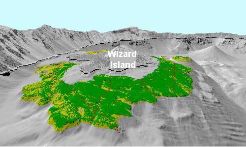
Perspective view looking north toward Wizard Island showing the distribution of the bryophyte mat (green and yellow) over the Wizard Island platform.
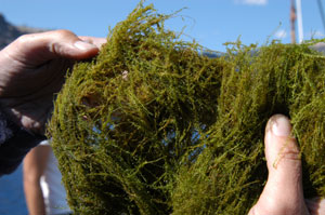
Sample of the deep-water, bryophyte aquatic moss found within Crater Lake, Oregon.
Traditionally, multibeam data have been used to map sea floor or lake floor morphology as well as the distribution of surficial facies in order to characterize the geologic component of benthic habitats. In addition to using multibeam data for geologic studies, we want to determine if these data can also be used directly to map the distribution of biota. Multibeam bathymetry and acoustic backscatter data collected in Crater Lake, Oregon, in 2000 are used to map the distribution of a deep-water bryophyte mat, which will be extremely useful for understanding the overall ecology of the lake. To map the bryophyte's distribution, depth range, acoustic backscatter intensity, and derived bathymetric index grids are used as inputs into a hierarchical decision-tree classification model. Observations of the bryophyte mat from over 23 line kilometers of lake-floor video collected in the summer of 2006 are used as controls for the model. The resulting map matches well with ground-truth information and shows that the bryophyte mat covers most of the platform surrounding Wizard Island as well as on outcrops around the caldera wall.
For more information contact: Peter Dartnell
Suggested citation and version history
|
Publications main page |
| Western Data Series Reports |
| Geology | Coastal and Marine Geology
|
This report is available only on the Web
