Data Series 397
|
|
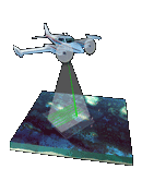
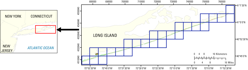
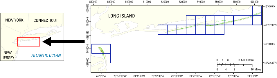
EAARL Coastal Topography–Northeast Barrier Islands 2007: First SurfaceAmar Nayegandhi,1 John C. Brock,2 A.H. Sallenger,3 C. Wayne Wright,3 Xan Yates,1 and Jamie M. Bonisteel1 1Jacobs Technology Inc., St. Petersburg, FL; 2U.S. Geological Survey, Coastal and Marine Geology Program, Reston, VA; 3U.S. Geological Survey, Florida Integrated Science Center, St. Petersburg, FL. This DVD contains Lidar-derived first surface (FS) topography GIS datasets of a portion of the northeast coastal barrier islands in New York and New Jersey. These datasets were acquired April 29-30 and May 15-16, 2007. Click on a blue tile to view the corresponding images and links to each data directory.
Suggested Citation: Nayegandhi, Amar, Brock, J.C., Sallenger, A.H., Wright, C.W., Yates, Xan, and Bonisteel, J.M., 2008, EAARL Coastal Topography–Northeast Barrier Islands 2007: First Surface: U.S. Geological Survey Data Series 397, 1 DVD. Publications are available from USGS Information Services, Box 25286, Federal Center, Denver, CO 80225-0046 (telephone: 1-800-ASK-USGS; email: infoservices@usgs.gov). |

![]() U.S. Department of the
Interior | U.S. Geological Survey
U.S. Department of the
Interior | U.S. Geological Survey
URL: https://pubsdata.usgs.gov/pubs/ds/397/index.html
Page Contact Information: Feedback
Maintained by: Publishing Service Center
Page Last Modified: Monday, 28-Nov-2016 13:45:25 EST