U.S. Geological Survey Data Series 421
| Item | Details | Trackline Map &ndash UTM Zone 17 |
|---|---|---|
| Minimum Northing Minimum Latitude |
3187533.4 28 48.8158' N |
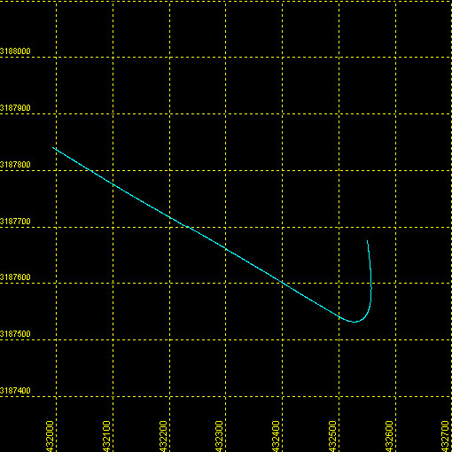 |
| Maximum Northing Maximum Latitude |
3187837.3 28 48.9822' N |
|
| Minimum Easting Minimum Longitude |
431989.8 081 41.8200' W |
|
| Maximum Easting Maximum Longitude |
432558.7 081 41.4713' W |
|Back|

![]() U.S. Department of the Interior |
U.S. Geological Survey
U.S. Department of the Interior |
U.S. Geological Survey
URL: DVD/maps/linenav/08b44_nav.html
Page Contact Information: Feedback
Page Last Modified: March 26, 2009 17:37 EST
