U.S. Geological Survey Data Series 421
| Item | Details | Trackline Map &ndash UTM Zone 17 |
|---|---|---|
| Minimum Northing Minimum Latitude |
3193489.8 28 52.1392' N |
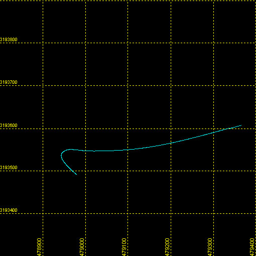 |
| Maximum Northing Maximum Latitude |
3193607.2 28 52.2032' N |
|
| Minimum Easting Minimum Longitude |
478942.2 081 12.9556' W |
|
| Maximum Easting Maximum Longitude |
479364.8 081 12.6957' W |
|Back|

![]() U.S. Department of the Interior |
U.S. Geological Survey
U.S. Department of the Interior |
U.S. Geological Survey
URL: DVD/maps/linenav/08b68_nav.html
Page Contact Information: Feedback
Page Last Modified: March 26, 2009 17:37 EST
