U.S. Geological Survey Data Series 421
| Navigation Statistics | ||
| Item | Description | Details |
| Minimum Northing Minimum Latitude |
3176461.4 28 42.8747' N |
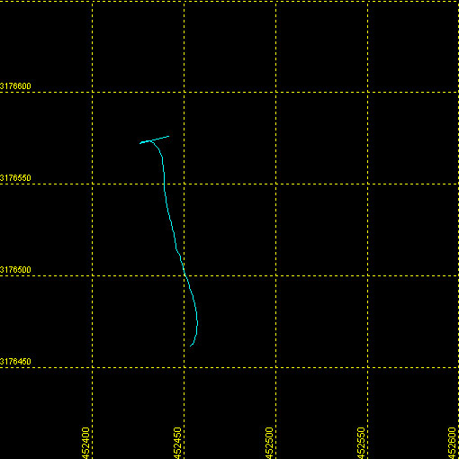 |
| Maximum Northing Maximum Latitude |
3176576.3 28 42.9371' N |
|
| Minimum Easting Minimum Longitude |
452425.1 081 29.2268' W |
|
| Maximum Easting Maximum Longitude |
452457.3 081 29.2073' W |
|
|Back|

![]() U.S. Department of the Interior |
U.S. Geological Survey
U.S. Department of the Interior |
U.S. Geological Survey
URL: DVD/maps/linenav/08b73_nav.html
Page Contact Information: Feedback
Page Last Modified: March 26, 2009 17:37 EST
