U.S. Geological Survey Data Series 436
Introduction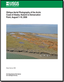
The Arctic Coastal Plain of northern Alaska, an area of strategic economic importance to the United States, is home to remote Native American communities and encompasses unique habitats of global significance. Coastal erosion along the Arctic coast is chronic and widespread; recent evidence suggests that erosion rates are among the highest in the world (up to ~16 m/yr) and may be accelerating. Coastal erosion adversely impacts energy-related infrastructure, natural shoreline habitats, and Native American communities. Climate change is thought to be a key component of recent environmental changes in the Arctic. Reduced sea-ice cover in the Arctic Ocean is one of the probable mechanisms responsible for increasing coastal exposure to wave attack and the resulting increase in erosion. Extended periods of permafrost melting and associated decrease in bluff cohesion and stability are another possible source of the increase in erosion. Several studies of selected areas on the Alaska coast document past shoreline positions and coastal change, but none have examined the entire North coast systematically. Results from these studies indicate high rates of coastal retreat that vary spatially along the coast. To address the need for a comprehensive and regionally consistent evaluation of shoreline change along the North coast of Alaska, the U.S. Geological Survey (USGS), as part of their Coastal and Marine Geology Program’s (CMGP) National Assessment of Shoreline Change Study, is evaluating shoreline change from Peard Bay to the United States/Canadian border, using historical maps and photography and a standardized methodology that is consistent with other shoreline-change studies along the Nation’s coastlines (for example, URL http://coastal.er.usgs.gov/shoreline-change/ (last accessed March 2, 2009). This report contains photographs collected during an aerial-reconnaissance survey conducted in support of this study. An accompanying ESRI ArcGIS shape file (and plain-text copy) indicates the position of the aircraft and time when each photograph was taken. The USGS-CMGP Field Activity ID for the survey is A-1-06-AK, and more information on the survey and how to view the photographs using Google Earth software is available online at: URL http://walrus.wr.usgs.gov/infobank/a/a106ak/html/a-1-06-ak.meta.html (last accessed March 2, 2009).Also of InterestData Series 503, Oblique Aerial Photography of the Arctic Coast of Alaska, Cape Sabine to Milne Point, July 16–19, 2009, by Ann E. Gibbs and Bruce M. Richmond. |
Posted April 20, 2009
For additional information contact: Western Coastal and Marine Geology This report is available only on the Web. Part of this report is presented in Portable Document Format (PDF); the latest version of Adobe Reader or similar software is required to view it. Download the latest version of Adobe Reader, free of charge. |
Gibbs, A.E., and Richmond, B.M., 2009. Oblique aerial photography of the Arctic coast of Alaska, Nulavik to Demarcation Point, August 7-10, 2006: U.S. Geological Survey Data Series 436, 6 p., 4 databases [https://pubs.usgs.gov/ds/436/].
Introduction
Survey Information
Photographic and GIS Data
Acknowledgements
References Cited
metadata
data

![]() U.S. Department of the Interior |
U.S. Geological Survey
U.S. Department of the Interior |
U.S. Geological Survey
URL: http://pubsdata.usgs.gov/pubs/ds/436/index.html
Page Contact Information: GS Pubs Web Contact
Page Last Modified: Monday, 28-Nov-2016 14:15:34 EST