Data Series 481

LIDAR Illustration

Home Link

Purpose Link

Metadata Link

Collaborators

Acronyms Link

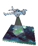
EAARL Coastal Topography and Imagery–Naval Live Oaks Area, Gulf Islands National Seashore, Florida, 2007


Collaborators


Funding for this project was provided by the U.S. Geological Survey - Coastal and Marine Geology Program and by the NPS - Gulf Coast Network.


U.S. Geological Survey Logo and Link

U.S. Geological Survey

Center for Coastal and Watershed Studies

St. Petersburg Science Center


National Park Service Logo and Link

National Park Service

Inventory and Monitoring Program

Gulf Coast Network


NASA Cooperator Logo and Link

National Aeronautics and Space Administration

Wallops Flight Facility


Accessibility FOIA Privacy Policies and Notices

Take Pride in America home page USA Gov LinkU.S. Department of the Interior | U.S. Geological Survey
URL: pubsdata.usgs.gov /pubs/ds/481/html/collaborators.html
Page Contact Information: Feedback
Page Last Modified: Monday, 28-Nov-2016 15:11:00 ESTNovember 6, 2009