U.S. Geological Survey Data Series 542
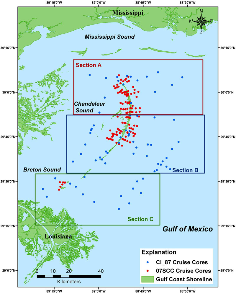
The study area map has been divided regionally from north to south into Sections A, B, and C (northern, central, and southern, respectively); each section is further divided into areas. Clicking on the highlighted boxes will open the area maps associated with each section, and these maps show the vibracore locations in greater detail. In each area map, the individual vibracores are linked to the Core Data Table, which can be accessed by clicking on a vibracore's mapped data-point or the associated Core ID of the vibracore. The Core Data Table contains all available vibracore information including downloadable files and previews for Core Description Sheets, Interpretive Core Classification Profiles, Grain-Size Data, and Core Photographs.
Refer to Core Data Table for a list of all the vibracores from each cruise (07SCC04, 07SCC05, and 87039).
ArcGIS - Vibracore Study Area MapsVibracore study area maps were generated with Environmental Systems Research Institute (ESRI) ArcGIS 9.2 software. The map files used for the HTML pages and printable versions were exported to Adobe Illustrator for further editing and saved in JPEG or GIF format. The map images on the HTML pages can be accessed through the section links or from the interactive outlined areas on the Study Area Map (above). The printable GIF or JPEG images can be accessed through the Maps folder. The map documents and shapefiles used to create the study area map provided on this disc can be found in the Arc_CI.zip file located in the ARC subfolder of the Software folder. Shapefiles may also be viewed with other versions of ArcView, ArcGIS, or the public domain software ArcExplorer (http://www.esri.com/software/arcexplorer/). For more information about the ESRI ArcGIS software and files used to create these maps, refer to the Metadata or Software pages. |
|||

![]() U.S. Department of the Interior |
U.S. Geological Survey
U.S. Department of the Interior |
U.S. Geological Survey
URL: pubs.usgs.gov/ds/542/
Page Contact Information: Feedback
Page Last Modified: Tuesday, 12-October-2010 3:00 PM EST