U.S. Geological Survey Data Series 553
1U.S. Geological Survey, St. Petersburg, FL 33701.
U.S. Department of the Interior
U.S. Geological Survey
St. Petersburg Coastal and Marine Science Center
Publications are available from USGS Information Services, Box 25286, Federal Center, Denver, CO 80225-0046 (telephone 1-888-ASK-USGS; e-mail: infoservices@usgs.gov).
Page Contents (Disc 1 of 3): |
||||
 |
||||
This Digital Versatile Disc (DVD) publication was prepared by an agency of the United States Government. Although these data have been processed successfully on a computer system at the U.S. Geological Survey, no warranty expressed or implied is made regarding the display or utility of the data on any other system, nor shall the act of distribution imply any such warranty. The U.S. Geological Survey shall not be held liable for improper or incorrect use of the data described and (or) contained herein. Reference herein to any specific commercial product, process, or service by trade name, trademark, manufacturer, or otherwise does not constitute or imply its endorsement, recommendation, or favoring by the United States Government or any agency thereof.
This disc is readable on any computing platform that has standard DVD driver software installed. The minimum software requirements are a Web browser, portable document format (PDF) reader, and a text editor. If you cannot fully access the information on this page, please contact USGS Information Services at infoservices@usgs.gov or 1-888-ASK-USGS. NOTE: The only supported Web browsers that properly display all features of the interactive profiles are Internet Explorer 8 for Windows and Firefox 3.6 or greater for all platforms
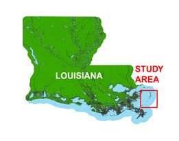
In June of 2007, the U.S. Geological Survey (USGS) conducted a geophysical survey offshore of the Chandeleur Islands, Louisiana, in cooperation with the Louisiana Department of Natural Resources (LDNR) as part of the USGS Barrier Island Comprehensive Monitoring (BICM) project. This project is part of a broader study focused on Subsidence and Coastal Change (SCC). The purpose of the study was to investigate the shallow geologic framework and monitor the enviromental impacts of Hurricane Katrina (Louisiana landfall was on August 29, 2005) on the Gulf Coast's barrier island chains. This report serves as an archive of unprocessed digital 512i and 424 Chirp sub-bottom profile data, trackline maps, navigation files, Geographic Information System (GIS) files, Field Activity Collection System (FACS) logs, observer's logbook, and formal Federal Geographic Data Committee (FGDC) metadata. Gained (a relative increase in signal amplitude) digital images of the seismic profiles are also provided. Refer to the Acronyms page for expansion of acronyms and abbreviations used in this report.
The USGS St. Petersburg Coastal and Marine Science Center (SPCMSC) assigns a unique identifier to each cruise or field activity. For example, 07SCC01 tells us the data were collected in 2007 for the Subsidence and Coastal Change (SCC) study and the data were collected during the first field activity for that study in that calendar year. Refer to http://walrus.wr.usgs.gov/infobank/programs/html/definition/activity.html for a detailed description of the method used to assign the field activity identification (ID).
All Chirp systems use a signal of continuously varying frequency; the Chirp systems used during this survey produce high resolution, shallow penetration profile images beneath the seafloor. The towfish is a sound source and receiver, which is typically towed 1 - 2 m below the sea surface. The acoustic energy is reflected at density boundaries (such as the seafloor or sediment layers beneath the seafloor), detected by a receiver, and recorded by a PC-based seismic acquisition system. This process is repeated at timed intervals (for example, 0.125 s) and recorded for specific intervals of time (for example, 50 ms). In this way, a two-dimensional vertical image of the shallow geologic structure beneath the ship track is produced. Figure 1 displays the acquisition geometry. Refer to table 1 for a summary of acquisition parameters. See the digital FACS equipment log (11-KB PDF) for details about the acquisition equipment used. Table 2 lists trackline statistics. Scanned images of the handwritten FACS logs and handwritten science logbook (449-KB PDF) are also provided.
The archived trace data are in standard Society of Exploration Geophysicists (SEG) SEG-Y rev 1 format (Norris and Faichney, 2002); ASCII character encoding is used for the first 3,200 bytes of the card image header instead of the SEG-Y rev 0 (Barry and others, 1975) EBCDIC format. The SEG-Y files may be downloaded and processed with commercial or public domain software such as Seismic Unix (SU) (Cohen and Stockwell, 2010). See the How To Download SEG-Y Data page for download instructions. The web version of this archive does not contain the SEG-Y trace files. These files are very large and would require extremely long download times. To obtain the complete DVD archive, contact USGS Information at 1-888-ASK-USGS or infoservices@usgs.gov. The printable profiles provided here are GIF images that were processed and gained using SU software; refer to the Software page for links to example SU processing scripts and USGS software for viewing the SEG-Y files (Zihlman, 1992). The processed SEG-Y data were also exported to Chesapeake Technology, Inc. (CTI) SonarWeb software to produce an interactive version of the profile that allows the user to obtain a geographic location and depth from the profile for a given cursor position. This information is displayed in the status bar of the browser.
| NOTE: The interactive features of the geospatial profiles are only fully functional when using Internet Explorer 8 or Firefox 3.6. If using IE8, Active Content/Active X controls must be disabled. Please refer to the details and setup page for more information.
For both browsers, the status bar and JavaScript must be enabled. Firefox also requires "Change status bar text" to be checked under Advanced JavaScript Settings. This option can be found on the main Toolbar under Tools > Options > Content (tab) > Advanced... > Allow scripts to:
Use of other browsers may result in spurious or no information given in the status window. |
The printable and interactive profiles can be viewed from the Profiles page or from links on the trackline maps. Detailed information about the navigation system used can be found in table 1 and the FACS equipment log (11-KB PDF). To view the trackline maps and navigation files, and for more information about these items, see the Navigation page.
NOTE: Differences between the 424 and 512i Chirp systems are shown on table 1. An interference of unknown origin occurred on lines 07c14, 07c15, and 07i40.
The Disc Contents page is a diagram with links to the locations of all files and folders contained on this disc; all discs in the set are identical except for the SEG-Y files they contain. Disc 1 contains SEG-Y files for lines 07i1 - 07i20, disc 2 contains SEG-Y files for lines 07i21 - 07i40, and disc 3 contains SEG-Y files for lines 07i41 - 07i49.
To access the information contained on this disc, use a Web browser to open the file index.html. This report is divided into seven sections: Acronyms and Abbreviations, Disc Contents, Navigation Data and Maps, Seismic Profiles, Field Activity Logs, FGDC Metadata, and Software. Links at the top and bottom of each page provide access to these sections. This report contains links to the USGS and collaborators or other resources that are accessible only if access to the Internet is available while viewing these documents.
Funding and (or) support for this study was provided by the Louisiana Department of Natural Resources (LDNR) and USGS Coastal and Marine Geology Program. We thank R/V G.K. Gilbert captain Richard Young of the USGS in St. Petersburg, FL, for his assistance in data collection. This document was improved by the reviews of Jordan Sanford (USGS) and Jamie Bonisteel-Cormier (Jacobs Technology Inc.) of the USGS St. Petersburg Coastal and Marine Science Center.
Barry, K.M., Cavers, D.A., and Kneale, C.W., 1975, Recommended standards for digital tape formats: Geophysics, v. 40, no. 2, p. 344-352. Also available on-line at http://www.seg.org/SEGportalWEBproject/prod/SEG-Publications/Pub-Technical-Standards/Documents/seg_y_rev0.pdf. (284-KB PDF)
Cohen, J.K., and Stockwell, J.W., Jr., 2010, CWP/SU: Seismic Unix Release 41: an open source software package for seismic research and processing: Center for Wave Phenomena, Colorado School of Mines. Also available on-line at http://www.cwp.mines.edu/cwpcodes/.
Norris, M.W., and Faichney, A.K., eds., 2002, SEG Y rev 1 Data Exchange format: Society of Exploration Geophysicists. Also available on-line at http://www.seg.org/SEGportalWEBproject/prod/SEG-Publications/Pub-Technical-Standards/Documents/seg_y_rev1.pdf. (518-KB PDF)
Zihlman, F.N., 1992, DUMPSEGY V1.0: A program to examine the contents of SEG-Y disk-image seismic data: U.S. Geological Survey Open-File Report 92-590, 28 p. Also available on-line at http://pubs.er.usgs.gov/usgspubs/ofr/ofr92590.
Forde, A.S., Dadisman, S.V., Flocks, J.G., and Wiese, D.S., 2010, Archive of digital Chirp sub-bottom profile data collected during USGS Cruise 07SCC01 offshore of the Chandeleur Islands, Louisiana, June 2007: U.S. Geological Survey Data Series 553, 3 DVDs.

![]() U.S. Department of the Interior |
U.S. Geological Survey
U.S. Department of the Interior |
U.S. Geological Survey
URL: http://pubsdata.usgs.gov/pubs/ds/553/index.html
Page Contact Information: Feedback
Page Last Modified: Monday, 28-Nov-2016 15:48:48 EST
