U.S. Geological Survey Data Series 569
U.S. Geological Survey, St. Petersburg, FL 33701.
U.S. Department of the Interior
U.S. Geological Survey
St. Petersburg Coastal and Marine Science Center
Publications are available from USGS Information Services, Box 25286, Federal Center, Denver, CO 80225-0046 (Telephone: 1-888-ASK-USGS; Email: infoservices@usgs.gov).
Page Contents (Set of 5 Discs): |
||||
 |
||||
This Digital Versatile Disc (DVD) publication was prepared by an agency of the United States Government. Although these data have been processed successfully on a computer system at the U.S. Geological Survey, no warranty expressed or implied is made regarding the display or utility of the data on any other system, nor shall the act of distribution imply any such warranty. The U.S. Geological Survey shall not be held liable for improper or incorrect use of the data described and (or) contained herein. Reference herein to any specific commercial product, process, or service by trade name, trademark, manufacturer, or otherwise does not constitute or imply its endorsement, recommendation, or favoring by the United States Government or any agency thereof.
This disc is readable on any computing platform that has standard DVD driver software installed. The minimum software requirements are a Web browser, a portable document format (PDF) reader, and a text editor. If you cannot fully access the information on this page, please contact USGS Information Services at infoservices@usgs.gov or 1-888-ASK-USGS. NOTE: The only supported Web browsers that properly display all features of the geospatially interactive profiles are Internet Explorer 8 for Windows and Firefox 3.6 for all platforms
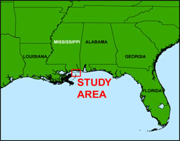
In July and September of 2008, the U.S. Geological Survey (USGS) conducted geophysical surveys to investigate the geologic controls on island framework from Ship Island to Horn Island, MS, for the Northern Gulf of Mexico (NGOM) Ecosystem Change and Hazard Susceptibility project. This project is also part of a broader USGS study on Coastal Change and Transport (CCT). This report serves as an archive of unprocessed digital Chirp sub-bottom profile data, trackline maps, navigation files, Geographic Information System (GIS) files, Field Activity Collection System (FACS) logs, observer's logbook, and formal Federal Geographic Data Committee (FGDC) metadata. Gained (a relative increase in signal amplitude) digital images of the sub-bottom profiles are also provided. Refer to the Acronyms page for expansion of acronyms and abbreviations used in this report.
The USGS St. Petersburg Coastal and Marine Science Center (SPCMSC) assigns a unique identifier to each cruise or field activity. For example, 08CCT02 and 08CCT03 tells us the data were collected in 2008 to study the Coastal Change and Transport (CCT) and the data were collected during the second and third field activities for that study in that calendar year. Refer to http://walrus.wr.usgs.gov/infobank/programs/html/definition/activity.html for a detailed description of the method used to assign the field activity identification (ID).
All Chirp systems use a signal of continuously varying frequency; the EdgeTech SB-424 Chirp system used during these surveys produces a high resolution, shallow penetration (less than 50-ms) profile image beneath the seafloor. The towfish is a sound source and receiver, which is typically towed 1 - 2 m below the sea surface. The acoustic energy is reflected at density boundaries (such as the seafloor or sediment layers beneath the seafloor), detected by a receiver, and recorded by a PC-based seismic acquisition system. This process is repeated at timed intervals (for example, 0.125 s) and recorded for specific intervals of time (for example, 50 ms). In this way, a two-dimensional vertical image of the shallow geologic structure beneath the ship track is produced. Figure 1 displays the acquisition geometry. Refer to table 1 for a summary of acquisition parameters. See the digital FACS folder equipment files for details about the acquisition equipment used. Table 2 and table 3 list trackline statistics for 08CCT02 and 08CCT03, respectively.
The archived trace data are in standard Society of Exploration Geophysicists (SEG) SEG-Y rev 0 (Barry and others, 1975) format; the first 3,200 bytes of the card image header is in EBCDIC format. The SEG-Y files may be downloaded and processed with commercial or public domain software such as Seismic Unix (SU) (Cohen and Stockwell, 2010). See the How To Download SEG-Y Data page for download instructions. The web version of this archive does not contain the SEG-Y trace files. These files are very large and would require extremely long download times. To obtain the complete DVD archive, contact USGS Information at 1-888-ASK-USGS or infoservices@usgs.gov. The printable profiles provided here are GIF images that were processed and gained using SU software; refer to the Software page for links to example SU processing scripts and USGS software for viewing the SEG-Y files (Zihlman, 1992). The processed SEG-Y data were also exported to Chesapeake Technology, Inc. (CTI) SonarWeb software to produce an interactive version of the profile that allows the user to obtain a geographic location and depth from the profile for a given cursor position. This information is displayed in the status bar of the browser.
| NOTE: The interactive features of the geospatial profiles are only fully functional when using Internet Explorer 8 or Firefox 3.6. If using IE8, Active Content/Active X controls must be disabled. Please refer to the details and setup page for more information.
For both browsers, the status bar and JavaScript must be enabled. Firefox also requires "Change status bar text" to be checked under Advanced JavaScript Settings. This option can be found on the main Toolbar under Tools > Options > Content (tab) > Advanced... > Allow scripts to:
Use of other browsers may result in spurious or no information given in the status window. |
The printable and geospatial profiles can be viewed from the Profiles page or from links on the trackline maps. Detailed information about the navigation system used can be found in table 1 and the FACS equipment logs. To view the trackline maps and navigation files, and for more information about these items, see the Navigation page.
NOTE: An unknown software malfunction resulted in no data being recorded for lines 08c565, 08c656, and 08c674.
The Disc Contents page is a diagram with links to the locations of all files and folders contained on this disc; all discs in the set are identical except for the SEG-Y files they contain. Lines 08c500 - 08c729 were collected during cruise 08CCT02 and lines 08c01 - 08c13 during 08CCT03.
Disc 1 contains SEG-Y files for lines 08c500 through 08c560; disc 2 contains SEG-Y files for lines 08c561 through 08c600a; disc 3 contains SEG-Y files for lines 08c601 through 08c675; disc 4 contains SEG-Y files for lines 08c676 through 08c710; and disc 5 contains SEG-Y files for lines 08c711 through 08c729 and 08c01 through 08c13.
To access the information contained on this disc, use a Web browser to open the file index.html. This report is divided into seven sections: Acronyms and Abbreviations, Disc Contents, Navigation Data and Maps, Sub-bottom Profiles, Field Activity Logs, FGDC Metadata, and Software. Links at the top and bottom of each page provide access to these sections. This report contains links to the USGS and collaborators or other resources that are accessible only if access to the Internet is available while viewing these documents.
Funding and (or) support for this study was provided by the USGS Coastal and Marine Geology Program NGOM project. We thank R/V Survey Cat captains B.J. Reynolds and Nancy DeWitt of the USGS - St. Petersburg, FL, for their assistance in data collection. This document was improved by the reviews of Ray Sliter (USGS - Menlo Park, CA) and Ginger Tiling-Range (Jacobs Technology Inc. - St. Petersburg, FL).
Barry, K.M., Cavers, D.A., and Kneale, C.W., 1975, Recommended standards for digital tape formats: Geophysics, v. 40, no. 2, p. 344-352. Also available on-line at http://www.seg.org/resources/publications/misc/technical-standards. (576-KB PDF)
Cohen, J.K., and Stockwell, J.W., Jr., 2010, CWP/SU: Seismic Unix Release 41: A free package for seismic research and processing: Center for Wave Phenomena, Colorado School of Mines. Available on-line at http://www.cwp.mines.edu/cwpcodes/.
Zihlman, F.N., 1992, DUMPSEGY V1.0: A program to examine the contents of SEG-Y disk-image seismic data: U.S. Geological Survey Open-File Report 92-590, 28 p. Also available on-line at http://pubs.er.usgs.gov/usgspubs/ofr/ofr92590.

![]() U.S. Department of the Interior |
U.S. Geological Survey
U.S. Department of the Interior |
U.S. Geological Survey
URL: http://pubsdata.usgs.gov/pubs/ds/569/index.html
Page Contact Information: Feedback
Page Last Modified: Monday, 28-Nov-2016 16:45:09 EST
