U.S. Geological Survey Data Series 577
|
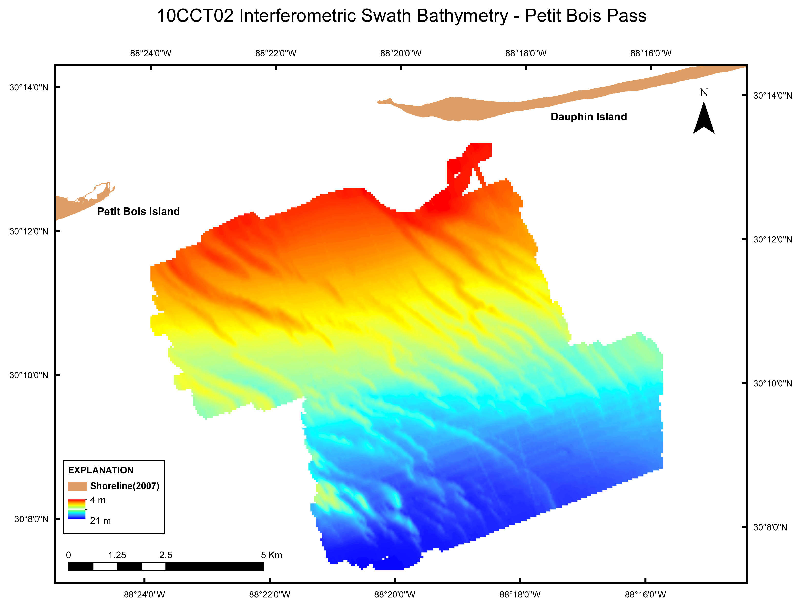
GeoTIFF image of the swath bathymetry grid (50-m) layout view, WGS84 UTM Zone 16N. Depth values range from 4 meters to 21 meters, MLLW. |
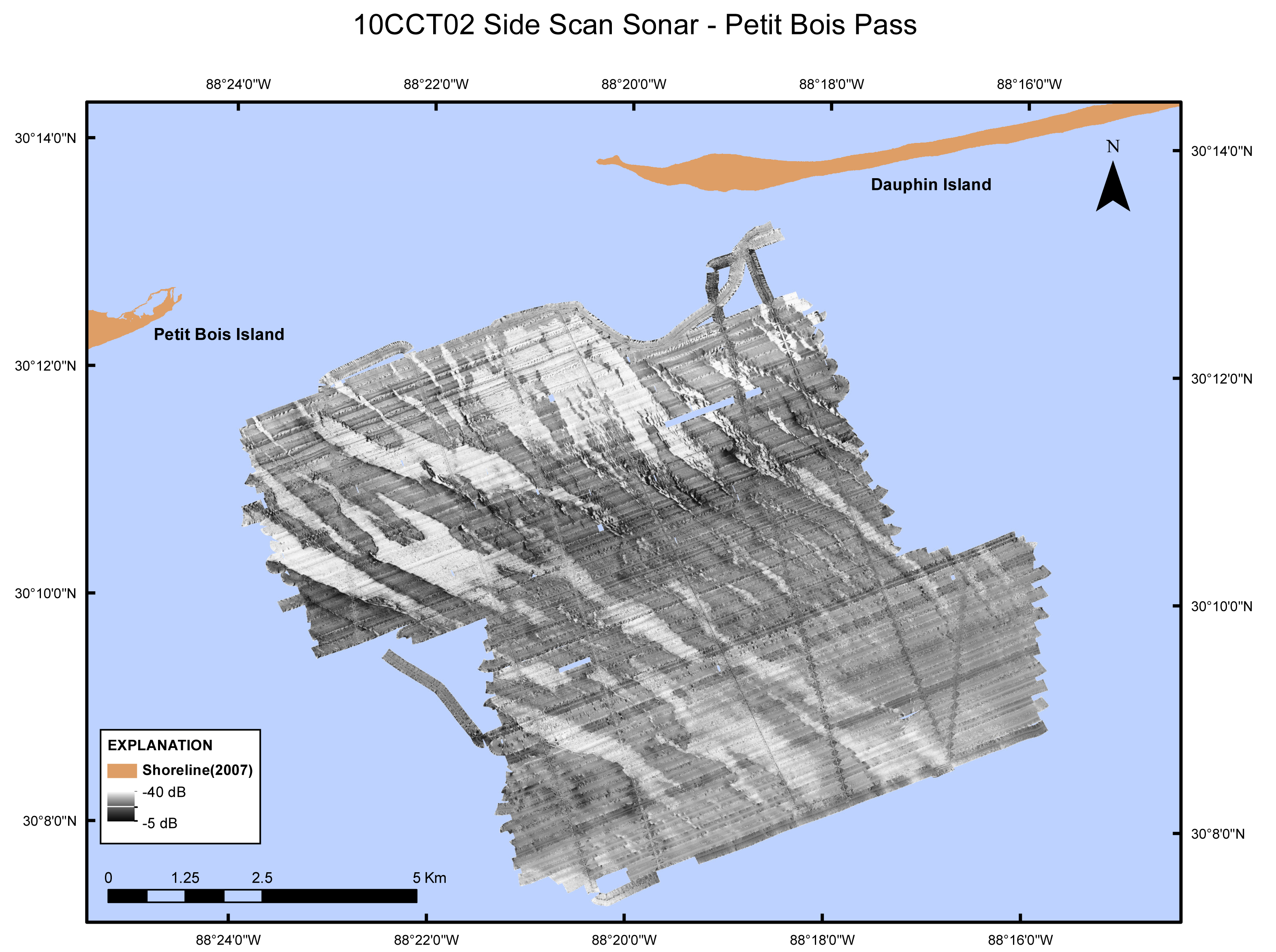
Side Scan Sonar Mosaic 1-Meter Grid
GeoTIFF image of the side scan sonar (1-m pixel) layout, WGS84 UTM Zone 16N. Amplitude intensity values range from -5 decibels to -40 decibels. |

![]() U.S. Department of the Interior |
U.S. Geological Survey
U.S. Department of the Interior |
U.S. Geological Survey
URL: https://pubsdata.usgs.gov/pubs/ds/577/html/images.html
Page Contact Information: William R. Pfeiffer
Page Last Modified: Monday, 28-Nov-2016 16:47:49 EST