U.S. Geological Survey Data Series 611
1U.S. Geological Survey, St. Petersburg, FL 33701.
2Jacobs Technology Inc., St. Petersburg, FL 33701.
U.S. Department of the Interior
U.S. Geological Survey
St. Petersburg Coastal and Marine Science Center
Publications are available from USGS Information Services, Box 25286, Federal Center, Denver, CO 80225-0046 (telephone 1-888-ASK-USGS; e-mail: infoservices@usgs.gov).
Page Contents (Disc 1 of 11): |
||||
 |
||||
This Digital Versatile Disc (DVD) publication was prepared by an agency of the United States Government. Although these data have been processed successfully on a computer system at the U.S. Geological Survey, no warranty expressed or implied is made regarding the display or utility of the data on any other system, nor shall the act of distribution imply any such warranty. The U.S. Geological Survey shall not be held liable for improper or incorrect use of the data described and (or) contained herein. Reference herein to any specific commercial product, process, or service by trade name, trademark, manufacturer, or otherwise does not constitute or imply its endorsement, recommendation, or favoring by the United States Government or any agency thereof.
This disc is readable on any computing platform that has standard DVD driver software installed. The minimum software requirements are a Web browser, a portable document format (PDF) reader, and a text editor. If you cannot fully access the information on this page, please contact USGS Information Services at infoservices@usgs.gov or 1-888-ASK-USGS. NOTE: The only supported Web browsers that properly display all features of the geospatially interactive profiles are Internet Explorer 8 or greater for Windows and Firefox 3.6 or greater for all platforms
To access the information contained on this disc, use a Web browser to open the file index.html. This report is divided into seven sections: Acronyms and Abbreviations, Disc Contents, Navigation Data and Maps, Subbottom Profiles, Field Activity Logs, FGDC Metadata, and Software. Links at the top and bottom of each page provide access to these sections. This report contains links to the USGS and collaborators or other resources that are accessible only if access to the Internet is available while viewing these documents.
The Disc Contents page is a diagram with links to the locations of all files and folders contained on this disc; all discs are identical except for the SEG-Y files they contain. Lines 10c01 - 10c36 were collected during 10CCT01, lines 10c01 - 10c05 and 10i06 - 10i192 collected during 10CCT02, and lines 10i01 - 10i44 collected during 10CCT03.
Disc 1 contains SEG-Y files for lines 10c01 through 10c19b disc 2 contains SEG-Y files for lines 10c20 through 10c36 (10CCT01) and 10c01 through 10c05 (10CCT02); disc 3 contains SEG-Y files for lines 10c06 through 10i34; disc 4 contains SEG-Y files for lines 10i35 through 10i69; disc 5 contains SEG-Y files for lines 10i70 through 10i102; disc 6 contains SEG-Y files for lines 10i103 through 10i125; disc 7 contains SEG-Y files for lines 10i125 through 10i154; disc 8 contains SEG-Y files for lines 10i155 through 10i180; disc 9 contains SEG-Y files for lines 10i181 through 10i192 and 10i01 through 10i20 (10CCT03); disc 10 contains SEG-Y files for lines 10i21 through 10i35 and disc 11 contains SEG-Y files for lines 10i36 through 10i44.
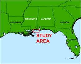
In March and April of 2010 the U.S. Geological Survey (USGS), in cooperation with the U.S. Army Corps of Engineers (USACE), conducted geophysical surveys to investigate the geologic controls on barrier island framework from just east of Cat Island, Mississippi, to Dauphin Island, Alabama, as part of a broader USGS study on Coastal Change and Transport (CCT). These surveys were funded through the Mississippi Coastal Improvements Program (MsCIP) and the Northern Gulf of Mexico Ecosystem Change and Hazard Susceptibility Project as part of the Holocene Coastal Evolution of the Mississippi-Alabama Region Subtask (http://ngom.er.usgs.gov/task2_2/index.php). This report serves as an archive of unprocessed digital Chirp subbottom profile data, trackline maps, navigation files, Geographic Information System (GIS) files, Field Activity Collection System (FACS) logs, and formal Federal Geographic Data Committee (FGDC) metadata. Gained (a relative increase in signal amplitude) digital images of the seismic profiles are also provided. Refer to the Acronyms page for expansion of acronyms and abbreviations used in this report.
The USGS St. Petersburg Coastal and Marine Science Center (SPCMSC) assigns a unique identifier to each cruise or field activity. For example, 10CCT01, 10CCT02, and 10CCT03 indicate the data were collected in 2010 to study Coastal Change and Transport (CCT) during the first, second, and third field activities for that study in that calendar year. Refer to http://walrus.wr.usgs.gov/infobank/programs/html/definition/activity.html for a detailed description of the method used to assign the field activity identification (ID).
All Chirp systems use a signal of continuously varying frequency; the EdgeTech SB-512i and SB-424 Chirp systems used during these surveys produce high-resolution, shallow-penetration (less than 50 ms) profile images of sub-seafloor stratrigraphy. The towfish contains a transducer that transmits and receives acoustic energy and is typically towed 1 - 2 m below the sea surface. As transmitted acoustic energy intersects at density boundaries, such as the seafloor or sub-surface sediment layers, some energy is reflected back toward the transducer, received, and recorded by a PC-based seismic acquisition system. This process is repeated at regular time intervals (for example, 0.125 s) and returned energy is recorded for a specific duration (for example, 50 ms). In this way, a two-dimensional vertical image of the shallow geologic structure beneath the ship track is produced. Figure 1 displays the acquisition geometries used during each cruise. Refer to table 1 for a summary of acquisition parameters. See the digital FACS folder equipment files for details about the acquisition equipment used. Trackline statistics for the three cruises are compiled in table 2 (10CCT01), table 3 (10CCT02), and table 4 (10CCT03).
The original trace files for lines 10i01, 10i03, 10i04, 10i05, 10i12, 10i29, 10i30, 10i32, 10i36, 10i37, 10i39, 10i40, 10i41, 10i42, and 10i43 were divided into two or more trace files each (for example, 10i01 became 10i01a and 10i01b; 10i4a became 10i4a1) because the original total number of traces exceeded the 20,000 shot maximum allowed by SonarWeb v. 3.16.0096 PRO processing software.
The archived trace data are in standard Society of Exploration Geophysicists (SEG) SEG-Y rev. 0 (Barry and others, 1975); the first 3,200 bytes of the card image header are in ASCII format instead of EBCDIC format. The SEG-Y files may be downloaded and processed with commercial or public domain software such as Seismic Unix (SU) (Cohen and Stockwell, 2010). See the How To Download SEG-Y Data page for download instructions. The web version of this archive does not contain the SEG-Y trace files. These files are very large and would require extremely long download times. To obtain the complete DVD archive, contact USGS Information at 1-888-ASK-USGS or infoservices@usgs.gov. The printable profiles provided here are GIF images that were processed and gained using SU software; refer to the Software page for links to example SU processing scripts. The processed SEG-Y data were also exported to Chesapeake Technology, Inc. (CTI) SonarWeb software to produce a geospatially interactive version of the profile that allows the user to obtain a geographic location and depth from the profile for a given cursor position; this information is displayed in the status bar of the browser. Please note that clicking on the profile image switches it to "Expanded View" (a compressed image of the entire line) and cursor tracking is not available in this mode.
| NOTE: If using Internet Explorer 8, Active Content/Active X controls must be disabled. Please refer to the details and setup page for more information.
PC Instructions: For both browsers, the status bar and JavaScript must be enabled. Firefox also requires "Change status bar text" to be checked under Advanced JavaScript Settings. This option can be found on the main Toolbar under Tools > Options > Content (tab) > Advanced... > Allow scripts to:
Use of other browsers may result in spurious or no information given in the status window. Macintosh Instructions (Firefox Only): From the Menu Bar go to Preferences > Content (tab) > Checkmark "Enable JavaScript"> Click Advanced... > Checkmark "Change Status Bar Text". Verify that the status bar is enabled by selecting View from the Menu Bar and looking for a checkmark next to "Status Bar"; if the check is missing, highlight and select the text to activate the bar. |
The printable and geospatial profiles can be viewed from the Profiles page. Detailed information about the navigation system used can be found in table 1 and the FACS logs. To view the trackline maps and navigation files, and for more information about these items, see the Navigation page.
NOTE: Due to system malfunctions, some lines were terminated early or did not have data collected; therefore, they are not included in this archive.
Funding and (or) support for this study was provided by the USGS Coastal and Marine Geology Program and MsCIP. We thank R/V Tommy Munro captain Paul Beaugez and crew (University of Southern Mississippi/Gulfcoast Research Laboratory - Biloxi, MS) and R/V Irvington captains Fred Roberts and Reid Boa (USACE - Mobile, AL) for their assistance in data collection. This document was improved by the reviews of Wayne Baldwin (USGS Woods Hole Coastal and Marine Science Center (WHSC) - Woods Hole, MA) and Jennifer Miselis (USGS - SPCMSC).
Disc Image Credit: Descloitres, J., MODIS Land Rapid Response Team at the NASA Goddard Space Flight Center, 2001, Mississippi.A2001361.1640.250m.jpg. Available on-line at http://visibleearth.nasa.gov/view_rec.php?id=2364.
Barry, K.M., Cavers, D.A., and Kneale, C.W., 1975, Recommended standards for digital tape formats: Geophysics, v. 40, no. 2, p. 344-352. Also available on-line at http://www.seg.org/resources/publications/misc/technical-standards.
Cohen, J.K., and Stockwell, J.W., Jr., 2010, CWP/SU: Seismic Unix Release 41: A free package for seismic research and processing: Center for Wave Phenomena, Colorado School of Mines. Available on-line at http://www.cwp.mines.edu/cwpcodes/.
Zihlman, F.N., 1992, DUMPSEGY V1.0: A program to examine the contents of SEG-Y disk-image seismic data: U.S. Geological Survey Open-File Report 92-590, 28 p. Also available on-line at http://pubs.er.usgs.gov/usgspubs/ofr/ofr92590.
Forde, A.S., Dadisman, S.V., Flocks, J.G., Wiese, D.S., DeWitt, N.T., Pfeiffer, W.R., Kelso, K.W., and Thompson, P.R., 2011, Archive of digital Chirp subbottom profile data collected during USGS cruises 10CCT01, 10CCT02, and 10CCT03, Mississippi and Alabama Gulf Islands, March and April 2010: U.S. Geological Data Series 611, 11 DVDs.

![]() U.S. Department of the Interior |
U.S. Geological Survey
U.S. Department of the Interior |
U.S. Geological Survey
URL: http://pubsdata.usgs.gov/pubs/ds/611/index.html
Page Contact Information: GS Pubs Web Contact
Page Last Modified: Monday, 28-Nov-2016 17:29:20 EST
