 Abstract Abstract
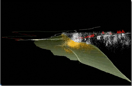
We present a Geographic Information System (GIS) of a new 3-dimensional (3D) model of the subducted Juan de Fuca Plate beneath western North America and associated seismicity of the Cascadia subduction system. The geo-referenced 3D model was constructed from weighted control points that integrate depth information from hypocenter locations and regional seismic velocity studies. We used the 3D model to differentiate earthquakes that occur above the Juan de Fuca Plate surface from earthquakes that occur below the plate surface. This GIS project of the Cascadia subduction system supersedes the one previously published by McCrory and others (2006). Our new slab model updates the model with new constraints. The most significant updates to the model include: (1) weighted control points to incorporate spatial uncertainty, (2) an additional gridded slab surface based on the Generic Mapping Tools (GMT) Surface program which constructs surfaces based on splines in tension (see expanded description below), (3) double-differenced hypocenter locations in northern California to better constrain slab location there, and (4) revised slab shape based on new hypocenter profiles that incorporate routine depth uncertainties as well as data from new seismic-reflection and seismic-refraction studies. We also provide a 3D fly-through animation of the model for use as a visualization tool.
|
Files for Viewing and Printing
- Readme text. Overview of the slab-grid project (14 kB)
- Animation folder. This folder contains PNW_animation_Readme.txt which is a text explanation of content portrayed in the animations as well as three animation files—formats consist of .mp4, one .mov, and .m4v (cell phone) (45 MB total)
- Location map PDF. This is a A map for reference to locations and features discussed in the 1_README.txt and shown in the animations (1.1 MB)
GIS Data
- Data zip package. A compressed folder containing GIS ASCII data, GIS binary data, and metadata files (8.1 MB)
- Metadata folder. This folder contains metadata files for the ASCII GIS data and binary GIS data (104 kB total)
-
This report is available only on the Web.
Part of this report is presented in Portable Document Format (PDF); the latest version of Adobe Reader or similar software is required to view it. Download the latest version of Adobe Reader, free of charge.
Parts of this report are presented in .mov and .mp4 formats; the latest version of Apple QuickTime or similar software is required to view them. Download the latest version of Quicktime, free of charge.
|

