U.S. Geological Survey Data Series 651
1Jacobs Technology Inc., St. Petersburg, FL 33701.
2U.S. Geological Survey, St. Petersburg, FL 33701.
U.S. Department of the Interior
U.S. Geological Survey - St. Petersburg Coastal and Marine Science Center
Publications are available from USGS Information Services, Box 25286, Federal Center, Denver, CO 80225-0046 (telephone 1-888-ASK-USGS; e-mail: infoservices@usgs.gov).
Page Contents: |
||||
 |
||||
This Digital Versatile Disk (DVD) publication was prepared by an agency of the United States Government. Although these data have been processed successfully on a computer system at the U.S. Geological Survey, no warranty expressed or implied is made regarding the display or utility of the data on any other system, nor shall the act of distribution imply any such warranty. The U.S. Geological Survey shall not be held liable for improper or incorrect use of the data described and (or) contained herein. Reference herein to any specific commercial product, process, or service by trade name, trademark, manufacturer, or otherwise does not constitute or imply its endorsement, recommendation, or favoring by the United States Government or any agency thereof.
This disc is readable on any computing platform that has standard DVD driver software installed. The minimum software requirements are a Web browser, a Portable Document Format (PDF) reader, and a text editor. Additional features are provided using Google Earth software (http://www.google.com/earth/download/ge/). If you cannot fully access the information on this page, please contact USGS Information Services at infoservices@usgs.gov or 1-888-ASK-USGS.
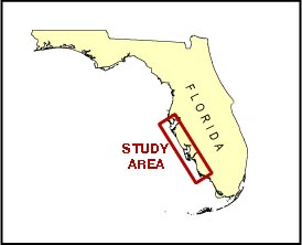
On August 15, 2004, the U.S. Geological Survey (USGS) conducted an oblique aerial photographic survey off the southwest coast of Florida, from Marco Island to Fort DeSoto, aboard a Navajo Chieftain airplane, tail number N2KK, at an altitude of 500 ft and approximately 1000 ft offshore. These photographs were used to document coastal changes such as beach erosion and overwash caused by Hurricane Charley. They will also be used as baseline data for future coastal change. The oblique photography also served as qualitative ground truthing for the Experimental Advanced Airborne Research Lidar (EAARL) coastal topography and bathymetry data collected on August 16, 2004 (Bonisteel and others, 2009). This report serves as an archive of photographs collected during the August 15, 2004, post-Hurricane Charley coastal oblique aerial survey along with associated flight path maps, KML files, navigation files, digital Field Activity Collection System (FACS) logs, and Federal Geographic Data Committee (FGDC) metadata. Refer to the Acronyms page for expansions of all acronyms and abbreviations used in this report.
The USGS St. Petersburg Coastal and Marine Science Center (SPCMSC) assigns a unique identifier to each cruise or field activity. For example, 04CCH01 tells us the data were collected in 2004 for the Coastal Change Hazards (CCH) study and the data were collected during the first field activity for that project in that calendar year. Refer to http://walrus.wr.usgs.gov/infobank/programs/html/definition/activity.html for a detailed description of the method used to assign the ID number.
Two separate records of flight navigation were collected during the survey. The first was a continuous ASCII text file from the PLGR that recorded only latitudes, longitudes, and altitudes every 30 sec for the entire flight. No time values were recorded by the PLGR. The second navigation record was recorded by a Trimble Centurion GPS and converted to subtitles on the video, using a Compix Titler unit. The video was shot continuously during the survey. The video subtitles recorded day, month, year, latitude, longitude, and time in hours, minutes, and seconds. In order to produce a digital record of the navigation values that included latitude, longitude, and time, each was manually extracted from the video every 5 min, and these values were matched to the latitude and longitude in the PLGR file. Next, the time was interpolated between these 5-min fixes using Excel to produce time values for each navigation fix recorded in the PLGR file.
The location of each photograph taken was determined in the following manner. A Nikon MF-14 data back marks the time each photograph was acquired on the lower right corner of the image in day, hour, and minute format (in UTC). These values were entered from the photographs into an Excel spreadsheet. It is assumed for the purposes of locating the images that the photographs were taken at a constant rate during any given minute of flight. To assign the time value in seconds to each photograph, the number of photographs taken during each minute was evenly distributed across that minute. For example, if 15 photographs were taken during minute 19:00:00, we assume that a picture was taken every 4 sec. The photographs were assigned the time values 19:00:00, 19:00:04, 19:00:08, and so on. The video time navigation file was then merged with the new interpolated photograph file based on time to produce the point of which each photograph was collected. As a result, the positions assigned to each photograph are an estimate of the aircraft position, not the location of the landmark photographed.
The photographs provided here are JPEG scanned images of the analog slides. The metadata values for photo creation time, GPS latitude, GPS longitude, GPS position, keywords, credit, artist, caption, copyright, and contact were added to each photograph's EXIF header using EXIFtools (see the Software page). Photographs can be opened directly with any JPEG-compatible image viewer by clicking on a thumbnail on the contact sheet, or, when viewing the Google Earth KML file, by clicking on the marker and then clicking on either the thumbnail or the link below the thumbnail. The KML files were created using the photographic navigation files and the CreateKML JavaScript (see the Software page).
To view the survey maps and navigation files, and for more information about these items, see the Navigation page. Figure 1 displays the acquisition geometry. The tables provide detailed information about the assigned location, name, data, and time the photograph was taken along with links to the photo and corresponding 5-min contact sheet. Refer to table 1 and table 2 for details of the northern and southern county photographs, respectively.
NOTE: There were no photographs taken during the 5-min segment 2004_0815_183500.
This report contains links to other resources if access to the Internet is available while viewing these documents. Keyhole Markup Language (KML) files, Hypertext Markup Language (HTML) files, images used to produce the Web pages, and a readme file are also included in this report. Links at the top and bottom of each page provide access to these sections.
The survey's full-size photographs have been split up into two discs, northern counties (Disc 1) and southern counties (Disc 2) (see full survey area map). Each disc contains a KML file with links to the related full-size photographs.
The Disc Contents contains a diagram of the location of all files and folders mentioned in the text and provides links to these files and folders.
To access the information contained on this disc, use a Web browser to open the file index.html. This report is divided into seven sections: Acronyms, Contents, Navigation, Photographs, Logs, Metadata, and Software. Links at the top and bottom of each page provide access to these sections. This report contains links to the USGS and collaborators and to other resources that are only accessible if access to the Internet is available while viewing these documents.
Funding and (or) support for this study was provided by the USGS Coastal and Marine Geology Program (CMGP).
The authors wish to thank Russell Peterson (formerly with the USGS - St. Petersburg, FL), Philip Thompson (USGS - St. Petersburg, FL), and Navajo Chieftain Airplane pilot Mark Frame from Bay Air Charters, Inc. for their assistance in data collection. Karynna Calderon (contracted with Jacobs Technology, Inc., at the USGS - St. Petersburg, FL) assisted with data post processing. This report benefited from the comments and reviews from Hilary Stockdon (USGS - St. Petersburg, FL), Matthew Cimitile (contracted with Jacobs Technology Inc., at the USGS - St. Petersburg, FL) and Kara Doran (USGS - St. Petersburg, FL).
Bonisteel, J.M., Nayegandhi, Amar, Wright, C.W., Sallenger, A.H., Brock, J.C., Yates, Xan, and Klipp, E.S., 2009, EAARL coastal topography–western Florida, post-Hurricane Charley, 2004: first surface: U.S. Geological Survey Data Series 478, 1 DVD. Available online at https://pubs.usgs.gov/ds/478/.
Subino, J.A., Morgan, K.L.M., Krohn, M.D., Miller, G.K., Dadisman, S.V., Forde, A.S., 2012, Archive of post-Hurricane Charley coastal oblique aerial photographs collected during U.S. Geological Survey field activity 04CCH01 from Marco Island to Fort DeSoto, Florida, August 15, 2004: U.S. Geological Survey Data Series 651, 2 DVDs.

![]() U.S. Department of the Interior |
U.S. Geological Survey
U.S. Department of the Interior |
U.S. Geological Survey
URL: http://pubsdata.usgs.gov/pubs/ds/651/index.html
Page Contact Information: GS Pubs Web Contact
Page Last Modified: Monday, 28-Nov-2016 18:41:32 EST
