Data Series 654
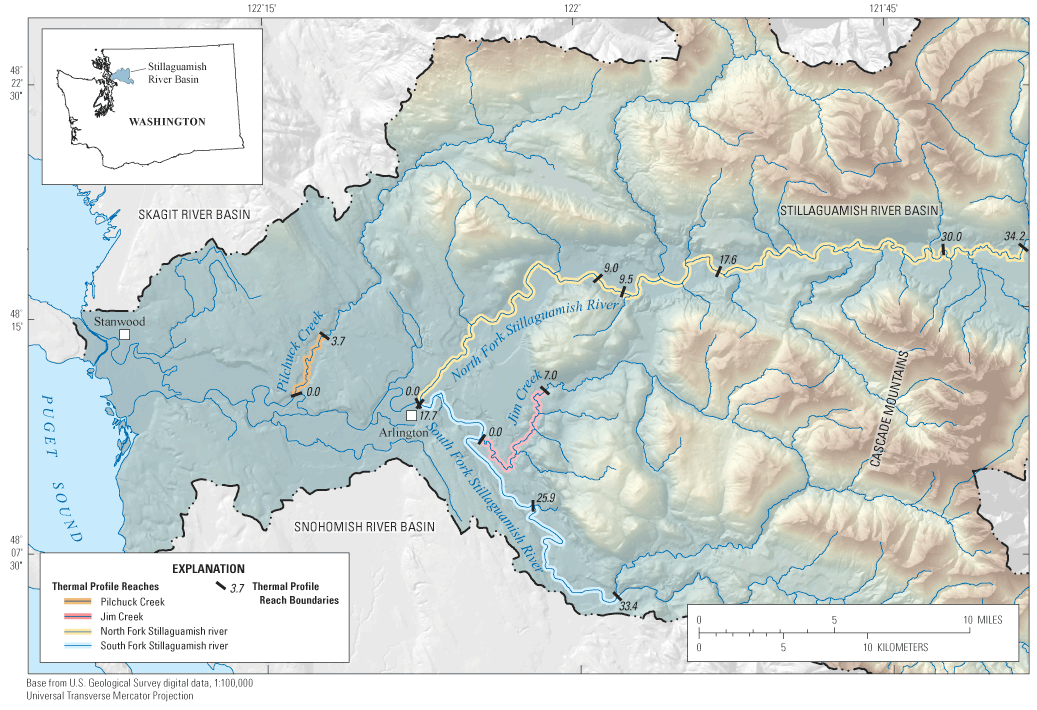
Figure 1. Location of the study area where stream water temperature profiles were measured on the North Fork and South Fork of the Stillaguamish River, Jim Creek, and Pilchuck Creek, Washington. |
First posted December 6, 2011 For additional information contact: Part or all of this report is presented in Portable Document Format (PDF); the latest version of Adobe Reader or similar software is required to view it. Download the latest version of Adobe Reader, free of charge. |

![]() U.S. Department of the Interior |
U.S. Geological Survey
U.S. Department of the Interior |
U.S. Geological Survey
URL: http://pubsdata.usgs.gov/pubs/ds/654/figure1.html
Page Contact Information: GS Pubs Web Contact
Page Last Modified: Monday, 28-Nov-2016 18:27:20 EST
