Skip Links

USGS - science for a changing world

Data Series 681

Prepared in cooperation with the U.S. Department of Agriculture Natural Resources Conservation Service, the Edwards Aquifer Authority, and the Texas Parks and Wildlife Department

Hydrologic and Water-Quality Data at Government Canyon State Natural Area, Bexar County, Texas, 2002–10

By J. Ryan Banta and Richard N. Slattery

Thumbnail of and link to report PDF (1.72 MB)Abstract

The U.S. Geological Survey, in cooperation with the U.S. Department of Agriculture Natural Resources Conservation Service, the Edwards Aquifer Authority, and the Texas Parks and Wildlife Department, collected rainfall, streamflow, evapotranspiration, and stormflow water-quality data at the Laurel Canyon Creek watershed, within the Government Canyon State Natural Area, Bexar County, Tex. The purpose of the data collection was to support evaluations of the effects of brush management conservation practices on components of the hydrologic budget and water quality. One component of brush management was to take endangered wildlife into consideration, specifically the golden-cheeked warbler (Dendroica chrysoparia). Much of the area that may have been considered for brush management was left intact to protect habitat for the golden-cheeked warbler. The area identified for brush management was approximately 10 percent of the study watershed. The hydrologic data presented here (2002–10) represent pre- and post-treatment periods, with brush management treatment occurring from winter 2006–07 to spring 2008.

First posted April 20, 2012

For additional information contact:
Director, Texas Water Science Center
U.S. Geological Survey
1505 Ferguson Lane
Austin, Texas 78754-4501
http://tx.usgs.gov/

Part or all of this report is presented in Portable Document Format (PDF); the latest version of Adobe Reader or similar software is required to view it. Download the latest version of Adobe Reader, free of charge.


Suggested citation:

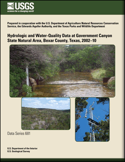
Banta, J.R., and Slattery, R.N., 2012, Hydrologic and water-quality data at Government Canyon State Natural Area, Bexar County, Texas, 2002–10: U.S. Geological Survey Data Series 681, 43 p.


Contents

Abstract

Introduction

Data Collection Methods

Hydrologic and Water-Quality Data

References
Appendix 1. Daily total rainfall during 2003–10 at site LCSW
Appendix 2. Daily mean streamflow during 2002–10 at site LCSW
Appendix 3. Daily total evapotranspiration during 2003–10 at site LCET
Appendix 4. Water-quality and isotope data in samples collected from site LCSW

Accessibility FOIA Privacy Policies and Notices

Take Pride in America logo USA.gov logo U.S. Department of the Interior | U.S. Geological Survey
URL: http://pubsdata.usgs.gov/pubs/ds/681/index.html
Page Contact Information: GS Pubs Web Contact
Page Last Modified: Monday, 28-Nov-2016 18:27:12 EST