Fact Sheet 143-99
By Krysten M. DeBroka and David A. Cohen, U.S. Geological Survey, Robert E. Dunn and Bruce J. Nielsen, Natural Resources Conservation Service
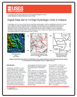
IntroductionA hydrologic unit (HU) is an area of land upstream from a specific point on a stream that is defined by a hydrologic boundary. The boundary includes all of the source area that could contribute surface-water runoff directly or indirectly to the designated outlet point. HU’s are used by local, State, and Federal agencies and by private and academic interests for natural-resource, water-quality, and flood-damage activities; water-data management; and geographic information systemsbased (GIS-based) spatial analyses (U.S. Department of Agriculture, 1992). Before 1999, the most-detailed statewide hydrologic-unit data for Indiana were published on a 1:500,000-scale map of 8-digit hydrologic-unit boundaries (U.S. Geological Survey, 1974). That map was part of a series developed by the U.S. Geological Survey (USGS) to provide uniform hydrologic-unit boundaries and to present them on nationally consistent base maps. The 8-digit HU’s in Indiana are identified by a unique 8-digit hydrologic-unit code (HUC) based on four levels of classification (fig. 1, page 3): regions, subregions, accounting units, and cataloging units (Seaber and others, 1987). During the mid- to late-1970’s, the U.S. Department of Agriculture Natural Resources Conservation Service (NRCS) subdivided 8-digit HU’s by adding three digits to identify a fifth level of classification, 11-digit HU’s—watersheds. Since that time, water-resources professionals have recognized a need for further delineation and subdivision of HU’s in Indiana for research, planning, and regulatory activities. In 1992, the NRCS developed guidelines for mapping and digitizing a sixth level of classification, 14-digit HU’s—subwatersheds (U.S. Department of Agriculture, 1992). In 1996, the USGS, the NRCS, the Indiana Department of Environmental Management, and the Indiana Department of Natural Resources Division of Water agreed to create a digital data set of 14-digit HU’s in Indiana. |
For additional information contact: U.S. Geological Survey Home Website http://www.usgs.gov/ Download the Digital Data Set Part or all of this report is presented in Portable Document Format (PDF); the latest version of Adobe Reader or similar software is required to view it. Download the latest version of Adobe Reader, free of charge. |

![]() U.S. Department of the Interior |
U.S. Geological Survey
U.S. Department of the Interior |
U.S. Geological Survey
URL: https://pubsdata.usgs.gov/pubs/fs/1999/fs143-99/
Page Contact Information: Contact USGS
Page Last Modified: Tuesday, 29-Nov-2016 18:11:34 EST
