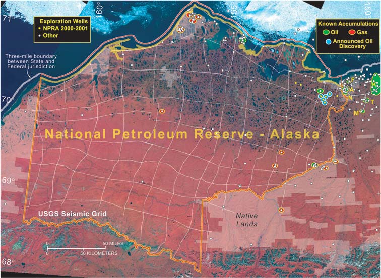
Figure 2. Map of the National Petroleum Reserve in Alaska (NPRA; boundary shown by yellow line) and surrounding region with locations of seismic lines, wells, oil and gas accumulations, and Native lands. Red line shows the total area assessed in 2002 by the U.S. Geological Survey (USGS), including Federal and Native lands and State offshore areas. USGS seismic grid shows location of those seismic lines reprocessed and reinterpreted for this assessment. The assessment incorporated information on all exploration wells except those in the northeast part of NPRA drilled during 2000 and 2001. Oil fi elds east of NPRA, including several recently discovered accumulations, are labeled as follows: A, Alpine; F, Fiord; K, Kuparuk River; M, Meltwater; N, Nanuq; and T, Tarn. The map base is a false-color composite Landsat image on which vegetation appears as shades of red, and soil and rock with little or no vegetation appear in shades of green and brown. Deep and clear water appears dark blue to black, and shallow or sediment-laden water appears in lighter shades of blue. Ice is white or bluish white.
Return to the NPRA Fact Sheet main page