|
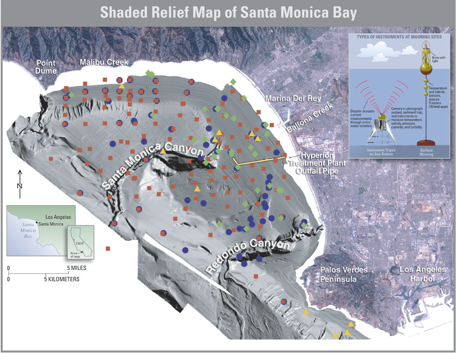
| This U.S. Geological Survey (USGS) map shows the sea-floor topography (see caption of map below) of Santa Monica Bay. The bay is located offshore of the Greater Los Angeles metropolitan area. Primary drainage into the bay is from Malibu Creek, Ballona Creek, the Hyperion Treat-ment Plant wastewater outfall, and storm drains located along the shore of the bay. USGS research cruises collected cores of sea-bottom sediment from sites in the bay in 1997 (green diamonds), 1998 (red squares), and 1999 (purple dots) to study contamination. Instrumented moorings (inset) placed at sites in the bay (yellow triangles) collected information about temperature, salinity, and current conditions in the water column and near the sea floor, key parameters that are being used to study and model sediment and contaminant transport. |