Fact Sheet 2005–3055
Introduction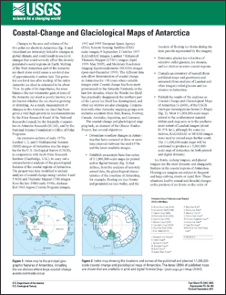
Changes in the area and volume of the two polar ice sheets in Antarctica (fig. 1) and Greenland are intricately linked to changes in global climate, and could result in sea-level changes that could severely affect the densely populated coastal regions on Earth. Melting of the West Antarctica part of the Antarctic ice sheet alone could cause a sea-level rise of approximately 6 meters (m). The potential sea-level rise after melting of the entire Antarctic ice sheet is estimated to be about 73 m. In spite of its importance, the mass balance (the net volumetric gain or loss) of the Antarctic ice sheet is poorly known; it is not known whether the ice sheet is growing or shrinking. As a result, measurement of changes in the Antarctic ice sheet has been given a very high priority in recommendations by the Polar Research Board of the National Research Council, by the Scientific Committee on Antarctic Research (SCAR), and by the National Science Foundation’s Office of Polar Programs. An extensive archive of early 1970s Landsat 1, 2, and 3 Multispectral Scanner (MSS) images of Antarctica was the impetus for the U.S. Geological Survey (USGS), in cooperation with Scott Polar Research Institute (Cambridge, U.K.), to carry out a comprehensive analysis of the glaciological features of the coastal regions of Antarctica. The project was later modified to include analysis of coastal change using Landsat 4 and 5 MSS and Thematic Mapper (TM) images from the late 1980s/early 1990s, declassified 1963 Argon (Corona Program) images, 1992 and 1995 European Space Agency (ESA) Remote Sensing Satellite (ERS) radar images, 9 September–2 October 1997 RADARSAT images, Landsat 7 Enhanced Thematic Mapper (ETM+) images (April 1999 to May 2003), and Moderate Resolution Imaging Spectroradiometer (MODIS) images (post-mid-December 1999). The different data sets allow determination of coastal change in Antarctica for more than 30 years where suitable images exist. Coastal change has been most pronounced on the Antarctic Peninsula in the last few decades, where the Wordie Ice Shelf has practically disappeared, the northern part of the Larsen Ice Shelf has disintegrated, and other ice shelves are also changing. Cooperation with other Antarctic mapping groups now includes scientists from Italy, Russia, Norway, Canada. Australia, Argentina, and Germany. |
First posted May 27, 2005 For additional information contact: Part or all of this report is presented in Portable Document Format (PDF); the latest version of Adobe Reader or similar software is required to view it. Download the latest version of Adobe Reader, free of charge. |
Williams, Jr., R.S., Ferrigno, J.G., Foley, K.M., 2005, Coastal-change and glaciological maps of Antarctica: U.S. Geological Survey Fact Sheet 2005-3055, 2 p., at https://pubs.usgs.gov/fs/2005/3055.

![]() U.S. Department of the Interior |
U.S. Geological Survey
U.S. Department of the Interior |
U.S. Geological Survey
URL: http://pubsdata.usgs.gov/pubs/fs/2005/3055/index.html
Page Contact Information: GS Pubs Web Contact
Page Last Modified: Tuesday, 29-Nov-2016 18:15:33 EST
