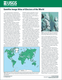
Fact Sheet 2005–3056
IntroductionMost mountain glaciers worldwide have been retreating since the late 1800s (at the end of the “Little Ice Age”), and global sea level has risen about 30 centimeters since then. Glaciers vary in size in response to changes in global and regional climates (such as warmer summers). The U.S. Geological Survey (USGS) studies the complex links among glacier variation, climate change, and global sea level. Sea-level changes, especially in densely populated, low-lying coastal areas and on islands, have significant effects on human activities and facilities. The present volume of the Earth’s glacier ice, if totally melted, represents about 80 meters in potential sea-level rise. About 200 meters is the range of sea-level changes that can be caused by water being frozen in glaciers during an ice age (glacial stage) or melted during an interglacial stage. For example, during the last glacial maximum (LGM), about 21,000 years ago, sea level is estimated to have been 125 meters lower than it is today. During a warmer climatic interval in the last interglacial stage, about 125,000 years ago, sea level was about 6 meters higher than it is today; during an even warmer interval about 2.2 million years ago, sea level is estimated to have been 25 to 50 meters higher. |
Revised September, 2005, (Supersedes FS–130–02, FS–133–99, and FS–94–009) First posted May 2005 For additional information contact: Part or all of this report is presented in Portable Document Format (PDF); the latest version of Adobe Reader or similar software is required to view it. Download the latest version of Adobe Reader, free of charge. |
Williams, R.S., Jr., and Ferrigno, J.G., 2005, Satellite image atlas of glaciers of the world: Fact Sheet 2005–3056, 2 p., at https://pubs.usgs.gov/fs/2005/3056.

![]() U.S. Department of the Interior |
U.S. Geological Survey
U.S. Department of the Interior |
U.S. Geological Survey
URL: http://pubsdata.usgs.gov/pubs/fs/2005/3056/index.html
Page Contact Information: GS Pubs Web Contact
Page Last Modified: Tuesday, 29-Nov-2016 18:15:37 EST
