U.S. GEOLOGICAL SURVEY
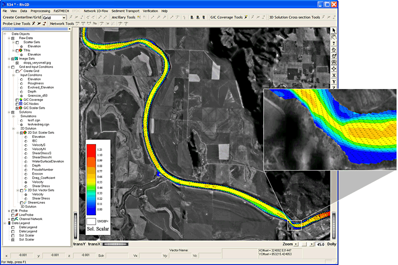
Figure 1. The MD_SWMS GUI tool shown with an application of the Kootenai River, Idaho. The GUI features menus, toolbars, treeview of data objects loaded into the project, graphics view with tools for zooming and panning, status bar and probe bar for dynamic feedback of data values. The main panel of the application shows a portion of a 10-kilometer reach of the Kootenai River with a model prediction of velocity overlain on a georeferenced digital orthoquad. A detail (inset) of the solution shows the complicated flow pattern in a sharp bend of the river. Velocity magnitude is shown by color and velocity vectors are shown in black.

![]() U.S.
Department of the Interior | U.S. Geological
Survey
U.S.
Department of the Interior | U.S. Geological
Survey
Persistent URL: https://pubs.water.usgs.gov/fs20053078
Page Contact Information: Publications Team
Page Last Modified: Tuesday, 29-Nov-2016 18:17:54 EST
