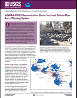
Once the smoke clears from a wildfire, the danger is not over!! Other hazards,
such as flash floods and debris flows, now become the focus. Just a small
amount of rainfall on a burn scar can lead to flash floods and debris
flows. The powerful force of rushing water, soil, and rock, both within
the burned area and downstream, can destroy culverts, bridges, roadways,
and structures. Flash floods and debris flows can thus cause serious
injury or death if care is not taken. The National Oceanic and Atmospheric
Administration (NOAA) and the United States Geological Survey (USGS)
have established a demonstration flash-flood and debris-flow early-warning
system for recently burned areas in southern California. The demonstration
project covers eight counties within southern California and will begin
in the autumn of 2005.
Version 1.0
|
| Posted September 2005 |
|
Part or all of this report is presented in Portable Document Format. The latest
version of Adobe Acrobat Reader or similar software is required
to view it. If you wish to download the latest version of Acrobat
Reader free of charge, click here.
|
|

