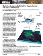
Fact Sheet 2006–3063
The Platte River in central Nebraska is a wide, sand-bedded river that provides habitat for migratory water birds along the North American flyway. The central Platte River functions as critical habitat for the endangered whooping crane (Grus americana) and also is an important habitat for the endangered least tern (Sterna antillarum) and the threatened piping plover (Charadrius melodus). Upstream water-resource development over the last century has decreased the water and sediment supplied to the central Platte River. This has resulted in vegetation encroachment and narrowing of Platte River channels. The National Academy of Sciences’ National Research Council, in a recent review of these critical habitat designations, concluded that the current morphology of Platte River channels is limiting the recovery of the endangered and threatened avian species. Habitat-enhancement efforts along the Platte River currently (2006) are focused on the clearing of vegetation from in-channel and riparian areas, whereas future plans propose the release of water from upstream dams as a means to prevent vegetation from encroaching on the active river channel. For this reason, monitoring the physical response of the river channel to these management treatments is an important component of a proposed habitat recovery program. Understanding the effects of management strategies on Platte River riparian habitat also is a key objective of the U.S. Geological Survey’s Platte River Priority Ecosystem Program (http://mcmcweb.er.usgs.gov/platte/). This fact sheet describes applications of LiDAR to monitor changes in the Platte River riparian corridor. |
Version 1.0 Posted August 2006
|
Part or all of this report is presented in Portable Document Format (PDF); the latest version of Adobe Acrobat Reader or similar software is required to view it. Download the latest version of Acrobat Reader, free of charge or go to access.adobe.com for free tools that allow visually impaired users to read PDF files.
