Fact Sheet 2007-3019
U.S. GEOLOGICAL SURVEY
Fact Sheet 2007-3019
By USGS Alaska Science Center
|
|
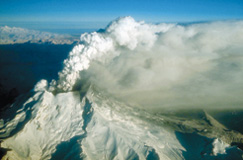 Redoubt Volcano |
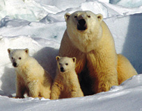 Polar Bears |
The U.S. Geological Survey (USGS), the Nation’s largest water, earth, and biological science and civilian mapping agency, has studied the natural features of Alaska since its earliest geologic expeditions in the 1800s. The USGS Alaska Science Center (ASC), with headquarters in Anchorage, Alaska, studies the complex natural science phenomena of Alaska to provide scientific products and results to a wide variety of partners. The complexity of Alaska’s unique landscapes and ecosystems requires USGS expertise from many science disciplines to conduct thorough, integrated research.

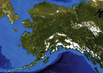
Alaska Facts Alaska is the largest state in the U.S. (656,425 square miles), more than twice as large as Texas, the next largest State. Alaska is larger in area than all but 18 of the world’s nations. Alaska has more than 40 active volcanoes. On average, one or two Alaskan volcanoes erupt each year. Alaska has more coastline than the rest of the U.S. combined. Eighty-eight percent of all National Wildlife Refuge lands and 65 percent of all National Park lands of the U.S. are in Alaska. Eight of the ten largest earthquakes recorded in the U.S. occurred in Alaska. The strongest earthquake recorded in North America occurred in Alaska in 1964. Alaska has the world’s largest zinc producing mine. More than one-third of the Nation’s stream runoff is from Alaska. |
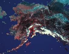
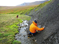 Mapping Alaska’s Geology |
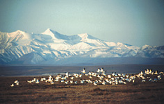
Tracking Animal Migration |
 Research and Monitoring |
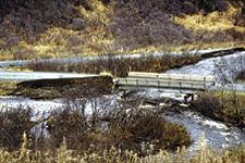 Flood Damage |
Alaska contains many of the most important biological, hydrological, mineral, and energy resources of the Nation and is subject to a wide variety of natural hazards, particularly earthquakes, volcanic eruptions, and landslides. Alaska has large intact ecosystems, rich in natural resources with enormous pressures for development or preservation. Federal, State, and local managers often are at the center of national debate about reaping Alaska’s natural resources and preserving its large-scale natural and wilderness integrity. The USGS ASC provides high-quality scientific information necessary for these resource decisions as well as for monitoring long-term change and human-induced effects on the environment.
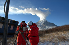 Volcanoes |
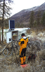
Identifying natural and emerging hazardsIn Alaska each year, natural hazards may cause deaths and can cost millions of dollars due to the disruption of commerce, and the destruction of critical infrastructure. The USGS ASC science helps forecast and mitigate disasters and build resilient communities through cutting edge science, research, and monitoring tools and techniques pioneered here for Alaska’s diverse and challenging landscape. Monitoring programs that address natural and emerging hazards include:
|
 Earthquakes |
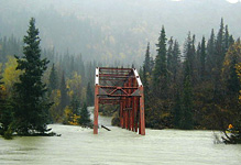 Floods |
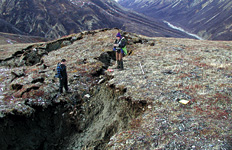
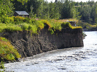 Stream-Channel Erosion |
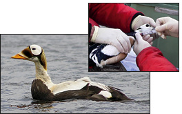 Wildlife Diseases |
Agencies of the Department of the Interior (DOI) manage more than 200 million acres of trust lands in Alaska. These include the lands and waters of National Parks, National Wildlife Refuges, Bureau of Land Management units, and Federal offshore areas. The USGS ASC provides the science for the management of Alaska’s Federal trust lands and waters, including:
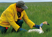
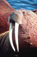
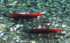
The USGS ASC provides research on DOI trust species including:
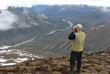 Interior Refuges & Parks |
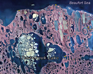 North Slope Lands and Water |
 Coastal Parks and Refuges |
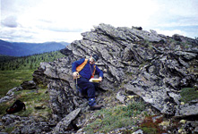
The USGS ASC conducts studies to gain a better understanding of the mineral-resource and mineral-environmental potential of all public lands in Alaska to provide information for land planners and decision makers about where mineral commodities are known and suspected in the Earth’s crust and about the environmental consequences of the presence of those commodities. Studies focus on:
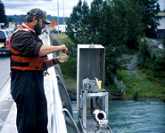
The USGS ASC monitors streamflow at more than 170 locations to:
Monitoring and modeling stream-channel erosion and morphology is critical for communities located on the banks of unstable rivers. Hydrological assessments and ground-water modeling can assist in evaluating water availability for communities and natural resource development.
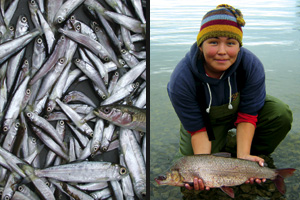
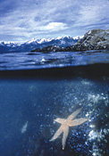
USGS ASC provides research support for the protection of the health of Alaskan waters and their inhabitants. USGS ASC conducts fisheries research on public lands and waters. National parks, refuges, and preserves are homes of lakes, rivers, estuaries, bays, and marine waters that provide recreation, commercial uses, and subsistence. Topics include:
 Streamgaging |
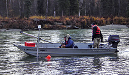 Measuring Streamflow |
Getting the Information Out!The portal is a searchable, web map-based tool to facilitate public and partner access to information on nearly 150 subjects under USGS study in the Nation’s largest State. It also provides access to more detailed information available in USGS web pages across the Nation. |
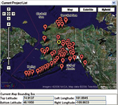 Alaska Science Portal |
*All photos taken by USGS Alaska Science Center employees.
For more information:
USGS Alaska Science Center
Leslie Holland-Bartels, Director
4230 University Dr., Suite 201
Anchorage, AK 99508-4650
(907)786-7000
http://alaska.usgs.gov
This report is available online in Portable Document Format (PDF). If you do not have the Adobe Acrobat PDF Reader, it is available for free download from Adobe Systems Incorporated.
Document Accessibility: Adobe Systems Incorporated has information about PDFs and the visually impaired. This information provides tools to help make PDF files accessible. These tools convert Adobe PDF documents into HTML or ASCII text, which then can be read by a number of common screen-reading programs that synthesize text as audible speech. In addition, an accessible version of Acrobat Reader 7.0 for Windows (English only), which contains support for screen readers, is available. These tools and the accessible reader may be obtained free from Adobe at Adobe Access.
| AccessibilityFOIAPrivacyPolicies and Notices | |
 |
|

 The
mission of the Alaska Science Center is to provide objective and timely data,
information, and research findings about the earth and its flora and fauna to
Federal, State, and local resource managers and the public to support sound
decisions regarding natural resources, natural hazards, and ecosystems in Alaska
and circumpolar regions.
The
mission of the Alaska Science Center is to provide objective and timely data,
information, and research findings about the earth and its flora and fauna to
Federal, State, and local resource managers and the public to support sound
decisions regarding natural resources, natural hazards, and ecosystems in Alaska
and circumpolar regions.