Fact Sheet 2007–3093
What Is the LDCM and Why Is It Important?
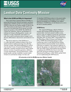
The Landsat Data Continuity Mission (LDCM) is a partnership between the National Aeronautics and Space Administration (NASA) and the U.S. Geological Survey (USGS) to place the next Landsat satellite in orbit by late 2012. The Landsat era that began in 1972 will become a nearly 45-year global land record with the successful launch and operation of the LDCM. The LDCM will continue the acquisition, archival, and distribution of multispectral imagery affording global, synoptic, and repetitive coverage of the Earth’s land surfaces at a scale where natural and human-induced changes can be detected, differentiated, characterized, and monitored over time. The mission objectives of the LDCM are to (1) collect and archive medium resolution (circa 30-m spatial resolution) multispectral image data affording seasonal coverage of the global landmasses for a period of no less than 5 years; (2) ensure that LDCM data are sufficiently consistent with data from the earlier Landsat missions, in terms of acquisition geometry, calibration, coverage characteristics, spectral characteristics, output product quality, and data availability to permit studies of land-cover and land-use change over time; and (3) distribute LDCM data products to the general public on a nondiscriminatory basis and at a price no greater than the incremental cost of fulfilling a user request. Distribution of LDCM data over the Internet at no cost to the user is currently planned. |
For additional information contact: U.S. Geological Survey Earth Resources Observation and Science (EROS) Center Sioux Falls, South Dakota (605) 594-6151 World Wide Web: http://eros.usgs.gov/ |
U.S. Geological Survey, 2007, Landsat Data Continuity Mission: U.S. Geological Survey Fact Sheet 2007–3093, 4 p.

![]() U.S. Department of the Interior | U.S. Geological Survey
U.S. Department of the Interior | U.S. Geological Survey
URL: http://pubsdata.usgs.gov/pubs/fs/2007/3093/index.html
Questions or Assistance: Contact USGS
Last modified: Tuesday, 29-Nov-2016 18:07:40 EST
