Fact Sheet 2007-3099
The U. S. Geological Survey (USGS) has been collecting streamflow information since 1889 using nationally consistent methods. The need for such information was envisioned by John Wesley Powell as a key component for settlement of the arid western United States. Because of Powells vision the nation now has a rich streamflow data base that can be analyzed with confidence in both space and time. This means that data collected at a stream gaging station in Maine in 1903 can be compared to data collected in 2007 at the same gage in Maine or at a different gage in California. Such comparisons are becoming increasingly important as we work to assess climate variability and anthropogenic effects on streamflow. Training employees in proper and consistent techniques to collect and analyze streamflow data forms a cornerstone for maintaining the integrity of this rich data base. |
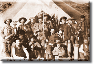 |
Data collection techniques used at the first USGS streamgaging stations were developed and taught at Embudo, New Mexico. The handful of student hydrographers who learned these techniques were distributed throughout the western United States where they set about establishing what is now the U.S. Geological Surveys streamgaging network. The USGS now employs hundreds of hydrographers who measure streamflow at over 7000 gaging stations in all 50 States, Puerto Rico, Guam, and the Virgin Islands. Those employees must continue to use standard practices to collect streamflow data if the integrity of the data base is to be maintained. To help USGS employees (and employees of other agencies who have a need to collect streamflow data) keep abreast of current USGS streamgaging techniques, a variety of training classes have been developed. Designed to augment traditional classroom-style training and published technique manuals, these classes are available either on CD-ROMs or over the Internet.
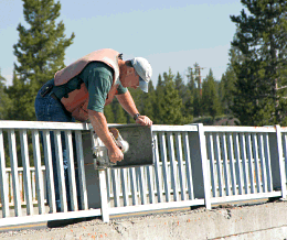
Photo of Robert Erickson reading the gage height at a streamgaging station using a wire-weight gage.
This class provides a basic understanding of techniques the U.S. Geological Survey uses to collect data at streamflow gaging stations. The class reviews:
You can also take virtual visits to two streamgages from this training class. This class is listed as Training Class SW4230 with the USGS National Training Center.
Photo of the artificial control that stabilizes the stage-discharge relation at a gaging station on San Francisquito Creek at Stanford, CA.
At most streamgaging stations stream discharge is estimated by applying the relation between stream stage, which is measured continuously, and discharge. This class provides a basic understanding of techniques the U.S. Geological Survey uses to develop these important relations. The class reviews:
A set of fourteen exercises accompany this class. USGS employees can take a modified version of this class that uses the graphical tool GRSAT to work class exercises. This class is listed as Training Class SW1409 with the USGS National Training Center.
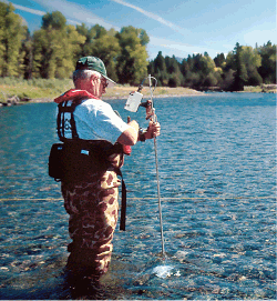
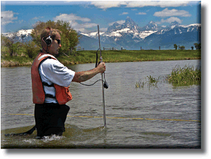
Photo of Ron Shields measuring the discharge of the Blackfoot River in Montana.
Most years the USGS makes over 50,000 stream discharge measurements. Over 75 percent of those measurements are made by wading streams and using the velocity-area method. This class describes how stream discharge should be measured when wading and using the velocity-area method. It is intended as a learning and reference tool for anyone responsible for making wading discharge measurements. This class, which was originally published on CD-ROM, has recently (2007) been revised and is now web-based. The class is listed as Training Class SW1271 with the USGS National Training Center.
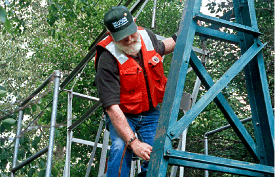
Photo of Lucky Sultz inspecting a streamgaging cableway prior to use.
Cableways, which are used regularly as platforms from which to make streamflow discharge measurements, impose unique risks to streamgagers. This class is designed for all cableway users and outlines how to inspect a cableway before it is used. The class describes:
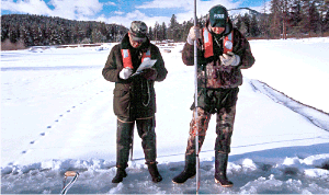
Photo of Jake Jacobson and Stan Landon measuring the discharge of Pacific Creek at Moran, Wyoming under ice cover.
This training presentation shows procedures used by the U. S. Geological Survey to measure streamflow when streams are covered by ice. Although Ice Measurements are generally more difficult to make than open-water measurements and are often made under uncomfortable conditions, it is very important that ice measurements be made regularly during the winter because the quality of long periods of winter streamflow data are often dependant on ice measurements. This class is listed as Training Class SW4288 with the USGS National Training Center.
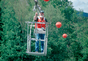
Photo of Lucky Sultz using the streamgaging cableway across the Middle Fork Flathead River in Montana.
Cableways have been used for decades as a platform for making stream discharge measurements. Use of cableways eliminates the need to expose personnel to hazards associated with working from highway bridges. In addition, cableways allow sites to be selected that offer the best possible hydraulic characteristics for measuring stream discharge. This training presentation describes methods currently used by the U.S. Geological Survey to make stream discharge measurements from cableways. The class is listed as Training Class SW4292-TC with the USGS National Training Center.
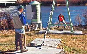
Photo of Stan Landon and Jake Jacobson running gaging stations levels at a gage on the Henrys Fork River in Idaho.
Streamgages record the elevation of the water surface above some reference surface, or datum. This datum is assumed to remain unchanged throughout the life of the gage. However, the elevation of gages and their supporting structures often change over time as a result of ground movement, floods, ice, and debris. The surveying practice of leveling is used to establish datum for new gage structures and to check for vertical movement of those structures over time. Vertical changes in gage structures can affect stage-discharge relations and, thus, could result in incorrect discharge determinations. Datum checks are used to correct stage-discharge relations and allow the USGS to document gage datum throughout the life of a gage. This training presentation describes methods currently used by the U.S. Geological Survey to run levels at gaging stations. The class is listed as Training Class SW1307 with the USGS National Training Center.
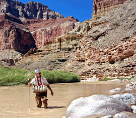
Photo of John Gray sampling suspended-sediment concentration of the Little Colorado River at the mouth near Desert View, Arizona.
Knowledge of the amount and timing of sediment transport in streams is important to those directly or indirectly responsible for developing and managing water and land resources. Such data are often used to judge the health of watersheds and the success or failure of activities designed to mitigate adverse impacts of sediment on streams and stream habitats. This training class presents an introduction to methods currently used by the USGS to sample suspended-sediment concentrations and particle-size distribution in streams. The class is listed as Training Class SW4416 with the USGS National Training Center.
All classes are USGS publications and, as such, are available to USGS employees as well as to the general public. Most classes are narrated and many contain video clips that illustrate selected concepts. Videos associated with the web-based classes are best viewed using a relatively high-speed internet connection.
Most classes contain tests that can be used by students and/or supervisors to assess how well students understand class materials. Certificates can be downloaded and filled out by students and supervisors to demonstrate successful completion of a class.
We will continue to update existing training materials and hope to develop training opportunities on additional subjects.
Frey, C. and Nolan, K.M., 1999, Cableway Safety Training Class: Pre-use inspection, U. S. Geological Survey WRI 99-4038
Nolan, K. M., Frey, C. and Jacobson, J., 1998, Surface-water field techniques training class, U. S. Geological Survey WRI 98-4252, Version 2, at: https://doi.org/10.3133/wri984252
Nolan, K. M., Shields, R. R. and Rehmel, M., 2000, Measurement of stream discharge by wading, U. S. Geological Survey WRI 2000-4026, at: https://doi.org/10.3133/wri20004036
Nolan, K. M. and Jacobson, N. D., 2000, Stream discharge measurements under ice cover, U. S. Geological Survey WRI 00-4257, CD-ROM, various pages
Nolan, K. M. and Sultz, L., 2000, Stream discharge measurements from cableways, U. S. Geological Survey WRI 2001-4102, CD-ROM, various pages
Nolan, K. M., Jacobson, N., Erickson, R. and Landon, S., 2003, Levels at streamflow gaging stationsA CD-ROM based training class, U. S. Geological Survey WRI 2003-4002, CD-ROM, various pages
Nolan, K.M., Bohman, L., Stamey, T. and Firda, G., 2005, Stage-discharge relationsbasic concepts, U. S. Geological Survey SIR 2005-5028, at: https://doi.org/10.3133/wri20034002
Nolan, K. M., Gray, J.R., and Glysson, G.D., 2005, Introduction to suspended-sediment sampling, U. S. Geological Survey SIR 2005-5077, CD-ROM, various pages
This report is available online in Portable Document Format (PDF). If you do not have the Adobe Reader, it is available for free download from Adobe Systems Incorporated.
Document Accessibility: Adobe Systems Incorporated has information about PDFs and the visually impaired. This information provides tools to help make PDF files accessible. These tools convert Adobe PDF documents into HTML or ASCII text, which then can be read by a number of common screen-reading programs that synthesize text as audible speech. In addition, an accessible version of Adobe Reader 8.0 for Windows (English only), which contains support for screen readers, is available. These tools and the accessible reader may be obtained free from Adobe at Adobe Access.

![]() U.S. Department of the Interior |
U.S. Geological Survey
U.S. Department of the Interior |
U.S. Geological Survey
URL: https://pubs.usgs.gov/fs/2007/3099
Page Contact Information: Publications Team
Page Last Modified: Monday, 24-Feb-2020 14:31:25 EST
